Independence…. The word conjures up notions of patriotism, revolution, the American Dream. Since 1776 Americans have claimed the word as if it was our own creation. To me, however, at least for one weekend, the word came to mean something entirely different. It meant sandstone, pitons, and exposure. Off-widths, overhangs, and, of course, Otto.
It is October in an election year. Everyone wants to talk about politics. Some might say that this is an especially important election, a crucial and vital turning point for our country. Now I won’t say “I don’t care”, even though I might be tempted some days, but I will say that during this election season my mind has been a bit distracted, and the importance of the perpetual Elephant vs. Donkey boxing match has fallen a distant second to my final push to get as much rock and alpine climbing in as possible before Old Man Winter brings his inevitable complications. Next on our list was a climb we had been looking at for awhile: Independence Tower.
A BRIEF HISTORY
Otto’s Route is a classic of American Rock Climbing. While some may say that the climbing on Otto’s Route is too sandy, gnarled and unnatural to be even considered on the same level as other desert tower classics like Castleton, the Priest, or the Fisher Towers, I believe that the route’s unique history makes it more appealing rather than less.
In 1911 a man named John Otto chopped steps and drilled pockets for artificial pipe holds on the west side of the formation. On Independence Day he completed the climb donning cowboy boots and erected an American Flag on its summit. Now John Otto loved this monument. It is hard to judge him today by modern standards when over a hundred years have now passed since his accomplishment. To this day I know people that refuse to climb this route because it is “chipped”. But it’s not like some unworthy climber hacked their way up it by moonlight in the mid 1990’s, Otto’s Route is a rare example of very early North American rock climbing history.
PREPARATIONS
My girlfriend Ella and I decided to make a base camp in Grand Junction, Colorado for a four-day climbing stint culminating in our attempt of Independence Tower. My old college roommate lived in Grand Junction, and with a little libation-related bribery, we convinced him to host our Fall weekend in the desert.
The first day we thought we would warm-up with a little bouldering at a small but well-featured bouldering area just outside of Grand Junction on the border of the Colorado National Monument. This area, known as “Dynamite Shacks”, is home to several area classics, but the best and most famous is an amazingly shaped rock called the Millennium Falcon with a namesake problem that is probably the best juggy roof problem I have ever seen.
Millennium Falcon silhouette
Mt. Garfield in background
Manik sending the Millennium Falcon:
On the second day we decided to step it up and headed up to Unaweep to do some trad climbing. Unaweep is one of my favorite granite playgrounds. I am especially fond of it because of sentimental attachment. While I won’t say “I learned to climb there” (I am still learning to climb), it is where I did some of my first climbing. First on top rope, then later I did my first trad lead there. On this trip we headed to the Sunday Wall. Joined by friends, we decided to spend a relaxing day climbing single pitch.
After taking turns leading a few pitches we packed up our gear and drove down to Nine Mile Hill to spend the rest of our forearms bouldering in Unaweep’s vast fields of Dakota and Burro Canyon sandstone boulders.
On day 3, it seemed like a good idea to get back into sandstone, so we started up Monument trail to climb the Lower Monument Canyon slabs, a fun set of slabby dihedrals and face climbs. We were joined again by a group of friends, this time bringing our number up to five. Sandstone is one of my favorite types of rock. We climbed Luhr’s Route (5.8), First Dihedral (5.8), and onsighted a slabby sport climb just to the right called Circle, Square, and Triangle (5.10a). With five people, it took the better part of the afternoon shuttling each of us up, reloading for each climber to have their shot at leading. As the sun set after a perfect fall day in the high desert, we decided to finish off the rest of our forearms back at the Dynamite Shacks’ boulders.
Left Dihedral (5.8+)
Luhr's Route (5.8)
Leading Luhr's Route
Circle, Square and Triangle (5.10a)
After a dinner and a few beers at a local brewery by my alma mater (now called Colorado Mesa University) we settled in for the evening and organized our rack for the main event the following morning: Independence Tower.
THE CLIMB
I was awake early with excitement, and after breakfast we made our way back to the Lower Monument Canyon trailhead for the climb. Not long after starting the hike, we encountered a Bighorn Sheep ram and accompanying harem at very close range. We snapped a few pictures and continued, excited by this excellent omen. A great start to what we hoped was going to be a great day.
It is a two and a half mile approach to the Tower, and with a backpack laden with a full trad rack and a stomach with two cups of dark coffee, we arrived at the base of the climb with our hearts hammering in our chests and sweat dripping from our brows. I made the decision to leave my long sleeve shirt behind in my backpack at the route’s base.
Bighorn Sheep in Monument Canyon
Proud Bighorn ram
We quickly sorted out the rack, tied in, and got ready to begin the climb.
Ella and I had struck a deal. She was anxious about the exposed and overhanging crux on pitch 4, so I offered to lead it as long as she battled through the off-width crux of pitch 2. She had just sent a gnarly off-width at the Sunday Wall called Three’s Company two days earlier. While no Pamela Pack, her dexterous climbing style has allowed her to fight through gnarly and awkward off-widths that battered and/or rejected me. Also joining us for the climb was a sport-climbing friend of ours who, having no experience with trad gear or with multi-pitch, was relegated to following and carrying the backpack (something he grumbled about more than once).
Having sorted out the logistics and affixed all the cams, slings and caribiners to my harness that I could possibly need on the climb, I called out “On Belay?” and having received a satisfying answer, took a deep breath and started up the first pitch.
Starting Pitch 1
For those of you who aren’t familiar with the route, pitch one is the longest pitch of the climb. It started with and easy ramp to a mini-chimney followed by a good crack made easy by numerous chopped steps, the first signs of Otto’s legacy. The long pitch in easy and well-protected, clocking in somewhere around 5.5/5.6. I ran it out twenty feet at times and cruised up to the belay ledge in good time.
Since Otto’s Route is almost entirely in the shade, and it being October, I quickly regretted leaving my long-sleeve behind. By the time all three of us had climbed and were on the belay ledge I was cold.
Next up was the off-width. It loomed ahead looking a bit ugly. Ella took the sharp end and started up an easy ramp leading to the bottom of the most difficult part. The off-width, as it t urns out, is not as bad as it looks. Though there was some groveling and thrutching and swearing, Ella found Otto’s chopped holds and pulled through without undue troubles. She belayed us up to the ledge.
Otto’s Route is a friendly multi-pitch in the sense that all the belays are on huge ledges, often big enough to feel quite comfortable de-roping. We coiled our ropes here and passed through a skinny passage known as the Time Tunnel, which was narrow enough that I had to shift sideways to get my shoulders through.
Pitch 2 Off-width
The Time Tunnel
We emerged on a huge ledge that was partially bathed in sunshine, and I spent the next ten minutes warming up on the sandstone, enjoying a break.
Pitch 3 and the crux at the top of pitch 4 towered impressively above us. The top was almost within reach, yet it was clear that things were about to get more interesting. While the rest of the route is essentially a sport climb, it is famous for its exposure and runouts.
The first obstacle was a twenty-foot runout to clip the first piton on pitch 3. This was the place for the tri-cams we didn’t have. Otto had drilled holes in the rock, however, to install via ferrata style aluminum pipe holds. While the pipes are gone, the remaining holes make for perfect two-finger pockets. Climbing carefully, Ella clipped the first piton, paused for a deep breath, and climbed past two more somewhat widely spaced pitons to a crux mantle before the anchors at the bottom of pitch 4.
P3 & top P4
Pitch 3
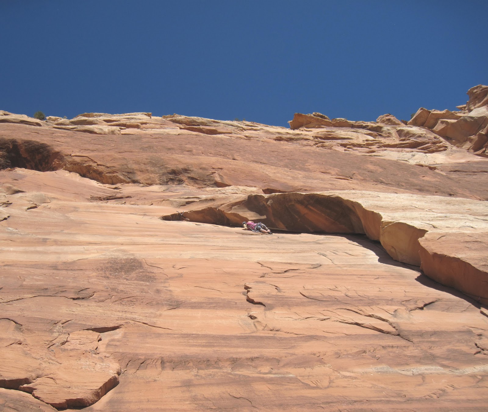
I arrived second on the Sun Deck Ledge and started anxiously up at the famous/infamous pitch 4 and Ella belayed Manik up pitch 3. The first piton was very high and the exposure was impressive. I was more nervous than I thought I would be. We arranged everything for the final pitch and I remember blathering a bit nervously about a sudden lack of confidence I was experiencing, almost hoping that someone else would step up and lead, but feeling suddenly calm, I started slowly and cautiously up the prow towards the summit cap.
No Falls mode is familiar to anyone who climbs class 3 or above in the alpine realm. Knowing that any slip, any mistake at all, could cost you very dearly, perhaps even with your life, is part of adventure climbing and mountaineering. It is not that we venture to these places recklessly with some sort of “death wish”, as some might believe. To me it is more the experience of the total focus and confidence you can achieve when placed in such a situation that requires such utter control. For every accomplishment there is risk. Without the risk and without achievement, there is no going forward. Or in this case, up….
In reality, it didn’t take long to climb the fifty feet of ~5.3 to the first piton. And although the exposure is intense, with 400 feet of air on both sides, when you focus on your climbing you don’t really notice it. The climbing became steeper after the piton. Otto’s drilled pockets, however, were always present right where you needed them. And the worn chipped steps provided decent, albeit slippery, footholds. Resting on a pocket, I made an easy clip of the second piton. Although the crux move was still ahead, the fall potential was basically controlled on the overhanging terrain. Moving up on insecure feet, I clipped the final piton, hesitated a moment, and made an airy and excellent move to the final ledge and pulled the overhang with confidence. I heard Ella and Manik cheer below.
The final pitch
Crux moves
I top-belayed them both up and we mantled onto the summit. This is an amazing perch: a throne amongst a giant cathedral of sandstone spires and walls. We could here the voices of tourists and road bikers at various overlooks along Rim Road in the Park talking about us echoing through the canyon. “Look! There are people on top!” “What are they doing?!?” “How did they get up there?”
summit
From the top
We took in the moment and the scenery for fifteen to twenty minutes then decided it was time to get started on the descent. Descents are always anxious. Most accidents, after all, occurring on the way down. The downclimb off the summit block is a bit scary. Although there are really good handholds it is hard to see your feet, and the exposure is tremendous. From there we did a double-rope rap to the bottom of the third pitch, scrambled down the Time Tunnel, rapped from the top of pitch 2 to the top of pitch 1 (not sure if we could trust beta that you can rap to the ground from the top of P2 with doubled 60ms—which I am told now by several sources now that you can). From the top of pitch 1 we double-rope rapped to the ground and it was done. We had climbed Independence.
One last move for freedom
Story by: Brian Wright
Photos: Brian Wright, Manik Johnson Visit THE ARCHIVE: A list of most of our articles sorted by department
Copyright notice: This website and all its contents are the intellectual property of www.coloradomountaineering.com and its authors. None of the content can be used or reproduced without the approval of www.coloradomountaineering.com.
Climbing and mountaineering are dangerous!! Please see the DISCLAIMER page
For information about how to contact us, visit this link
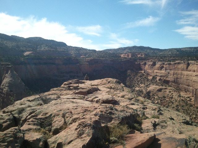
By many measures Colorado’s Mt. Sopris is a minor mountain. It’s not a fourteeneer. Hell, it’s not even a thirteener. At a paltry 12,953’ (3948 m) it is the 688th tallest mountain in Colorado. The twin-summit massif forms the relatively low, northern shoulder of the mighty Elk Range. It is overshadowed by famous neighbors: Snowmass Mountain, Pyramid Peak, Capitol Peak, and the Maroon Bells. Despite all of this, however, Mt. Sopris will always be one of my favorite Colorado Mountains. If you were to rip Mount Sopris from the surrounding area and place it next to any of those other Elk Range favorites, Sopris would dominate. It is simply a massive mountain.
The view from the north, like when traveling from Glenwood Springs to Aspen, Co on Highway 82, reveals Sopris for the mighty mountain it is. The town of Carbondale, which sits at Sopris’s northern foot, lies at an elevation of 6,181’, giving Sopris almost 7,000’ of relative prominence. The spectacular northern aspect of Sopris towers over the lower Roaring Fork Valley and has become a symbol for the area. Having spent a good portion of my childhood living in this part of the state, Mt. Sopris will always be a mountain that, in some strange way, offers a definition of who I am. No matter what great mountains I have the fortune to climb in my life, Mt. Sopris will always be high on my list as a favorite.
We began our hike at the standard Dinkle Lake trailhead, not far outside of Carbondale, CO, on the northern flank of Mount Sopris. It was early afternoon and a few other hikers were active in the parking lot as we were, tugging bootlaces tight and making last second adjustments on their backpacks. We had decided to climb the mountain at a leisurely two day pace in order to maximize the amount of time we spent in this beautiful area. After shrugging our packs on, we turned our backs to my subaru and started up the trail towards the mountain.
The first part of the approach is on an old road, so the path is wide and mostly straight. The four of us marched up the trail, talking excitedly with the anticipation of a good summit the following day. After hiking for almost an hour and gaining a thousand feet, we came to a clearing in the trail where we encountered a hippy-looking couple with their dog on descent. They stopped us as we drew near, pushing their sandwiches on us at $5 a piece. Who would have thought? A trailside concession stand! We politely refused and wished them a pleasant descent.
Sopris towered above us, and big, gray clouds were building to the south and west. We weren’t terribly concerned yet, as there was no sign of lightning or thunder. It did, however, seem likely that we might see some rain before the day was over. But we were ready for this; afternoon summer rain is part of alpine life.
At around 9,800’, we re-entered the forest for the final section of the approach. By then I was regretting not training more with a weighted pack on. My shoulders ached and my back was stiff. And I only had two days worth of gear. Sweat poured from my limbs the last mile.
At last we reached the established camp sites huddled between and around the two Thomas Lakes. It is only legal to camp at designated sites, which are numbered with small placards. We chose site 4. Site 4 had no direct lakeview but was huddled amongst the trees out of sight from the trail. It was comfortable and private.
After setting up camp we hiked around to the backside of the lake to relax for the evening. We found a place among boulders to the east overlooking the lake. The view of Sopris was inspiring. As the day faded into evening, the only downside was a sudden onslaught of mosquitoes. Apparently, our outing had un-fortuitously coincided with some sort of mega hatch. I had never experienced such a swarm of mosquitoes like this at Thomas Lakes, and rarely anywhere else. I found myself hoping for an all inclusive extinction of their species. I suppose every creature on earth serves some function, but what, besides utter irritation and misery, does a mosquito contribute? While other members of the group, however, complained that their shell-layers were not sufficient in repelling the needle-like proboscises of the mosquito swarm, they were not able to get to me through mine. Black is supposedly a bad mosquito color, but when my hood was pulled tight over my head they seemed too interested in swarming the impenetrable Gore-Tex than going after my face or ears.
We relaxed by the lake for quite a while before negotiating the trail back to our campsite. We still had enough light to cook a large and satisfying spaghetti dinner and play a game of travel scrabble. The storm that had seemed to be building all afternoon had swung to our north, giving us no more than a light drizzle. We set our alarms for 4 am and went to bed early. It’s always better to get an early start for an alpine climb. Even though we were at 10,200’ and the summit was only very manageable 2,700’ above us, and we knew we would be able to make good time on the summit ridge, we wanted to give ourselves every chance possible to make the summit successfully if the afternoon brought any weather. Sopris is a notorious lightning-rod.
Four a.m. proved to be everything that you’d expect: cold, dark, exhausting. But it was also thrilling to know that most everyone else we knew was at that very moment asleep in their beds while we prepared to climb a mountain. After a quick breakfast we hiked around to the backside of the lake and filtered water for the summit attempt. It was deep black; dark enough that without our headlamps very little could be made from the mud of night. The sky was a little overcast too, filtering the moon and starlight. It was almost five o'clock by now, however, and the sun was fast approaching. In the twenty minutes or so that it took for us to fill all of our water bottles the sky was already turning purple and blue with light.
When we started filtering water
By the time we were done
Once we left the lakeshore, the next portion of the trail snaked through the fading alpine forest and onto the east ridge of Mt. Sopris. In a sense, we had finally reached the mountain.
We passed treeline not much farther and faced a long push up a sometimes distinct sometimes not trail through the scree. A couple of sections were moderately steep, and we could hear layers of rocks shifting beneath us. Still, I never like a slip would lead to a catastrophic tumble. Soon, Capitol Peak appeared to the south. The changing light of the morning illuminated this powerful peak. The rest of the Elks extended out to the horizon. The Elks provided an impressive array of color: red sedimentary layers, the same that construct the world famous Bells; green grasses and pine canopies; dark gray shales; and even the white snowfields that that still freckled the landscape. To the north we could peer down the rock glaciers of Sopris’s north face to Thomas Lakes, which were tiny now from above.
At about 12,500’ we surmounted the eastern false summit and dropped down to the saddle between it and the east summit of Mt. Sopris. A patch of high alpine grass seemed an inviting place for a snack, and we relaxed here for a minute before making our final push. Morning had arrived in full.
The last part of the climb was steep but not overly strenuous. There was one more false summit to navigate before arriving on top. At 7:30 am, we reached the Sopris’s 12,953’ summit about the same time as everyone in town below us was waking up. We made a few calls to friends and family on our cell phones and listened to their disbelieving exasperations: “You are on top now!?!” I wondered if they looked with a strong enough telescope, perhaps, if they could see us.
We debated attempting the identically elevated west summit but decided that we were too worn out to continue. To do so would require another mile and a half of climbing and over 500’ of extra elevation. Clouds were already building, and it seemed that today would be one of those days when the mountain would fall under assault from the weather earlier than usual. We would simply have to return and climb Sopris again.
The descent went, as usual, much faster than the ascent. We passed many groups of people on their way up, most of whom were shocked that we had made it all the way to the top and back before 8 am. We made it back to our tents around 10 am and we took a nap before packing it up and hiking out.
As we hiked out, we felt excited that we had climbed Mt. Sopris, the totem for the Roaring Fork Valley. It was hard in subsequent days as we returned to our daily lives not to pause and look up at Mt. Sopris from town. Our eyes were inexorably drawn to it. Sight feels limited in the low-lying valleys when you know how far to the horizon you can peer when standing on top of a mountain.
Visit THE ARCHIVE: A list of most of our articles sorted by department
Copyright notice: This website and all its contents are the intellectual property of www.coloradomountaineering.com and its authors. None of the content can be used or reproduced without the approval of www.coloradomountaineering.com.
Climbing and mountaineering are dangerous!! Please see the DISCLAIMER page
For information about how to contact us, visit this link
Mt. Elway, err…I mean Elbert, is Colorado’s tallest mountain and the second tallest in the Continental United States. It is also the tallest mountain of the Sawatch Range, a range filled with towering monsters that boasts 4 of Colorado’s 5 tallest peaks (Elbert #1, Massive #2, Harvard #3, and La Plata #5). Elbert anchors this proud range nicely. Yet another, sometimes underrated, accolade is that Elbert is also the highest mountain in the American Rockies. All things considered, Elbert is a powerful yet relatively gentle mountain.
Like many of the Sawatch Mountains Elbert is not a technical peak. Its gently sloping ridges and rounded battlements present little challenge to the mountaineer other than sheer endurance and little danger other than a dusting of loose rock. Solid class 1 trails ascend Elbert from both the north and the south. Elbert’s stature as a state highpoint and one of the tallest peaks in the Lower Forty-eight make it a popular peak to climb, and summer weekends can bring lines and crowds on the peak’s various routes. For those seeking more challenge and less crowds, Elbert is an excellent winter ascent and can be skied without undue difficulty.
GETTING THERE
North Mt. Elbert Trailhead
From Highway 24 approximately 3 miles south of Leadville, turn west onto Highway 300. After .8 mile turn left (south) on CR-11. 1.2 miles farther, follow signs toward Halfmoon Creek and turn right. The North Mt. Elbert TH is five miles farther on the left (south) side of the road. There are several National Forest campsites in the area as well as dispersed camping. The more environmentally correct option is to stay in the developed, fee-based areas. If you must set-up in dispersed areas, please avoid building fire rings, there are plenty already. The North Elbert trailhead is about one half-mile east of the Mt. Massive trailhead (which is on the opposite side of the road).
South Mt. Elbert Trailhead
From Highway 82 four miles west f the Highway 24/82 junction, turn north onto Lake County Road 24. Go 1.5 miles past Lakeview Campground to a parking lot on the west side of the road.
ROUTES
North Mount Elbert Trail [Northeast Ridge] (class 1)
A popular trail that ascends Mt. Elbert's north and east slopes from the Halfmoon Creek basin on the Leadville side of the peak. A mostly excellent trail winds around from the north to the east then ascends the northeast ridge of the peak. The trail gets a little rough above 13,000' but never exceeds high class 1.
South Mount Elbert Trail [East Ridge] (class 1)
Another popular route that ascends Elbert's east side via a very well-defined and popular trail, the South Mt. Elbert trail. It is a toss-up whether this or the North Mt. Elbert trail is the "standard" route. Both are similar in difficulty and length. This seems to be the more common way to climb Elbert in the winter.
Southeast Ridge (class 2)
A far less popular alternative that allows you to climb the unranked "South Elbert" (14,134') en route to the main summit. This route is accessible from the Black Cloud Trailhead off Highway 82 west of Twin Lakes.
Box Creek Cirque (class 3)
Box Creek cirque visible on the left
A fun slow climb in the winter and probably Elbert's most technical route. Follow the North Elbert trail to treeline. The steep Box Creek Cirque will be visible in front of you. Leave the trail and head for the basin, picking one of several semi-defined couloirs to ascend to the top. This cirque would make a good challenging ski descent. Beware, however, of avalanche potential.
SPECIAL CONSIDERATIONS
Mt. Elbert is a relatively mild mountain, but that doesn’t guarantee you safety. By any route ascending Elbert is a long, strenuous journey that will gain at least 4,000’ and keep you high and exposed above treeline for a considerable amount of time, leaving you vulnerable to thunderstorms, high winds, searing UV radiation, etc. In addition, loose scree in some sections of the trail can be painful for the ankles and knees and the possibility of twists, sprains and breaks, however unlikely, is still there. Take care with your feet, stay hydrated, wear sunscreen, and look out for your fellow mountaineers and you should be just fine.
STANDARD ROUTE (North Mount Elbert Trail)
From the trailhead at just over 10,000', follow the North Mt. Elbert Trail as winds through a pristine forest on Elbert's northeast flank. Leave the Colorado Trail behind at mile 1.4 and turn right towards Mt. Elbert. This junction is at about 10,400'. This may be a good place for a short rest as the route becomes much steeper from here.
Around mile 2.7 you reach treeline, and the upper portion of the mountain comes into view (note: you cannot see the actual summit yet). From this point you have about two miles of hiking left but you still must climb over 2,500' of elevation to reach the top.
Once past treeline, the trail begins to switchback steeply up Mt. Elbert's barren northeast ridge. Though the trail is quite good, you may still have to pay close attention to your footing on the steepest sections, especially if you aren't used to hiking on scree at altitude. In terms of difficulty of terrain, this route is slightly harder than the Grays Peak trail but not as hard as the South Slopes standard route up Torreys.
When you reach what has thus far appeared to be the top, you will find that it is only a false summit and the actual top is still a little farther. Depending on what kind of day you are having this may or may not be discouraging. If you're feeling exhausted, take heart knowing that Colorado's highest point is just under a half mile and four-hundred vertical feet away.
On Mt. Elbert's summit you will most likely be joined by hikers who have climbed Elbert from other routes, such as the popular South Mt. Elbert Trail. No matter, this commodious summit has something for everyone. To the north you can look out across the Halfmoon Creek area at Mt. Massive and revel at the might of its girth and lofty summits. Also visible to the north and west are centennial thirteeners Mt. Oklahoma (13,845'), French Mountain (13,940'), Casco Peak (13,908'), and "Lackawanna Peak" (13,823'). The view to the south is dominated by the familiar shapes and humps of other Sawatch fourteeners, especially La Plata (14,336') whose dramatic north face and rugged Ellingwood Ridge are particularly astounding from the vantage atop Elbert. The surrounding mountains are so impressive, in fact, that we once met a man on Elbert's summit who was convinced (and pissed off) that he'd climbed the wrong mountain because others nearby appeared taller. We tried to assure him that distance and perspective can be deceiving and that he was indeed on the highest mountain in the American Rockies.
The best thing after a fall, they say, is to get back up on that damn horse. After our “fall” the day before on the Decalibron (and in lieu of forecasts calling for more high wind) we had essentially decided last night to sleep in this morning and call it a week. Just before it was time to turn in for the night, however, the itch to climb returned despite our exhaustion. In a stroke of inspiration, we re-packed our summit bags and set the alarm for the usual 4:00 am. Climbing mountains, after all, not sleeping in, was what we were here for.
When we awoke this morning, the air in Frisco was dead calm. This considerable improvement from the day before was omen enough to convince us to resist the temptation of a lazy morning and proceed Mt. Sherman's trailhead.
After driving up over Hoosier Pass for the second straight day, we made the turn onto the long dirt road up Fourmile Creek towards Sherman's lofty base. The drive was surprisingly smooth, and we were able to get Ella’s Subaru to nearly 12,000’. Though I’m not normally a fan of high trailheads (I prefer to climb mountains, not drive up them), we were at the frayed end of our proverbial ropes both physically and mentally after yesterday’s tribulations, and I was more than happy to abridge our day climbing Sherman. The dark side to the morning, however, was apparent from the moment we stepped out of the car and were greeted by eerily similar morning winds to the day before (let the second-guessing begin).
The first mile and a half of the climb coursed along old mining roads to a beautiful basin at 13,000’. Though I usually find the scars of Colorado's former mining industry repulsive, here the derelict remains of a 19th century mining operation oddly added to the beauty instead of distracting from it. These hardened miners, we decided, were truly the first Colorado mountaineers. They pioneered the way into these awesome places in more ways than one: literally by constructing the roads we present-day climbers use to access them, and yet also by filling in the blank corners of the map that these mountains once guarded with recalcitrance.
remnants from Colorado's pioneers:
The next part of the climb entailed a steep snow ascent to the saddle between Mt. Sherman and its 13,748’ neighbor Mt. Sheridan. The short climb was steep and icy, so we took a moment to strap crampons back on our feet. With these stainless-steel teeth to provide traction, the icy ascent was not a problem.
more mining detritus (the snow climb to the Sherman/Sheridan saddle visible in background):
Once on the ridge, we had reached 13,120’, and the unfortunate truth of the climb was immediately evident: we were in for another gusty summit attempt. Down in the bowl on the south side of the mountain, we had been sheltered from the worst of the wind's force. Exposed now on Sherman’s west ridge, we could tell that it was only slightly less intense than the day before.
From the saddle, the 900-foot climb to the Sherman’s summit was revealed before us. The climb looked strenuous but passed fairly quickly. At about 13,700’ there was one exposed section where we had to navigate around short gendarmes of rock with icy, hardpack snow jammed into the crevices between them. This short section gives Sherman its class II rating and proved quite intimidating. To the north were impressive views of the southern Mosquito Range and a thousand+ foot drop (at a steep fifty-degree angle) into the Iowa Basin. One tiny slip could easily lead to a vicious tumble. Though not as severe as the day before, the wind added considerable excitement to this section. Excitement that, still gun-shy from yesterday’s thrills, I wasn’t quite prepared for mentally. As a result, I fell into a let’s-get-up-this-and-back-down-as-soon-as-possible climbing mentality.
looking back on the crux section of Sherman's route (note the steep drop-off to the right):
Luckily, Sherman’s long, rotund summit appeared just after this spooky section, and we reached the summit cairn with the morning still young. Much like yesterday, I didn’t feel much into standing on the summit, and we spent just enough time on top to snap off a few pictures before beginning our descent back down.
the view to the north from the summit:
On the summit of Mt. Sherman:
As usual, the descent went much faster and passed with minimal excitement. We did, however, note a disturbing trend: a general un-preparedness of the majority of the climbers we encountered on their way to the summit. We saw everything from a family with kids easily under 12 years old donning sneakers, blue jeans and possessing no water, to an entire group of fifteen or more, each as ill-equipped as the last. Though Sherman (like most of the Tenmile-Mosquito Range mountains) has the reputation of being an “easy” fourteener, any mountain this high demands to be taken seriously. It is “casual” climbers such as these that get into trouble and give mountaineering its “extreme” reputation. Surely, with a dry trail on a hot day in July, Sherman is a Mecca for climbers of this sort, but the conditions today (with the ice and high wind) made this ascent challenging and potentially dangerous. I couldn't fathom exposing a young child to these conditions without even the protection of basic mountaineering accoutrements.
looking down on the valley from near 14,000' on Mt. Sherman:
At the end of the day we were glad that we’d decided to climb, and (with defiance to the accursed wind) had had yet another amazing mountain experience. Each mountain has a unique personality, and climbing a variety of them is far more enlightening than climbing a single favorite over and over.
Descending off Mt. Sherman's windy west ridge:
Visit THE ARCHIVE: A list of most of our articles sorted by department
Copyright notice: This website and all its contents are the intellectual property of www.coloradomountaineering.com and its authors. None of the content can be used or reproduced without the approval of www.coloradomountaineering.com.
Climbing and mountaineering are dangerous!! Please see the DISCLAIMER page
For information about how to contact us, visit this link


.jpg "Thomas Lakes and Mount Sopris in the Elk Range of Colorado")


