
INTRODUCTION

In many ways, Mount of the Holy Cross is probably Colorado's most famous mountain. It is also one of Colorado's only mountains, joining possibly Pikes Peak, that is distinctly more famous for reasons other than mountaineering. It is the image of the cross, caused by a deeply inset couloir intersected at three-quarters height by a ledge that has made this mountain famous. The image of the snowy cross is a postcard image that defines Colorado. Besides this aesthetic feature, Mount of the Holy Cross is simply an amazing mountain.
For full disclosure, I should divulge that Holy Cross is quite possibly my favorite Colorado 14er. It is a gem in the Sawatch Range, hidden from major highways, rugged, wild. I imagine that 100 years ago this was a very remote place. Different than other Sawatch mountains, it is festooned with massive walls of perfect granite. The basins on the mountains north and west sides are so rich with great stone, it seems a tragic accident that Holy Cross was not gifted with a good rock route. Oh well, the Standard Route is as fun as any class 2 mountain I have climbed in Colorado and the Cross Couloir and Angelica both provide high quality snow routes that can satiate the more aggressive mountaineer.
GETTING THERE
Just west of Vail take exit 171 off I-70 towards Tennessee Pass on Highway 24. Continue about 3 miles past the town of Minturn and turn right (west) onto Tiguwon Road (FR 707). This long, winding dirt road cuts through the forest, passing a couple of different trailheads and some camping (as well as huge swaths of complete deforestation that were part of the Forest Service attempts to stifle the Pine Beetle epidemic in 2011) before ending at the Half Moon Trailhead and campground after 8.5 miles. This trailhead is the access portal for all of the major routes on Holy Cross.
ROUTES
1. Standard Route (North Ridge)
 This is the easiest and most expedient route to the top of Holy Cross. From Halfmoon trailhead you climb up and over Half Moon Pass (11,600') and down into East Cross Creek Basin. There is good camping near the creek at around 10,700'. Due to the extra elevation go up and over the pass on both the approach and return, many people choose to do this route in 2 days. Please observe all wilderness ethics and regulations. From the creek follow the well-defined trail up the north ridge, past tree line and to a semi-airy ridge with amazing views of the north face of Holy Cross. While you dont get to see the cross (which is on the east face), you do get to see Angelica and jagged ridges and cliffs of the north face proper. Holy Cross is certainly one of the most dramatic Sawatch mountains.
2. Halo Ridge
This breathtaking tour is longer, more exposed, and considerably more strenuous than the North Ridge. But the scenery is even more rewarding. You will climb three thirteeners in addition to Holy Cross, two of which are ranked and one which is #91 on Colorado's 100 Highest list. From the trailhead take the Fall Creek Trail for two and a half miles to the Notch Mountain Trail at 11,100'. Switchback for 3 miles up the Notch Mountain trail to the Notch Mountain shelter at 13,080'. You can stay at this shelter. Call the Forest Service Minturn office for info: 970-827-5715. From here you must traverse the Halo Ridge, a strenuous exposed traverse. It is 2.1 miles from here to the summit of Holy Cross. Traverse over ranked Point 13,248 (#441), unranked Point 13,373 and ranked Point 13,831, also known as Holy Cross Ridge, Colorado's 91st highest summit. Descend to the 13,500' saddle then climb the final half mile to Holy Cross's summit just barely over 14,000'. You can return over Halo Ridge or some people choose to return via the standard North Ridge. There are advantages to either option. If you return over Halo Ridge you will not have as much total vertical gain, even though you have to re-summit all three 13ers along the ridge. If you descend the North Ridge the journey is shorter and you are exposed above 13,000 feet for a shorter amount of time. It is NOT RECOMMENDED to attempt to bypass any summit along Halo Ridge in an effort to save elevation gain. Many of these summits are cliffed out and people have gotten into trouble trying to do this!
3. Angelica
This great snow climb is not nearly as famous as the Cross Couloir, but it is still good and often has snow later than the Cross Couloir providing a good alternative. It is not as long as the cross nor as complicated and technical but is similar in terms of steepness. Follow the standard North Ridge route over Half Moon Pass and down into the East Cross Creek basin. Cross the creek and leave the main trail at some campsites near the creek crossing. Pick your way through the forest, possibly doing some boulder hopping, and find a vague climber's trail. It becomes more distinct. Follow it as wind winds through some boulderfields on the west side of the creek for at least a mile until it flattens out at 11,500'. Hike across the bench west of Lake Patricia. Instead of following the draining basin towards the Bowl of Tears, head instead towards the obvious North Face. Climb steepening snow angling toward the west side of the face until you reach a prominent and obvious Y. Take the left branch and climb an excellent inset couloir to a notch at 13,700' where you rejoin the North Ridge route. From here it is a short class 2 jaunt to the summit.
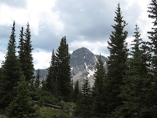
 |
| Angelica is the couloir on the right side that has barely any snow left. |
4. Cross Couloir
This route is famous because it climbs Holy Cross's famous feature. For mountaineers it is a coveted snow climb and one of the most classic alpine routes in the Sawatch Range. It is also a coveted ski descent and many expert backcountry skiiers lust for this committing challenge. Start as for Angelica. Follow this route all the way to 11,500' at the bench with Lake Patricia. Instead of turning and taking on Holy Cross's North Face, follow the climber's trail into a boulderfield up the roughening basin until you reach the Bowl of Tears at 12,000'. The approach is over. Angle up the slopes starting left (south) of the couloir aiming right to bypass a cliff system at the bottom of the cross. You enter the couloir at 12,800'. Now for the business. First consider the avalanche potential, knowing that a gnarly cliff you wouldn't want to get swept over sits at the bottom of this committing couloir. Falling, for that matter, as either a skiier or a mountaineer is ill advised on this part of the route. Climb the couloir for over 1,000 feet. There is a possibility of resting on the cross ledge at 3/4 height depending on snow conditions. After a tough climb, the top will be a welcome treat. Either carefully ski down, or descend the North Ridge.
This route is famous because it climbs Holy Cross's famous feature. For mountaineers it is a coveted snow climb and one of the most classic alpine routes in the Sawatch Range. It is also a coveted ski descent and many expert backcountry skiiers lust for this committing challenge. Start as for Angelica. Follow this route all the way to 11,500' at the bench with Lake Patricia. Instead of turning and taking on Holy Cross's North Face, follow the climber's trail into a boulderfield up the roughening basin until you reach the Bowl of Tears at 12,000'. The approach is over. Angle up the slopes starting left (south) of the couloir aiming right to bypass a cliff system at the bottom of the cross. You enter the couloir at 12,800'. Now for the business. First consider the avalanche potential, knowing that a gnarly cliff you wouldn't want to get swept over sits at the bottom of this committing couloir. Falling, for that matter, as either a skiier or a mountaineer is ill advised on this part of the route. Climb the couloir for over 1,000 feet. There is a possibility of resting on the cross ledge at 3/4 height depending on snow conditions. After a tough climb, the top will be a welcome treat. Either carefully ski down, or descend the North Ridge.
SPECIAL CONSIDERATIONS
Mount of the Holy Cross is in the Holy Cross Wilderness area and special regulations apply. You must register at the trailhead and carry a permit with you that has a list of all the regulations. One of which is that fires are not allowed in the wilderness area. Please respect this rule and read and abide all of the other rules carefully. They are there for the greater good, so breaking these rules is not a strike against the government but a strike against all of us who want to enjoy this place for years to come.
 For some reason, Holy Cross has attracted inordinate numbers of accidents, tragedies and near misses over the years. As as result it has earned a reputation even among the non-climbing community. While many if not most 14ers have had tragic accidents involving mountaineers, for some reason people seem to remember the ones that occurred on Holy Cross more than any other. I have even heard the Holy Cross Wilderness dubbed the "Bermuda Triangle" of Colorado's backcountry. Much of this reputation, it seems to me, stems from one particularly disturbing accident that occurred a few years back when a woman separated from her climbing partner at around 13,800' on the Halo route with plans to quickly re-unite but, despite a lengthy search involving hundreds of people, was never seen again. There is no space here on this webpage to get into theories about what exactly happened in this particular instance, that discussion has occurred elsewhere and is not my goal now. It is, however, good to take this terrible tragedy--and others that have occurred on this mountain--and learn the lessons that they might teach. However, I have been back into the region a couple times now, and I have some ideas about why more people have trouble here than in other Colorado wilderness areas.
 For some reason, Holy Cross has attracted inordinate numbers of accidents, tragedies and near misses over the years. As as result it has earned a reputation even among the non-climbing community. While many if not most 14ers have had tragic accidents involving mountaineers, for some reason people seem to remember the ones that occurred on Holy Cross more than any other. I have even heard the Holy Cross Wilderness dubbed the "Bermuda Triangle" of Colorado's backcountry. Much of this reputation, it seems to me, stems from one particularly disturbing accident that occurred a few years back when a woman separated from her climbing partner at around 13,800' on the Halo route with plans to quickly re-unite but, despite a lengthy search involving hundreds of people, was never seen again. There is no space here on this webpage to get into theories about what exactly happened in this particular instance, that discussion has occurred elsewhere and is not my goal now. It is, however, good to take this terrible tragedy--and others that have occurred on this mountain--and learn the lessons that they might teach. However, I have been back into the region a couple times now, and I have some ideas about why more people have trouble here than in other Colorado wilderness areas.
The first problem is one of numbers. The fame of Holy Cross draws a fair number of annual visitors, and although crowds have become the norm on almost all 14ers in Colorado, Holy Cross for whatever reason seems to attract an even less experienced and less prepared demographic. Throw these large numbers of ill-prepared mountaineers into an environment with some of the particular objective hazards that I discuss below and the result is what you see today with Holy Cross's reputation.
Another hazard is the treacherous, bouldery, and cliffed-out terrain. The Holy Cross Wilderness, particularly the area immediately surrounding the mountain proper, is rough and uneven. It is filled with large glaciated boulders and cliffs of all sizes. This is a very rugged place. While some of the big cliffs are obvious, there are numerous small cliffs many of which are hidden among thick trees and brush. It would be easy to slip scrambling here and become injured. I could also see how it might be very difficult to find someone who had fallen into a crevice or something like that in between boulders.

The Holy Cross Wilderness is an amazing place, and I don't think anybody should be deterred from venturing into it by grim warnings and dark stories. It is smart for everyone, however (and I would probably say this about any backcountry), to always remember the essentials: map, compass, proper clothing, extra food, rudimentary medical supplies, etc, and to use extra caution and common sense when venturing into a place with proven and serial objective hazards.
Gerry Roach, in his book Colorado Fourteeners 3rd Edition, examines the case of the vanished mountaineer as well as his theory about Holy Cross's unique dangers in depth. It is a useful and informative article for anyone venturing into the area. The book itself is the bible to Colorado's 14ers in my opinion and a great place to start for anyone who is just becoming curious about the great peaks of this state.
STANDARD ROUTE (NORTH RIDGE)
Length: 11 miles (roundtrip)
Total Elevation gain: 5,800'
trail access: Half Moon Trail
 The North Ridge of Holy Cross is one of Colorado's best class 2 adventures. It is an amazing and challenging climb that takes you to Colorado's hallowed places. The length and total elevation required for this climb necessitate a two-day outing for many people. This might be advised for anyone whose conditioning might not be up for a one-day approach. That trade off, however, is that you will have to lug a heavy backpack over Half Moon Pass twice. Is it easier? The more environmentally conscience choice is to minimize your impact by climbing Holy Cross in one day. However, this is a place that deserves a slow, contemplative pace. I recommend a backpack of at least two days. Three might be preferable. Take your time and enjoy this place. Please minimize your impact by adhering to No Trace Wilderness ethic.
From Half Moon Trailhead, follow Half Moon Trail for 2 miles to Half Moon Pass at 11,600'. On my last trip, I discovered crossing this pass can be exciting in an afternoon thunderstorm. After summitting Half Moon Pass, descend gradually at first towards East Cross Creek. You will soon get your first views of the North Face of Holy Cross, an impressive sight. Soon the trail starts to descend more steeply and you round a corner and get an amazing view of the mountain and the East Cross Creek Basin, complete with steep granite walls on the basin's north flank, the mountain to the south, and a tallish waterfall in the center. You know now if you didn't before that this is a special place. Descend another 900 feet into the creek basin where some very nice campsites exist near the creek. Stay in one of the numbered campsites to minimize impact. You can be ticketed by rangers for camping elsewhere. Not only is it a legal issue anyway, it is environmental, so please respect this.
Cross East Cross Creek at a makeshift rock bridge and follow the trail as it winds up the northern slopes into the high alpine zone. At around 11,500' you will cross treeline. A bit later you will get your first glimpse of the mountain, much closer and even more imposing now. Follow the trail as the ridge tightens to a prominent notch at 13,700'. you can peer down an inset couloir, which is impressive whether it has snow or not. This is the top of Angelica. From here the trail gets rougher. Pick your way through class 2 to 2+ terrain to an impressive summit.
Do not get lost on the descent! Remember the route. Going too far west or north can pull you into the Cross Creek drainage (not the East Cross Creek drainage where you want to be.) While there are trails there, they will take you very far away from your vehicle. Also don't forget you have to go up and over (1,000') Half Moon Pass on the way out. As aforementioned this can be exciting if the afternoon storms are rolling in and exhausting anytime after a long climb of Holy Cross.
Length: 11 miles (roundtrip)
Total Elevation gain: 5,800'
trail access: Half Moon Trail

From Half Moon Trailhead, follow Half Moon Trail for 2 miles to Half Moon Pass at 11,600'. On my last trip, I discovered crossing this pass can be exciting in an afternoon thunderstorm. After summitting Half Moon Pass, descend gradually at first towards East Cross Creek. You will soon get your first views of the North Face of Holy Cross, an impressive sight. Soon the trail starts to descend more steeply and you round a corner and get an amazing view of the mountain and the East Cross Creek Basin, complete with steep granite walls on the basin's north flank, the mountain to the south, and a tallish waterfall in the center. You know now if you didn't before that this is a special place. Descend another 900 feet into the creek basin where some very nice campsites exist near the creek. Stay in one of the numbered campsites to minimize impact. You can be ticketed by rangers for camping elsewhere. Not only is it a legal issue anyway, it is environmental, so please respect this.
 |
| The Gore Range in the distance from the North Ridge |
Do not get lost on the descent! Remember the route. Going too far west or north can pull you into the Cross Creek drainage (not the East Cross Creek drainage where you want to be.) While there are trails there, they will take you very far away from your vehicle. Also don't forget you have to go up and over (1,000') Half Moon Pass on the way out. As aforementioned this can be exciting if the afternoon storms are rolling in and exhausting anytime after a long climb of Holy Cross.
TRIP REPORTS
Angels and Demons- The Two Faces of Mount of the Holy Cross
An article examining the profound beauty of Holy Cross and its surrounding territory as well as the unique objective dangers it boasts. Also included: a brief look at the mysterious disappearance of Michelle Vanek in 2005 and other accidents related to this area.
Longs, Holy Cross & McGregor Mountain (July 2012)
A week in July and a successful climb of the Left Side of McGregor Peak, right variation (II 5.8 R), the North Face of Longs Peak (II 5.4), and a two backpack and ascent of the standard route of Holy Cross.
Frustration in Paradise (July 2010)
Just because you don't make the summit doesn't always mean you "failed". This is an account of a really amazing trip in which we, unfortunately, did not make the summit.
Copyright notice: This website and all its contents are the intellectual property of www.coloradomountaineering.com and its authors. None of the content can be used or reproduced without the approval of www.coloradomountaineering.com.
Climbing and mountaineering are dangerous!! Please see the DISCLAIMER page
For information about how to contact us, visit this link
Just because you don't make the summit doesn't always mean you "failed". This is an account of a really amazing trip in which we, unfortunately, did not make the summit.
For information about how to contact us, visit this link
No comments:
Post a Comment