Length: 14 miles
Elevation gain: 4,600 feet
difficulty: class 2
OVERVIEW
 |
| Mount Massive East Slopes |
Mount Massive is a mountain that fits its name. It is truly a giant among lesser Colorado peaks. Although there are shorter ways to climb Massive than this standard route, the
East Slopes is the easiest path to the summit from a technical standpoint. Almost the entire climb is on a well-traveled trail. The route is long, however, compared to many standard 14er hikes, and it will earn its name long before you stand on its top.
The East Slopes route on Massive is mostly a cruise and is one of the more popular 14er climbs in the Sawatch Range and probably the state. Don't expect solitude during the summer on this route. Still, this route is one of the classic 14er hikes in the state. Mount Massive is one of Colorado most, well, massive mountains. It sheer size makes it interesting to climb and powerful to include on your ticklist.
THE ROUTE
This first three miles of this climb follow wooded and mellow trail (part of the Colorado Trail). This trail (whose trailhead is almost exactly across the street from the trailhead for the
North Mount Elbert Trail) takes you from just over 10,000 feet on Massive's southeast flank around to Massive's east side. After three miles, the trail meets a junction and turns west (left) toward the basin on the mountains east slopes. This trail junction is at 11,200 feet.
 |
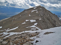
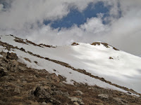
| Late spring conditions on Massive |
From here the route turn and quickly passses treeline, turning eventually into a long basin where Massive comes into view. It might seem close from here, but distances are deceiving. It may seem in this next section, that ou are hiking and hiking towards the mountain but it just keeps getting farther away.
Finally, after another 3 miles, you reach the saddle between Mount Massive's main summit and "South Massive," an unranked 14,000 sub-summit. From here it is just a short distance up a mildly scruffy class 2 slope to the top.
DIRECTIONS
From Highway 24 approximately 3 miles south of Leadville, turn west onto Highway 300. After .8 mile turn left (south) on CR-11. 1.2 miles farther, follow signs toward Halfmoon Creek and turn right. The Mt. Massive TH is five miles farther on the right (north) side of the road. There are several National Forest campsites in the area as well as dispersed camping. The more environmentally correct option is to stay in the developed, fee-based areas. If you must set-up in dispersed areas, please avoid building fire rings, there are plenty already. The Mount Massive trailhead is about one half-mile west of the
North Mt. Elbert trailhead (which is on the opposite side of the road).
TRIP REPORTS
Redemption on Mount Massive- After turning around on Mt. Massive the year before due to lightning, we returned in 2011 to battle deep, rotten snow and a late-spring snowstorm to make the summit just in time to glissade down.
LINKS
Mt. Massive on 14ers.com
Mt. Massive on summitpost.org
 |
| Near the top |
|
 |
| The final ridge |
|
Visit THE ARCHIVE: A list of most of our articles sorted by department
Copyright notice: This website and all its contents are the intellectual property of www.coloradomountaineering.com and its authors. None of the content can be used or reproduced without the approval of www.coloradomountaineering.com.
Climbing and mountaineering are dangerous!! Please see the DISCLAIMER page
For information about how to contact us, visit this link


How much time did it take for you to reach the summit and come back down?
ReplyDeleteIn these conditions it took us about nine or ten hours/ It would take less if the trail was dry
ReplyDelete