Showing posts with label Independence Tower. Show all posts

Wednesday, October 30, 2013

VIDEO: Independence Monument- Colorado's Moderate Desert Tower

A close-up look at a recent climb of Otto's Route (III 5.9) on Independence Tower in the Colorado National Monument. Otto's Route was first put-up in 1911 by John Otto. Though he did some major chipping (obvious in the video) he completed the climb in cowboy boots and with a hemp rope.


Visit THE ARCHIVE: A list of most of our articles sorted by department

find us on facebook


Copyright notice: This website and all its contents are the intellectual property of www.coloradomountaineering.com and its authors. None of the content can be used or reproduced without the approval of www.coloradomountaineering.com.

Climbing and mountaineering are dangerous!! Please see the DISCLAIMER page
For information about how to contact us, visit this link


Friday, September 20, 2013

Hot Route: Independence Tower Otto's Route (III 5.9 R)

Independence Monument in Western Colorado
Approaching Independence Monument
Trailhead: Lower Monument Canyon
Distance: 5 miles
Elevation gain: 1,200 feet
Difficulty: 4 pitches, 5.9

OVERVIEW
Independence Tower is not a mountain, nor is it alpine. It is a desert tower, which makes it somewhat rare for Colorado. And this is Otto's Route, a classic of Colorado climbing established in an age before climbing was set in its course towards what we know today.

Some people are against this route because it follows of line of chipped pipe holds the entire way. In a sense, I see their point. By modern standards this route would be an abomination. But John Otto, the man who drilled the holes in 1911 so he could insert pipe handholds, was considered a steward of nature and the forefront figure for establishing protection for the Colorado National Monument. He was an adventurer who loved these desert formations. If while climbing this route you are upset by the unnatural jugs throughout, consider a couple of things first: John Otto led this climb with a hemp rope in cowboy boots, without the chipped holds this route would probably go in the 5.11 range, and the chipping occurred over 100 years ago.

I encourage people, and I feel like most climbers who have climbed this route agree, to view Otto's as a historical route and not be bothered by its manufactured feel. It is still a great climb and the climbing itself despite everything is still fun. The positions are spectacular and the exposure is invigorating. Each pitch, not just the legendary pitch 4, has sections that are runout and hard to protect.

THE ROUTE
Approach: From the Lower Monument Trail, hike 2.5 miles (gaining 800 feet) to the base of Independence Monument. The route is on the northwest side of the tower following an obvious crack system. You will have to climb a small talus cone to get to the bottom.

Pitch 1: climb a 5.easy step to a junky 5.6 corner. Pass this to a nice finger crack with chopped steps. Climb up and left and gain a large ledge with a bolted belay. 130 feet (5.6)
Bighorn in the Colorado National Monument
You might have an audience...
Otto's Route (5.9) in Monument Canyon
Starting pitch 1
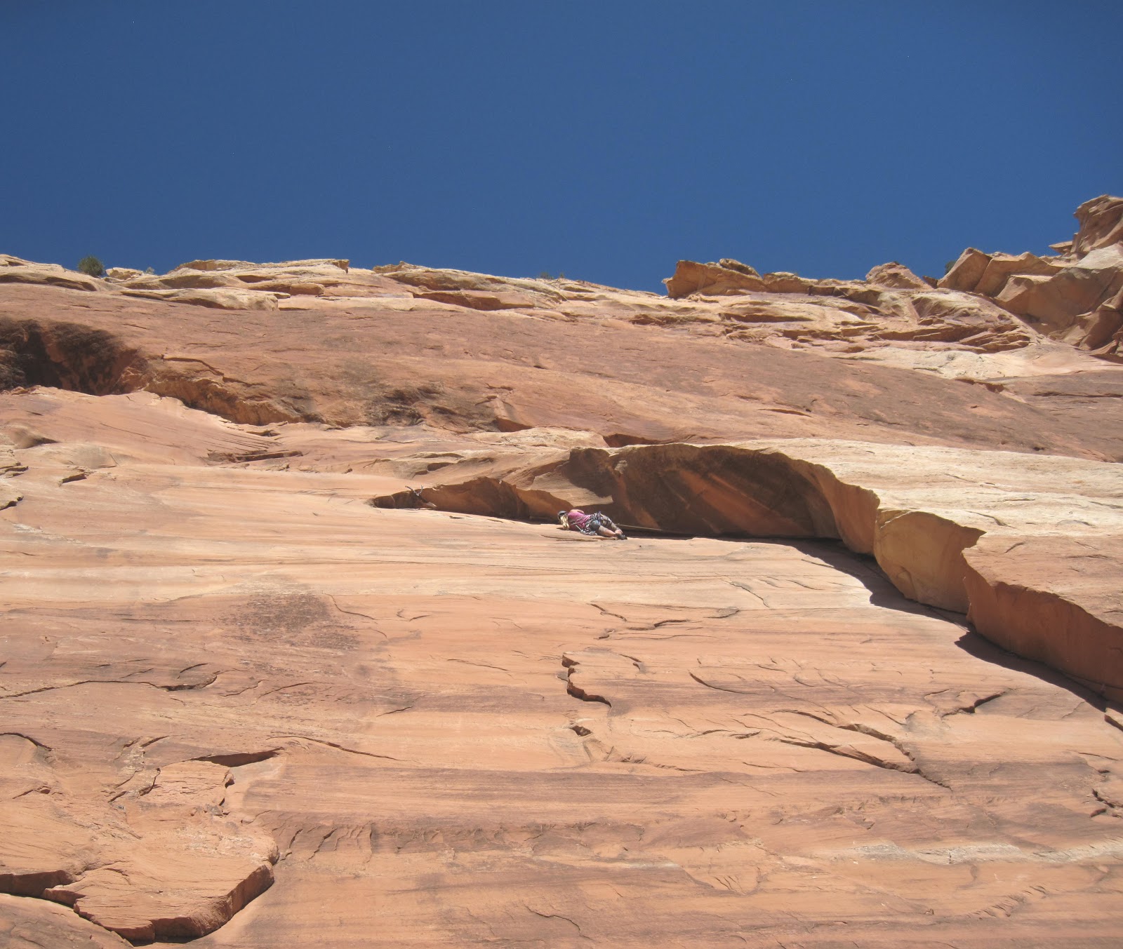
Pitch 2: move the belay to the right and scale a funky, over-hanging off-width. This would be a tricky pitch without the chopped holds. Here you will probably want a #4 and possibly a #5 too, though you can get away with less if you have good technique and a go-for-it attitude. There is some ledgefall potential pulling through the OW without big pieces. Pull, claw, thrutch through the OW and gain another huge belay ledge. Once you have belayed everyone up, most people with de-rope to pass through the next section. 70 feet (5.8+).

The OW P2 on Otto's Route
Climbing the overhanging OW on Pitch 2
The Time Tunnel on Otto's Route
The Time Tunnel between pitches 2 & 3

Scramble: Squeeze through the Time Tunnel, a tight gap between a the main tower and a detached spire. It is a little scrambly in one spot, maybe some minor, non-exposed class 3. At the other side is another massive belay ledge called the Lunch Box Ledge. Here you can leave most of your gear behind for the rest of the climb. All you need to get through the last 2 pitches are draws, maybe a few slings, optional tri-cams and gear to tie into the chain anchors at every belay.

Pitch 3: Pitch three is not hard or exposed, but it is runout between pitons. Tricams can be used in several spots but just trust those slightly sandy chopped buckets and the pitch will be over in no time. Climb up a seam and move up and right following the pipe holds through spaced pitons. Mantle a ledge and arrive at a bolted belay on Sundeck Ledge, where you might see get direct sunlight for the first time. Here the exposure might hit you for the first time. While this belay ledge is also large and comfortable, pitch 4 looms above you, and for some it can look pretty intimidating. 80 feet (5.7)

P3 of the classic Colorado climbing route Otto's Route (5.9)
Pitch 3 follows this seam then goes up and
right (the chopped holds can be seen
in the center). Pitch 4 can be seen top left
Pitches 3 ad 4
Pitches 3 & 4 seen from the Lunch Box Ledge
Pitch 4: This is the classic money pitch and a great lead for the grade. The position is spectacular and the exposure is tremendous. Leave the belay on the right-ish side of the fin and climb fifty feet of unprotected but easy climbing (5.3 R/X). Pay attention to your footwork and your hands on this sandy, dangerous section and keep your mind focused on careful movement. The climbing is easy and it's over in no time. There is potential to use a few tricams to moderate the danger somewhat. Clip a couple of solid pitons and arrive at the route's excellent crux: a fun overhang on massive, bucket holds. This section is well protected by pitons and there is potential for a couple cams to back them up if you want. It may be useful to extend a draw or two at the crux to reduce drag while top-belaying your follower. 90 feet (5.9)

Climber of the Pitch 4 crux of Otto's Route
Pulling the crux on P4 of Otto's Route
The top of Indy Tower
Looking down from the top of 
Independence Tower

Pitch 5: This "pitch" is really just a couple of moves from the big belay ledge at the top of P4. There is no protection, and the climbing is probably about 5.8. Some people "aid" through the botto by standing on the old flagpole base and/or the chains. What makes it a bit scary is that you are fully exposed at the top of the tower with air all around and no protection. Some choose to do this on belay. The top is spacious. On Independence Day you will find many people up here. You also have to downclimb P5, it is hard not to use the flagpole now.... Some people will want to be on belay for the downclimb too. NOTE: The flagpole has since been removed. You will have to climb the rock. There are still chopped holds, however, making it exciting because it is so exposed but not too difficult.

summit panorama from Independence tower
Panorama from the summit of Independence Tower
A shaky but mostly comprehensive helmet cam look at this route from Youtube:


Descent: Double-rope rap from the summit to the Lunch Box Ledge (the bottom of P3). Scramble back through the Time Tunnel. From the bolted anchor you can do a double rope rap (180') from these anchors straight to the ground or rap the route to the anchors of P1 (70 feet), then from these anchors to the ground (110 feet).

The first rappel
The first rappel to the Lunch Box Ledge

The last rappel

Rack: This could be debated and depends largely on your comfort. If you wanted to protect it as well as it can be, bring a full rack of cams to BD #4 Camalot (and possibly even a #5) with extras in the small to mid size, a set of tricams, slings, possible stoppers (though we didn't use any), 6-8 slings and 6-8 quickdraws.

DIRECTIONS
Independence Monument
Otto's Route follows the crack system right of center
then the top via the right skyline
Follow Grand Avenue from downtown Grand Junction west where it turns into Broadway and crosses the Colorado River. Continue on this road 8 miles through a neighbrhood and past many intersections (the road becomes Highway 340) until you reach a small dirt road marked with a sign for Lower Monument Canyon. This turnoff is notoriously easy to miss so be alert. There is a small parking lot here at this popular trailhead.

TRIP REPORTS
What does Independence Mean to You? Four days climbing in western Colorado including Unaweep Canyon, Monument Canyon, bouldering, and an ascent of Otto's Route on Independence Monument in the Colorado National Monument.

LINKS
Check out this helmet cam video guide for Otto's Route

Otto's Route on Mountainproject.com

Otto's Route on Summitpost.org

Monument Canyon- more info on climbing/hiking in Monument Canyon

Visit THE ARCHIVE: A list of most of our articles sorted by department

find us on facebook


Copyright notice: This website and all its contents are the intellectual property of www.coloradomountaineering.com and its authors. None of the content can be used or reproduced without the approval of www.coloradomountaineering.com.

Climbing and mountaineering are dangerous!! Please see the DISCLAIMER page
For information about how to contact us, visit this link


Thursday, January 17, 2013

Area Profile: Monument Canyon

OVERVIEW
Independence Tower ahead
approaching Independence Tower
in Monument Canyon
Monument Canyon is one of the premier destinations for hiking, climbing, and canyoneering in Colorado National Monument. The broad, sandstone canyon is home to many amazing rock formations and towers such as the Kissing Couple, the Coke Ovens, and, most famous of all, Independence Monument. This canyon is also home to a wealth of sport and trad routes ranging from moderately difficult to expert only. For the less technically-adept Monument Canyon offers simple hiking, bouldering, and scrambling in a pristine sandstone setting. This is a playground of recreational opportunity in a classic southwestern setting. The Colorado National Monument feels like a displaced (albeit far less-expansive) version of the Castle Valley area in Utah and the climbs more resemble what you would expect to find there than typical Colorado climbing areas.  

GETTING THERE

Upper Monument Canyon Trailhead: on Rim Rock Road in the Colorado National Monument, 8.1 miles from the park's west entrance.

Lower Monument Canyon Trailhead: Follow Grand Avenue from downtown Grand Junction west where it turns into Broadway and crosses the Colorado River. Continue on this road 8 miles through a neighbrhood and past many intersections (the road becomes Highway 340) until you reach a small dirt road marked with a sign for Lower Monument Canyon. This turnoff is notoriously easy to miss so be alert. There is a small parking lot here at this popular trailhead.

HISTORY

Pulling the crux of Otto's Route
The history of the Colorado National Monument and Monument Canyon inevitably begins with John Otto. It was thanks largely to Otto's efforts that the government recognized the Monument's value and placed it under national protection in 1911. Otto was named the park's first "custodian". Among other things, Otto established many trails through the park. He was also fond of bolting and chiseling into the rock when the climbing was too difficult. Though this, of course, is not an accepted practice in this part of the world now, Otto pioneered these routes during a different age. Signs of his work are visible on Liberty Cap trail, in Devil's Kitchen, and, most notably, on Independence Monument here in Monument Canyon. Otto's bolted rebar routes are sometimes jokingly called "Otto Ferrata".

The route Otto established on Independence Monument is still the easiest and standard route today. Named after its developer, Otto's Route is a four-pitch, 5.8+ Grade III. It is one of Colorado's few notable sandstone towers.

HIKING

Bighorn sheep in Monument Canyon
Monument Canyon offers a variety of hiking options, all stemming from the Monument Canyon trail. This 5.2 mile route gains almost 1,500’ of elevation as it winds along the broad shoulder of Monument Canyon. At various locations along its length it offers access to many side adventures, including Independence Monument, Wedding Canyon, numerous sport-climbing routes, and other features. While hiking in Monument Canyon, please try to stay on the trail. For all its ruggedness, the desert is a remarkably fragile environment.

The main trail is one of the more popular routes in the Monument. The trail contours along the western cliffs of Monument Canyon. The usually dry creekbed is almost always far below and away from you. The trail can be accessed from either the upper trailhead off Rim Drive or from the Lower Trailhead off Highway 340. The lower trailhead is popular for casual day hikers and is also the normal approach to Independence Monument and the climbs of the lower canyon. A fun day trip is to start at the upper trailhead and hike through to the bottom with a vehicle shuttle.

From the lower trailhead, it is 1 mile to the first climbing wall where the popular First Dihedral route is located. The second main wall comes around 1.3 or so and Independence Monument is at mile 2.3.

CLIMBING

trad climbing in Monument Canyon
Monument Canyon offers some of the best climbing in the Grand Junction area. Everything from tall, multi-pitch desert towers to technical sport climbs are available. There are some serious classics in Monument Canyon. Otto's Route on Independence Monument is the most obvious example but other routes such as First Dihedral, Get a Life, Desert Solitaire,and others are also excellent quality. The nearby Kissing Couple and Sentinel Spire also provide excellent, challenging and adventurous tower climbing.

Here are just a few of the routes in the Monument Canyon area:

Trad

Tower (by easiest route):
Atop Independence Monument

Independence Monument (4 pitches, 5.8+, Grade III)
Kissing Couple (5 pitches 5.11a, Grade III)
Pipe Organ (5 pitches 5.11+)
Sentinel Spire (3 pitches 5.10)
Get a Life (Clueless Tower) (5 pitches, 5.12c, Grade III)

Wall:

Trad climbing in the Colorado National Monument
Left Dihedral (2 pitches, 5.12- or 5.8+ for first pitch only)
Right Dihedral (1 pitch; 5.9)
Out of the Fryingpan (1 pitch, 5.9)
Route 2 (1 pitch, 5.9)
Route 4 (1 pitch, 5.9+)
Desert Solitaire (6 pitches, 5.11a A1, Grade III)

Sport

Circle, Square, and the Triangle (5.10a)
Wingate Warrior (5.11a)
Higher Mind Dynamics (5.11)
Friends Cant Be Trusted (5.12b)
(note: there is a bolting ban in the Monument. For full climbing regulations please check this link to the National Park Service website.)

A topo of the main wall in Lower Monument Canyon:

Route topo of Lower Monument Canyon


The routes in this photo:

1- Circle, Square, and the Triangle [Sport, 100 feet, 5.10a] **
2- Luhr's Route aka Right Dihedral [Trad, 90 feet, 5.8+] **
3- Higher Mind Dynamics [Sport, 100 feet, 5.11] *
4- Friends Can't Be Trusted [Sport, 110 feet, 5.12b] **
5- First Dihedral aka Left Dihedral (first pitch) [Trad, 50 feet, 5.8+] ***
6- First Dihedral aka Left Dihedral (second pitch) [Trad/aid, 70 feet, 5.10+ C2 or 5.12a] **
7- Carter Route [Trad, 100 feet, 5.9] *
8- Euro Route [Trad, 100 feet, 5.11 (class 4 scramble just to get to base)]*

other photos:

A trad climb in Colorado National Monument
Sport climbing in the Colorado National Monument
Bighorn Ram in Colorado National Monument
Desert tower climbing in Colorado
Independence Tower in Colorado National Monument
Monument Canyon in Colorado National Monument

This is only a small sample of the climbing in the area and there is likely still potential for development in the Canyon's hidden corners (which are numerous). This place is vast; the more effort you are willing to put in the more you are going to get out. For a deeper discussion of the trad and sport climbing in Monument Canyon check out the Mountain Project link in the external links section.

SPECIAL CONSIDERATIONS

Monument Canyon is within the borders of the Colorado National Monument. Check with the National Park Service for special regulations  One important rule for climbers is that bolting is no longer allowed within that canyon except to replace old dangerous hardware. The addition of new bolts is forbidden. Season raptor closures also affect several walls. Check with the National Park Service to find out when they are in effect.

TRIP REPORTS

Following in the Chipped Footsteps of a Pioneer
Is Otto's Route on Independence Monument a mega classic or chipped abomination? Explore this great route and the history of its creator.

What Does Independence Mean to You?- A weekend climbing in Unaweep and the Colorado National Monument, including a day at the Lower Monument Canyon slabs and an ascent of Otto's Route on Independence Tower.

Visit THE ARCHIVE: A list of most of our articles sorted by department

find us on facebook


Copyright notice: This website and all its contents are the intellectual property of www.coloradomountaineering.com and its authors. None of the content can be used or reproduced without the approval of www.coloradomountaineering.com.

Climbing and mountaineering are dangerous!! Please see the DISCLAIMER page
For information about how to contact us, visit this link