Showing posts with label area profile. Show all posts

Thursday, January 17, 2013

Area Profile: Monument Canyon

OVERVIEW
Independence Tower ahead
approaching Independence Tower
in Monument Canyon
Monument Canyon is one of the premier destinations for hiking, climbing, and canyoneering in Colorado National Monument. The broad, sandstone canyon is home to many amazing rock formations and towers such as the Kissing Couple, the Coke Ovens, and, most famous of all, Independence Monument. This canyon is also home to a wealth of sport and trad routes ranging from moderately difficult to expert only. For the less technically-adept Monument Canyon offers simple hiking, bouldering, and scrambling in a pristine sandstone setting. This is a playground of recreational opportunity in a classic southwestern setting. The Colorado National Monument feels like a displaced (albeit far less-expansive) version of the Castle Valley area in Utah and the climbs more resemble what you would expect to find there than typical Colorado climbing areas.  

GETTING THERE

Upper Monument Canyon Trailhead: on Rim Rock Road in the Colorado National Monument, 8.1 miles from the park's west entrance.

Lower Monument Canyon Trailhead: Follow Grand Avenue from downtown Grand Junction west where it turns into Broadway and crosses the Colorado River. Continue on this road 8 miles through a neighbrhood and past many intersections (the road becomes Highway 340) until you reach a small dirt road marked with a sign for Lower Monument Canyon. This turnoff is notoriously easy to miss so be alert. There is a small parking lot here at this popular trailhead.

HISTORY

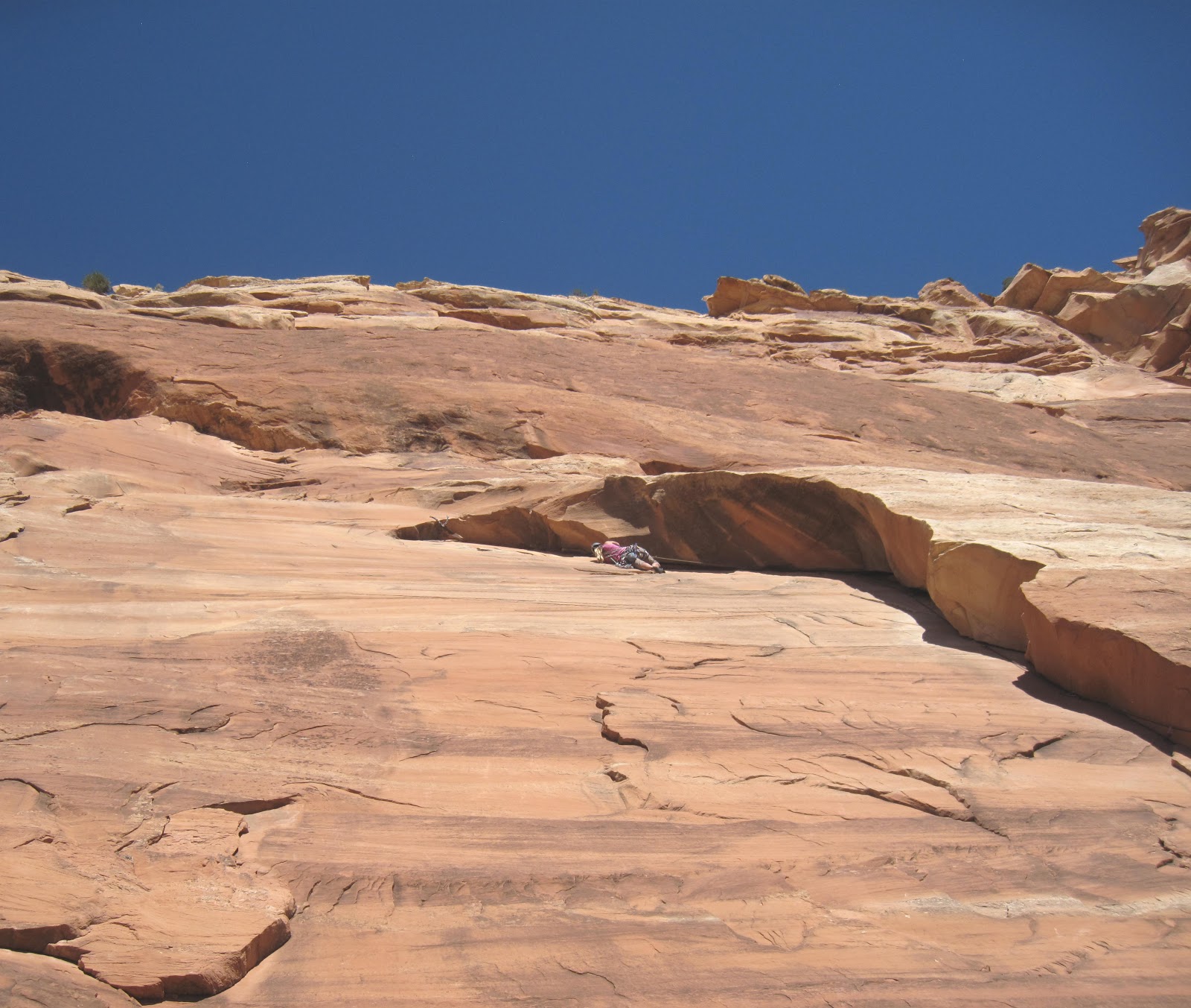
Pulling the crux of Otto's Route
The history of the Colorado National Monument and Monument Canyon inevitably begins with John Otto. It was thanks largely to Otto's efforts that the government recognized the Monument's value and placed it under national protection in 1911. Otto was named the park's first "custodian". Among other things, Otto established many trails through the park. He was also fond of bolting and chiseling into the rock when the climbing was too difficult. Though this, of course, is not an accepted practice in this part of the world now, Otto pioneered these routes during a different age. Signs of his work are visible on Liberty Cap trail, in Devil's Kitchen, and, most notably, on Independence Monument here in Monument Canyon. Otto's bolted rebar routes are sometimes jokingly called "Otto Ferrata".

The route Otto established on Independence Monument is still the easiest and standard route today. Named after its developer, Otto's Route is a four-pitch, 5.8+ Grade III. It is one of Colorado's few notable sandstone towers.

HIKING

Bighorn sheep in Monument Canyon
Monument Canyon offers a variety of hiking options, all stemming from the Monument Canyon trail. This 5.2 mile route gains almost 1,500’ of elevation as it winds along the broad shoulder of Monument Canyon. At various locations along its length it offers access to many side adventures, including Independence Monument, Wedding Canyon, numerous sport-climbing routes, and other features. While hiking in Monument Canyon, please try to stay on the trail. For all its ruggedness, the desert is a remarkably fragile environment.

The main trail is one of the more popular routes in the Monument. The trail contours along the western cliffs of Monument Canyon. The usually dry creekbed is almost always far below and away from you. The trail can be accessed from either the upper trailhead off Rim Drive or from the Lower Trailhead off Highway 340. The lower trailhead is popular for casual day hikers and is also the normal approach to Independence Monument and the climbs of the lower canyon. A fun day trip is to start at the upper trailhead and hike through to the bottom with a vehicle shuttle.

From the lower trailhead, it is 1 mile to the first climbing wall where the popular First Dihedral route is located. The second main wall comes around 1.3 or so and Independence Monument is at mile 2.3.

CLIMBING

trad climbing in Monument Canyon
Monument Canyon offers some of the best climbing in the Grand Junction area. Everything from tall, multi-pitch desert towers to technical sport climbs are available. There are some serious classics in Monument Canyon. Otto's Route on Independence Monument is the most obvious example but other routes such as First Dihedral, Get a Life, Desert Solitaire,and others are also excellent quality. The nearby Kissing Couple and Sentinel Spire also provide excellent, challenging and adventurous tower climbing.

Here are just a few of the routes in the Monument Canyon area:

Trad

Tower (by easiest route):
Atop Independence Monument

Independence Monument (4 pitches, 5.8+, Grade III)
Kissing Couple (5 pitches 5.11a, Grade III)
Pipe Organ (5 pitches 5.11+)
Sentinel Spire (3 pitches 5.10)
Get a Life (Clueless Tower) (5 pitches, 5.12c, Grade III)

Wall:

Trad climbing in the Colorado National Monument
Left Dihedral (2 pitches, 5.12- or 5.8+ for first pitch only)
Right Dihedral (1 pitch; 5.9)
Out of the Fryingpan (1 pitch, 5.9)
Route 2 (1 pitch, 5.9)
Route 4 (1 pitch, 5.9+)
Desert Solitaire (6 pitches, 5.11a A1, Grade III)

Sport

Circle, Square, and the Triangle (5.10a)
Wingate Warrior (5.11a)
Higher Mind Dynamics (5.11)
Friends Cant Be Trusted (5.12b)
(note: there is a bolting ban in the Monument. For full climbing regulations please check this link to the National Park Service website.)

A topo of the main wall in Lower Monument Canyon:

Route topo of Lower Monument Canyon


The routes in this photo:

1- Circle, Square, and the Triangle [Sport, 100 feet, 5.10a] **
2- Luhr's Route aka Right Dihedral [Trad, 90 feet, 5.8+] **
3- Higher Mind Dynamics [Sport, 100 feet, 5.11] *
4- Friends Can't Be Trusted [Sport, 110 feet, 5.12b] **
5- First Dihedral aka Left Dihedral (first pitch) [Trad, 50 feet, 5.8+] ***
6- First Dihedral aka Left Dihedral (second pitch) [Trad/aid, 70 feet, 5.10+ C2 or 5.12a] **
7- Carter Route [Trad, 100 feet, 5.9] *
8- Euro Route [Trad, 100 feet, 5.11 (class 4 scramble just to get to base)]*

other photos:

A trad climb in Colorado National Monument
Sport climbing in the Colorado National Monument
Bighorn Ram in Colorado National Monument
Desert tower climbing in Colorado
Independence Tower in Colorado National Monument
Monument Canyon in Colorado National Monument

This is only a small sample of the climbing in the area and there is likely still potential for development in the Canyon's hidden corners (which are numerous). This place is vast; the more effort you are willing to put in the more you are going to get out. For a deeper discussion of the trad and sport climbing in Monument Canyon check out the Mountain Project link in the external links section.

SPECIAL CONSIDERATIONS

Monument Canyon is within the borders of the Colorado National Monument. Check with the National Park Service for special regulations  One important rule for climbers is that bolting is no longer allowed within that canyon except to replace old dangerous hardware. The addition of new bolts is forbidden. Season raptor closures also affect several walls. Check with the National Park Service to find out when they are in effect.

TRIP REPORTS

Following in the Chipped Footsteps of a Pioneer
Is Otto's Route on Independence Monument a mega classic or chipped abomination? Explore this great route and the history of its creator.

What Does Independence Mean to You?- A weekend climbing in Unaweep and the Colorado National Monument, including a day at the Lower Monument Canyon slabs and an ascent of Otto's Route on Independence Tower.

Visit THE ARCHIVE: A list of most of our articles sorted by department

find us on facebook


Copyright notice: This website and all its contents are the intellectual property of www.coloradomountaineering.com and its authors. None of the content can be used or reproduced without the approval of www.coloradomountaineering.com.

Climbing and mountaineering are dangerous!! Please see the DISCLAIMER page
For information about how to contact us, visit this link


Friday, December 21, 2012

AREA PROFILE: Glenwood Canyon

INTRODUCTION

Glenwood Canyon is a major canyon along the Colorado River in the heart of the Rocky Mountains. It is a recreational hub for biking, hiking, riversports, spelunking and climbing as well as a major travel artery for Colorado and the west. The Cambrian and sedimentary rocks soar 2,000 feet above the river, providing dramatic scenery and unique geologic architecture. The canyon's limestone is home to many caves and other dramatic formations. Glenwood Canyon is an important travel corridor and during its history has been home to a railway, a bike path, a two-lane highway, and now a four-lane interstate which was completed in 1992. The Shoshone Dam and Powerplant, operated by Excel and located immediately downstream of the Hanging Lake recreation area, was completed in 1909 and utilizes hydroelectric energy to provide power to nearly 12,000 homes in the Glenwood Springs area.

From a climbing and hiking perspective, Glenwood Canyon is host to innumerable opportunities for recreation and exploration. Glenwood Canyon is in the White River National Forest and several of the trails can access, with a little proper preparation and know-how, the Flat Tops Wilderness Area. Several of the canyon's walls have been developed with both sport and trad routes, the most popular being No Name for traditional climbing and the Puoux for sport. Other types of climbing exist, however, including grade IV routes on the International Buttress in the heart of the canyon and Grizzly Creek Canyon's Mudwall as well as ice climbing in various locations. Glenwood Canyon is not only popular with hikers and climbers but with rafters, bikers, kayakers, inner-tubers, I-70 truckers, roller-skaters, sun bathers, and folk of all other sort. Most seem to coexist peacefully despite a premium on parking.

HISTORY

Record high water in Glenwood Canyon- June 2011
Glenwood Canyon has a unique and storied history. In the late 19th century the Denver and Rio Grande Western Railroad completed its tracks through the canyon, providing the first travel route through the canyon corridor. These tracks are owned and operated today by Union Pacific and are frequently used for coal transportation and by Amtrak. In 1906 the Taylor State Road was completed through the canyon. This highway was eventually paved. In 1992 the construction of I-70 was completed through the canyon. This section of I-70 was one of the last pieces of I-70 to be completed and, at the time, was the most expensive section of road in the interstate-highway system. Great care was taken during the construction of the I-70 project to preserve the canyon’s natural beauty and minimize the environmental impact. The project included 40 bridges and viaducts, miles of retaining walls, and three major tunnels. The entire system also includes considerable technology for monitoring and controlling traffic, accidents, and rockfall along this section of the interstate.

Glenwood Canyon also is home to the Shoshone Dam and Powerplant. When this project was completed in 1909 it made Glenwood Springs one of the first fully-powered cities in the United States.

Glenwood Canyon is also home to several major hot springs, many of which can be enjoyed for free at river level during low water. The Yampah spring is the largest and is the source for the ultra-popular Hot Springs Pool in Glenwood Springs. Old West gunslinger Doc Holliday died in Glenwood Springs where he came to find some relief for his tuberculosis in the Yampah spring.

Teddy Roosevelt frequented the Hotel Colorado at the mouth of the canyon many times during his life. Supposedly, one day after a failed bear hunt Hotel Colorado maids presented him with a stuffed bear made of scrap material as a consolation for failing to bag the real thing. As legend would have it, Teddy Roosevelt presented the bear to his daughter, the idea caught on, and the toy now known as the teddy bear was born. Teddy Roosevelt, interestingly, wasn't the only celebrity who frequented the Hotel Colorado. It was a mountain retreat for many of America's elite of the time. President William Howard Taft, The "Unsinkable" Molly Brown, "Diamond" Jack Alterie, and even Al Capone made frequent trips to the hotel. The building has such a storied (and even violent) history that it is rumored to be haunted. Almost every Glenwood Springs local either has or knows someone who has a Hotel Colorado ghost story.

HIKING

There are numerous quality hikes in Glenwood Canyon, many of which offer exciting potential for more in-depth exploration. The Glenwood Canyon Bike Path is a concrete trail that follows the river for the entire length of the canyon from near Dotsero to Glenwood Springs. This 18-mile trail is popular for joggers, bikers, and casual hikers.

Scenery along the Grizzly Creek Trail
The Grizzly Creek trail is an 8-mile trek (roundtrip) up a wide and rugged canyon along a perennial creek that provides the water supply for the City of Glenwood Springs. This popular trail is used by hikers of all abilities, from restless I-70 drivers shaking their legs after a long driving shift to casual hikers who rarely go past the first mile to full-on adventurers who continue well-past the seeming "end" of the trail, perhaps all the way into the Flat Tops Wilderness Area.

The Jess Weaver trail follows No Name Canyon, the next drainage west of Grizzly Creek. No Name also offers miles of hiking in a beautiful canyon setting.

The most popular trail, however, is the Hanging Lake trail which climbs 1,200 strenuous feet to a verdant oasis of waterfalls and lakes. Surely this is one of the most popular hiking trails in this part of the state and for good reason. While Hanging Lake can be very busy during the summer, especially on weekends, solitude can still be found in the off-season. Fall is one of the best times to visit the canyon. The combination of colors in the beautiful lake setting is breathtaking. Wintertime can be treacherous, as dangerous ice can form in the canyon. For those with knowledge of ice travel and ice climbing the trip can be very rewarding.

ROCK CLIMBING

Glenwood Canyon has several quality climbing areas that offer a variety of climbing adventures. The rock in Glenwood Canyon is a mixture of limestone, quartzite, and granite of mixed quality. In the 1960's and 70's, legendary Colorado climber and occasional Glenwood local Layton Kor spent much time training on the rock in Glenwood Canyon for more heralded first ascents across the Southwest, such as mega-classics the Naked Edge (III 5.9 A3) in Eldorado Canyon, The Yellow Wall (V 5.8 A4) on the Diamond on Longs Peak, the West Buttress (VI 5.10 A3) on El Cap, and the Kor-Ingalls (III 5.9+) route on Castleton Tower just to name a few. Relics of Kor's extensive exploration of the walls of Glenwood Canyon can be found in surprising places, from random pitons on the Puoux to established routes on the Mudwall to unknown random gear on many of the canyon's most obscure walls. It has been a common experience of modern Glenwood Canyon climbing pioneers to be climbing up dirty towers and faces, thinking they were establishing a brand new route only to find pitons and anchors likely placed there by Kor.
Ironing Board Direct (5.10b) in No Name Canyon

Despite this history and the immense wealth of large walls in the Canyon, it is a relatively untapped and under-appreciated climbing destination. There are several contributing factors to the obscurity of Glenwood Canyon's climbing. One is the presence of I-70. At crags like the Airy Block and the Puoux, the noise of numerous semis, cars, and SUVs is certainly enough to damper your experience. I-70 also takes up alot of space and limits the portals of access, making the approach to many walls quite a task, particularly those that are located on the opposite side of the river. The other deterring factor is the large band of loose, blocky quartzite that dominates much of the canyon terrain. While this large layer has yielded some interesting climbs and crags such as the Mudwall and the Deadhorse wall, its gnarly character eliminate all but hardened adventure climbers. Still, there are at least half a dozen established crags of both traditional and sport climbing, and there is amazing potential for expansion if you are willing to put in a little work. Here is a list of the most-popular Glenwood Canyon climbing destinations:

The Puoux- a limestone sport crag near the No Name exit. The Puoux (pronounced “Pukes”) offers easily accessible sport climbing immediately off of I-70 with difficulty ranging from 5.7 to 5.14. This fairly popular spot keeps the locals in shape. Some of the established sport lines include:


RouteTypePitchesDifficultyLocation/Description
No Name 1 (aka Graybeard)Sport15.8This excellent pitch is one of the better moderate routes at the wall
Pass the DitchieSport15.9Scramble up to a ledge and climb an arcing dihedral past a piton to the anchors. Fun!
No Name 5 (Roadside Attraction)Sport15.10aPolished and popular. This is probably the most frequently climbed pitch in the canyon
No Name 4 (aka Moral Decay)Sport15.10aAnother good moderate route on solid rock. 60 ft up a slab then onto a flake
Youth Warm UpSport15.11cOn the left side of the Main Wall at the Puoux. Challenging and popular route.
No Name 18 (aka Kors Korner)Sport15.11dA challenging route in the middle of the main wall.
Urban CowboySport15.12aOne of the best 5.12s around. Steep, perfectly bolted. Does have some manufactured holds.
The BirdmanSport15.13aA 55 ft route on the left side of the main wall. Part of recent development at the upper grades
Fault LineSport15.13dA local test piece! A photo of Joe Kinder on this difficult route accelerated the popularity of the Puoux


No Name Canyon- located just off the Jess Weaver trail, this area has several single-pitch trad climbing routes from 5.4 to 5.12. Here are some of the No Name favorites:

RouteTypePitchesDifficultyLocation/Description
Second Dihedraltrad15.6A high-quality corner, just to the right of the Pink Face. Perfect first lead.
Jungle Booktrad15.7An open corner just to the right of Unnamed aka "The Ironing Board" (5.9)
Electric Butterflytrad15.8A fun, moderate climb next to the power shack just before the footbridge over No Name Creek. Can be done as TR
The Ironing Boardtrad15.9A right-trending splitter with challenging gear placements and a 5.10b direct variation
The Pink Facetrad15.10+A long (110') splitter just left of Second Dihedral.
Lone Pine Directtrad15.10Down and left from the Pink Face heading towards a pine tree. Thin splitter with finger to hand sized moves
Lightning Bolt Cracktrad15.10West side of creek on the Poison Ivy Wall.
Lost Dogtrad15.12-A recently posted route that comes right out of the creek. Three bolts in addition to finger sized gear. Possible #3 Camalot sized piece


The Neighborhood- a sport crag near the canyon mouth just east of Glenwood Springs on the south side of the river. This little spot is easily accessible for Glenwood locals as an afterwork/school climb. The lines rate from 5.9 to 5.12b

RouteTypePitchesDifficultyLocation/Description
Planet Janetsport15.9+On the far right side of the Zipper Buttress. Short climb that follows a unique "groove".
California Dreamingsport15.9+Right-facing dihedral 20 feet left of where trail meets crag.
Git 'Er Donesport15.10cRight side of Zipper Buttress starting in a chimney.
Zippersport15.11cA 7-bolt climb sometimes called the best 5.11 in Glenwood Canyon
Enter the Dragonsport15.12aThe feature route on the Dragon Cave wall and one of the best 5.12's in the canyon.
Bitch Slapsport15.12bShares first bolts with The Tube but veers left.

Big (or almost big) Wall:

RouteTypePitchesDifficultyLocation/Description
The Internationaltrad185.10+, Grade IVA massive Grad IV climb in-between the Shoshone and Hanging Lake exits on south bank of river
Mudflap Girltrad105.10, Grade IVA monster, chossy wall about a mile up Grizzly creek on the west side of canyon. Can be seen from I-70


A non-exhaustive list of some of the other, less-traveled climbing crags in Glenwood Canyon:

The Airy Block- an interesting fin of granite with several good moderate trad climbs. The only catch is it's right next to the freeway...

Dead Horse Crag- this quartzite crag is accessed off the trail to Hanging Lake. There are several climbs of surprising quality from 5.9 to hard 5.11. Most require some gear to supplement bolts.

Fountain Buttress- Some of the best rock in the canyon, but difficult to access due to a river crossing. A tyrolean is sometimes set-up here, otherwise you will have to use a boat, swim or wait until very low water and walk across. Despite the excellent rock, classic routes, and massive potential, this rock sees surprisingly little use.

The Grey Slabs- Slabby, limestone climbing on the canyon's western end. Access by parking near the Hot Springs or Vapor Caves and hiking upstream along the bike path. Good moderate sport routes.

The Surgery Buttress- This limestone crag on the canyon's eastern end is also under-appreciated. There are about 15 climbs here from 5.9 to 5.12a.

OTHER RECREATIONAL ACTIVITIES
Biking- The Glenwood Canyon Bike Path offers 18 miles of uninterrupted concrete pathway through a beautiful canyon setting. This trail is mellow and popular and provides a nice opportunity for a good workout/escape.

Rafters in Glenwood Canyon
Spelunking-The limestone of Glenwood Canyon has formed many caves, some of which have been explored and some of which have not. The Glenwood Caverns, high on the northern side of the canyon near Glenwood, offers established cave tours in a family-oriented amusement park setting. Undeveloped caves such as Cave of the Clouds offer something for those with a sense of adventure looking for something off-the-beaten-path.

River Sports- River sports are one of the most popular recreational activities in Glenwood Canyon. There are many options for kayaking and rafting within the canyon ranging from beginner to expert only. Local commercial outfitters run half & full day raft trips down the Colorado River through Glenwood Canyon. This is also an excellent place to learn and hone your kayaking skills. The runs include (from top to bottom):

SectionPut-inTake-outLength <2,000cfs (low) 2,000-5,000 cfs (medium)5,000-10,000 cfs (high)>10,000 cfs (cranking)
Dotsero-Bair Ranch Bike Path east trailhead Bair Ranch3 milesclass I+class I+class I +class II
Barrel SpringsHanging LakeShoshone Power Plant2 milesclass IV+ (P)class V (P)class V (P)class V+ (P)
ShoshoneShoshone Power PlantGrizzly Creek2 milesclass IIIclass IIIclass IVclass IV+
GrizzlyGrizzly CreekTwo Rivers Park6 milesclass IIclass II+class IIIclass III

SEASON
Recreation is available in Glenwood Canyon year round. In the summer the canyon is busy with people pursuing adventures of all sorts. In the winter, however, the narrow canyon is mostly shaded and cold but you can still hike and climb. There is, in fact, a long-running tradition amongst kayakers to float the Shoshone section of the Colorado River on New Year’s Day.


GETTING THERE
Glenwood Canyon is accessible from I-70 just east of Glenwood Springs. There are several exits from the freeway from which to launch your adventure, the most popular are No Name (exit 119), Grizzly Creek (exit 121), and Hanging Lake (exit 125).

CAMPING
The only legal place to camp inside Glenwood Canyon is at the developed Glenwood Canyon Resort at the No Name exit. The resort offers cabins, showers, rec rooms, and tent sites.

EXTERNAL LINKS
Mountain Project climbing pages:

Puoux
No Name Canyon
The Neighborhood

Glenwood Hot Springs- The World's Largest Hot Springs Pool.

find us on facebook

Copyright notice: This website and all its contents are the intellectual property of www.coloradomountaineering.com and its authors. None of the content can be used or reproduced without the approval of www.coloradomountaineering.com.

Climbing and mountaineering are dangerous!! Please see the DISCLAIMER page
For information about how to contact us, visit this link


Monday, December 17, 2012

AREA PROFILE: Unaweep Canyon

INTRODUCTION

Unaweep Canyon is a vast and amazing venue for traditional and alpine style climbing. It's vast granite walls are filled with a lifetime of established routes as well as many many possibilities for future development. The boulder fields of Dakota and Burro Canyon Sandstone that you pass through en route to the granite offer an almost endless supply of boulders, many of which have been developed but many of which are yet to be explored.

HISTORY
The vast granite walls of Unaweep saw very little attention in terms of rock climbing until the 1980's and 1990's when climber K.C. Baum and his friends spent a lot of time in the canyon developing the main routes in the canyon, many of which are Unaweep classics still today. In the subsequent decades, development in Unaweep has been slow. In recent years a more exploratory group of young climbers, especially Rob Pizem and others, have developed new routes in the canyon. Many of these new routes are very difficult.

BOULDERING
In today's climbing landscape the vast boulderfields of Nine Mile Hill, a long sloping hill that precedes the main granite as you approach from the town of Whitewater, have grown more popular than the granite itself. These boulders consist of Dakota and Burro Canyon sandstone and are sometimes flaky and fragile. However, there are many classic areas, some of which were first climbed two decades ago or more. Some of the classic areas include the Fossil Boulder and the Plethora Boulders, Chinese Algebra, the Ice Cubes, just to name a few.

GETTING THERE

From Grand Junction take Highway 50 south towards Montrose and Delta. After 9 miles you will come to a small town called Whitewater. Exit Highway 50 to the west onto Highway 141 toward Naturita, CO. For the first 14 miles you will climb slowly up the slightly mis-named "Nine Mile Hill". The vast amount of the bouldering as well as several crags (such as the Grit Wall and the Peter Wall) are located along this section. The rock is almost entirely Dakota and Burro Canyon Sandstone. After about ten miles you will start to enter the granite inner canyon. You reach the turnoff for Divide Road at mile 14.5.

THE CANYON

Access Fund TH
The Access Fund trailhead is found 2.1 miles past the turn off to Divide Road. It provides access to some of the most popular cliffs in the canyon and for good reason. The Access Fund trail allows you to legally reach the base of the Sunday Wall, the Hidden Valley Wall, and the Fortress Wall: enough vertical terrain to provide many hours of entertainment.


Some of the most popular routes (left to right):

NameTypePitchesDifficulty
Beginner's Lucktrad15.7+
Napa Valleytrad55.11-
Don Juantrad15.6
Banditotrad15.9
Three's Companytrad15.8+
Echoestrad65.12d
Bridge of Airsport15.12a
Optical Illusionssport15.11c
Standard Routetrad15.7
Sweet Sunday Serenadetrad35.9
Sun Dancertrad25.8

Mother's Buttress
The Mother's Buttress area is probably the second most busy climbing area of the canyon. It is located 3.1 miles past the turn off to Divide Road, about a mile past the Access Fund trail. There are a variety of routes from some of the most user-friendly single pitch trad routes to some truly challenging and committing grade III multi-pitch adventures. The Upper and Middle Mother's Buttress are better known for long, challenging multi-pitch routes where the Lower Mother's Buttress is popular for its concentration of easy and moderate trad routes, some of which can be top-roped by scrambling up from the formation's east side.

Some of the more popular routes at the Mother's Buttress area:

NameTypePitchesDifficulty
Doppelgangertrad35.11
Questions and Answerstrad35.10+
Centuriontrad35.11b
Flora Doratrad35.11
Rise of the Phoenixtrad15.10a
Alex's Towertrad15.8
Mint Jamtrad15.8+
No Name Routetrad15.9+
Welcoming Partytrad15.7+
Guide's Routetrad65.9

Sun Tower
Dovercourt (5.7) Lower Sun Tower
The Sun Tower area is a collection of fun spires and cliffs that make for a good smattering of traditional and sport climbs. This area is not as busy as the Access Fund or Lower Mother's, so it is unlikely you will encounter a crowd of climbers here. The Sun Tower is located just east of mm 135 in the main canyon. The access is on private property but is allowed via a well-marked and developed trail.

NameTypePitchesDifficulty
Sunupsport15.8+
Crack of Dontrad15.6
Dovercourttrad15.7
Betty and Ray's Adventure trad35.6
Twin Owlstrad25.9
Daffy Duck Pinnacletrad25.10-


Other areas
This is only an introduction to the climbing available in Unaweep Canyon. Some of the other popular destinations include: The Mighty Mouse Wall, the Divide Wall, the Rainbow Buttress, the Grit Wall, the Unaweep Wall, Castle Rock, the Thimble, and others.

External Links
Unaweep Canyon on Mountainproject.com
Unaweep Canyon on Summitpost.org
The Sunday Wall on Summitpost.org

Visit THE ARCHIVE: A list of most of our articles sorted by department

find us on facebook


Copyright notice: This website and all its contents are the intellectual property of www.coloradomountaineering.com and its authors. None of the content can be used or reproduced without the approval of www.coloradomountaineering.com.

Climbing and mountaineering are dangerous!! Please see the DISCLAIMER page
For information about how to contact us, visit this link


Tuesday, September 20, 2011

Area Profile: Main Elk Canyon, Flat Tops Range

Main Elk Canyon is one of the major creek basins that drains the southwestern portion of the Flat Tops Range in central Colorado. While not really mountaineering, this little-known location is a great place to enjoy an alpine environment and even hone your skills. This major canyon is home to some remote alpine terrain, soaring limestone cliffs, and some of the best sport climbing in western Colorado. The creek, accessed from the small, non-descript town of New Castle, Colorado, also has a pair of significant trails that can lead one eventually into the Flat Tops Wilderness Area.

 The Main Elk area is one of western Colorado's most beautiful and least traveled places. It's semi-remote location and out-of-the-way approach have deterred many people. For those, however, that are willing to spend the time to seek out what lies within this amazing place, there are untold secrets just waiting to be discovered. The possibilities for future rock climbing seems almost limitless, and the possibility for adventure is there for those willing to put in the work. While the Pup Tent of Solitude and Main Elk crags offer only mediocre to moderate challenges, for the sport climbing master with a sense of adventure the Fortress of Solitude is one of the best climbing destinations around.

HISTORY

 The Main Elk drainage has mostly escaped the popularity that has engulfed the nearby creeks and trails of Glenwood Canyon, yet from a climbing perspective its history is more significant to the annals of rock history that any area within Glenwood Canyon. It could be said that without the attention gained by the hardwork and difficult redpoints of Tommy Caldwell in 1999 and 2003, the Fortress of Solitude would be just another obscure, if not massive and untapped, crag in the backcountry of Colorado. When Caldwell redpointed Kryptonite at last, it was the country’s first 5.14d, making the moment a benchmark in the history of American sport climbing. Due to subsequent changes in the route topography, perhaps due to natural processes or perhaps due to clandestine chipping by later climbers, Kryptonite is often now considered 5.14c.

 Nearly four years later, Caldwell returned to the Fortress and redpointed a monster project after several months of work. Famously, Caldwell refused to rate the route, claiming only that it was "significantly harder" than Kryptonite, which led to climbing media claiming Luthor as the first 5.15. To this day the route's rating has yet to have confirmation as nobody has been able to repeat Caldwell’s climb. Later rounds of development by climbers such as Dave Pegg, Matt Samet, Bryan Gall, and others have greatly expanded the climbing at the Fortress and the Pup Tent. Other walls nearby including some cliffs on the northeast side of the road are also starting to bee developed, though information about much of these routes is difficult to obtain.

 HIKING

 Two major hiking trails exist within the Main Elk Canyon system; the trail that follows along the creek into the canyon proper and the steeper Hadley Gulch trail that turns off the creek and follows Hadley Gulch up onto the canyon rim and, ultimately, onto the Flat Tops. From the parking area, follow the Hadley Gulch trail for .22 miles until you reach a prominent fork. Here is where the two routes differ:

  Hadley Gulch Trail- This trail takes the right branch at the fork and contours steeply up the hillside and ultimately into the steep, usually dry creekbed. In the spring, however, this creek can hold a substantial amount of water and even be difficult to cross, as was the case for several weeks during the banner year of 2011. A small side trail just after the creek crossing access the climbing and the first route, Gatehouse of Lonliness, is the black buttress right here at this junction. To continue up the Hadley Gulch trail, follow the steep and winding trail as it climbs in the shadow of the Fortress of Solitude (about a mile passed the creek crossing) and into a meadow with another fork in the trail. You can try to follow the creek here but the route quickly becomes overgrown and downed trees are a problem. The main route turns left and climbs up the hill side through the cliffs and topsout at some indistinct dirt roads on the canyon rim. From here you are about 2.75 from the trailhead and have gained over 2,000 feet of elevation. On top of the rim there are a number of options available by following a variety of backcountry roads. This is a barren place that doesn’t see much traffic. Be sure to remember how to find the trail again as it quickly becomes lost in the thick brush.

Cliffs along Hadley Gulch trail

Main Elk Creek/Canyon

This beautiful hike is much quieter than neighbors such as Grizzly Creek or No Name. This beautiful trail follows the creek along the bottom of a narrow, quaint canyon for two miles to a prominent fork in the canyon. There is possible camping in this area. The trail peters out here and to continue farther you will need good backcountry skills. Ultimately, if you were to follow this canyon to its source, you will emerge deep in the Flat Tops above the Crater Lake area.
Main Elk Canyon during runoff, any farther means gettin' wet....
CLIMBING

While the climbing in Main Elk Canyon will never be as popular and famous as nearby Rifle Mountain Park, there is some climbing in the area that is still world class. The rock that has been established is split into three main crags:

Fortress of Solitude

The Fortress is proud, famous, and burly. Some of the hardest climbs in North America if not the world sit up there waiting, yet it is rare to see more than a few people up here all season! There are several reasons for that, I suspect. One is that given the grueling approach, it is difficult to motivate for this out-of-the-way crag with the roadside walls at Rifle Mountain Park nearby. Still, for those undaunted by things like a steep hike or semi-remote location, it is hard to beat the Fortress in terms of challenge and adventure, especially for sport climbing! Some of the best climbs at the Fortress (left to right)

RouteTypePitchesDifficultyLocation/Description
Tommy’s 5.11Sport15.11dThe leftmost route at the Fortress. An early Tommy Caldwell creation.
The PummelingSport15.13b RThis 100 foot pitch is famous for it’s difficulty and runout after the third bolt.
Glamorama Sport15.12dNot as hard as it looks. Climb through a section of bad rock to some of the best and most interesting holds.
The Daily PlanetSport15.13dWork through a mediocre first half to an amazing 60 feet of .13d on great rock.
Kryptonite Sport15.14dIt takes a superhero to send this! A mega-famous route that has only been climbed a few times.
Flex Luthor Sport15.15aTouted as North America’s fist 5.15. Still unrepeated.
Metropolis Sport15.12cA 130 foot pitch that climbs some brilliant, sustained rock.
Orange Mechanique Sport15.13aLeft side of the eastern portion of the Fortress. Crimp. 60 ft.
Boy Wonder Sport15.12dA short climb for the Fortress but with a variety of holds.


The Fortress of Solitude
Pup Tent of Solitude

The Pup Tent is overshadowed by it’s towering neighbor, but it is still a worthy crag, particularly if you are a novice/intermediate climber. There are just over 50 established lines, most of which are bolted with a handful of short trad lines thrown in for the mix. The routes are usually short, and the rock in general is quite good. Some of the better routes at the Pup Tent (right to left, as encountered from trail):

RouteTypePitchesDifficultyLocation/Description
Gatehouse of Lonliness Sport15.8This short climb is the first route encountered at the Tent and one of the easiest. Could use a cleaning.
Total Eclipse Sport15.12aSteep, bouldery and long for the tent. 7 bolts.
SubprimeSport15.11aDifficult start on a tan-colored wall.
Stimulus PackageSport15.11dAn eight-bolt arĂȘte.
Rex Luthor Sport15.11cShort, challenging. Start on a flake and over a bulge.
CraptoniteSport15.12aone of the best routes at the Tent
Easiest Sport15.7A short climb, easiest at Tent. Can access anchors to next to climbs from top.
EasySport15.10aClimb easy terrain to an insecure flake and reachy, overhanging topout.
Easier Sport15.9A tricky climb with some fun movement at the crux topout
Deputy Dawg Lives to Fight Another Day Sport15.8Possibly the best moderate at the Tent
Country Style Pork Rib Sport15.9A challenging 5.9 with a counter-intuitive crux
First Blood Sport15.9+ On the right side of the next teir down from the previous climbs
Magical HandholdSport15.10cA fun climb with some sneaky beta
Subtle KnifeSport15.10aAn interesting arete feature with good, dark stone. Anchor chains were stolen from this climb and as of now still haven't been replaced
Puppy LoveSport15.11cOne of the Tent’s best! Long and challenging.
Nose Picking GoodSport15.9A cool, black-colored arete. Some choss on a ledge midway and possible rope snag near top.
NicklepupSport15.10aA fun long 5.10a with a easy diheadral to a great roof problem on big holds
Girls With GunsSport15.10dA long climb, one of the Tent’s best. Bouldery start to beautiful headwall
Ewok StewSport15.9An interesting climb up awesome, dark rock.
Disturbed SusanSport15.10bOne of the climbs farthest to the left at the Pup Tent sector. Some funky rock to a cool roof problem

Girls With Guns (5.10d). One of the Pup Tent's most classic climbs

Main Elk Crag

A slightly more obscure wall, this set of cliffs within the canyon proper above Main Elk Creek see even less traffic than the Pup Tent. The routes here are more advanced than the Tent as well, and the rock quality has moments of greatness and moments of ugliness. A couple of chossy trad routes are thrown in for fun.
 
RouteTypePitchesDifficultyLocation/Description
Giblet Gravy Sport15.10bA good warm-up for the area
Patchouli Sport15.11cA crack line over a bulge
Best in Show Sport15.12dOften considered the best route at the Main Elk Crag
Black Ball Retriever Sport15.12cA hard route with great rock. Identified by black hangers.
Jewel Rosena Sport15.12aJust right of a cave/roof.
Both Ends Burning Sport15.13aThe first route to te right of where the approach trail meets the cliff
Infinite Jest Sport15.12dA 80 foot pitch that crosses varying rock that improves as you climb
Mint Jelly Trad15.8+A good trad route, with some loose rock and choss to tiptoe around. Good protection.

GETTING THERE

Main Elk Canyon is accessed from the town of New Castle (exit 105) 7 miles west of Glenwood Springs, Colorado. At the exit, turn north and cross a bridge over some railroad tracks to a four-way blinking red light. Turn left. Go 1.2 through downtown New Castle and turn right onto N. 7th Street. If you cross the creek you have gone just a little too far. Follow this road for .7 miles through a neighborhood and continue straight at the junction with Castle Valley Boulevard. After another 3.1 miles turn right onto CR 243 (Main Elk Road) which is paved. Follow this road for 6 miles until it crosses the creek and reaches a trailhead and a small parking area.

SEASON

Main Elk offers various sorts of adventures in all seasons. While the main canyon gets snowy and cold in the winter, those adept with snow travel may find the quiet trails are at their best in these sorts of conditions. The Pup Tent is a very sunny crag that is often climbable even in the dead of winter. The summertime, however, can be too hot for the south-facing cliffs, especially at the Tent, but hiking within the shady canyon is quite pleasant in the hot season. In the spring, Main Elk Creek can be very swift and the narrowest point in the canyon can be flooded, making for difficult passage.

Main Elk in winter

CAMPING

Camping is illegal at the trailhead for the Main Elk area. My recommendation would be to either stay at the nearby Elk Creek Campground (just up nearby East Elk Creek) for a small fee, or backpack a short ways into Main Elk Canyon (being sure to adhere to No Trace ethic, of course). 

 EXTERNAL LINKS 

Rifle Mountain Park and Western Colorado Climbs is an excellent guidebook not only to the world-famous crags of Rifle and the adventurous rock here in Main Elk but to the entire Roaring Fork Valley and lower Valley area. It is a must for anyone who wants to visit the area to climb. Purchase the book at local climbing shops in the area such as Summit Canyon Mountaineering or online at Wolverine Publishing’s website. 

 Mountainproject.com has a database with user-created beta on climbs at the Fortress of Solitude and the Pup Tent of Solitude

Splitterchoss.com has more recent information about newer bolted routes at the Pup Tent.

Visit THE ARCHIVE: A list of most of our articles sorted by department

find us on facebook


Copyright notice: This website and all its contents are the intellectual property of www.coloradomountaineering.com and its authors. None of the content can be used or reproduced without the approval of www.coloradomountaineering.com.

Climbing and mountaineering are dangerous!! Please see the DISCLAIMER page
For information about how to contact us, visit this link