Sunday, June 30, 2013

Ten Class 5 Colorado Mountaineering Classics

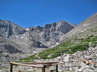
Longs Peak, Mount Meeker, & the Diamond. Shows
Pervertical, Kiener's and The Flying Buttress
There is nothing more exciting than a technical alpine route. The adventure, the scenery, the danger all combine to make for the ultimate challenge for a mountaineer. High, hard and exposed, these mountaineering classics demand such a level of expertise that they shine above all others in the minds of the climbers and alpinists who live in and visit this state. The following list would be an ambitious ticklist of some of the most famous, and most fun technical alpine climbs on a high peak in Colorado.

It is difficult to go about creating a list like this, as so many opinions exist about each and every one of these routes. I started by first establishing several criteria to reduce the number of worthy candidates to a manageable category. For example, I decided that to be included as a "mountaineering classic" the climb must be a summit route on a mountain higher than 12,000 feet. This eliminated many of Colorado's most classic lines such as The Naked Edge (6 pitches, 5.11b) in Eldorado Canyon, Otto's Route (4 pitches, 5.9) on Independence Monument outside Grand Junction, as well as anything in The Black Canyon or at Lumpy Ridge, etc. All of these climbs were worthy of being listed as Colorado Classics, but were they mountaineering? I considered expanding my criteria to include. But really, they didn't quite fit what I was looking for. I wanted to look at alpine routes, the kind that require a grueling approach and reach the top of a high peak. There seemed to be an intellectual line that defined what "mountaineering" meant, and the need for a strict definition waned.

Sunlight Spire (13,995') (5.10c)
With the 1988 datum bumping up the elevations on most mountains in Colorado, Sunlight Spire now just barely touches the 14,000' mark. However, most mountaineers still refer to the classic 1927 datum, so the Spire is usually still listed at 13,995'. Though it does not have 300 feet of topographical prominence, it holds the title as the hardest 14,000 foot summit in Colorado (if you adhere to the 1988 datum), perhaps in the entire United States. Sunlight Spire is a coveted and elusive summit for the true Colorado mountaineering master.

Wham Ridge on Vestal Peak
Vestal Peak and Wham Ridge
Vestal Peak (13,864')-Wham Ridge (Center Shift) (5.6)
The unique profile of Vestal Peak's Wham Ridge is unmistakable. It is one of Colorado's most beautiful and most astounding high alpine faces. While the standard Wham Ridge line alone is quality enough to warrant inclusion in this list of classics, the so-called "Center Shift," or direct variation, is the best way to experience the full value of this amazing mountain.

Hallett Peak (12,713')- Culp-Bossier (8 pitches, 5.8+)
The Culp-Bossier route is one of the classic alpine moderates. Located in Rocky Mountain National Park, this little mountain offers big adventure and big rewards. 8 pitches of good climbing including mostly solid rock, runout sections, and some solid "old school" 5.8.

Longs Peak (14,255')- Kiener's Route (5.4, moderate snow)
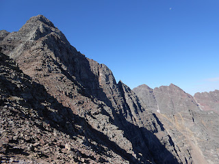
In my opinion, other than the Diamond, Kiener's Route is the best way to take on Longs Peak. Kiener's is an involved climb, with a long approach, a steep snow couloir, tremendous exposure, a little technical rock and a lot of route-finding. It's other name, The Mountaineer's Route, was given for the multiple skills necessary for a successful ascent.

Jagged Mountain (13,824')- Standard Route (5.2)
Jagged Mountain should be one of Colorado's most coveted mountaineering prizes. It is deep in the wilderness, impossible to see from almost any vantage in civilization, has an amazing route to the top, and is one of Colorado's 100 highest. There is exposure, loose rock, and patience necessary to make an ascent of this unique peak possible. It takes a broad spectrum of mountaineering and backcountry skills to climb reticent Jagged.


Climbers on the Diamond
Climbers on the Longs Peak's Diamond
Longs Peak (14,255')- Pervertical Sanctuary (IV 5.10c)
Any one of the routes on Longs Peak's Diamond deserve to be here. I picked Pervertical Sanctuary for this list. It is the second-easiest way up the Diamond and one of the highest quality in terms of rock and position. Does Longs Peak deserve two routes listed here on this page? It probably deserves more....

Crestone Needle (14,197')- Ellingwood Ledges (5.7)
A mega classic that would deserve to be listed here even if it had not been included in the famous book Fifty Classic Climbs of North America. Other than the numerous routes on Longs this is one of the best technical climbs on any 14er in Colorado. First climbed in 1925 by legendary Albert Ellingwood, this route is steeped in history. It is also very high quality and worth making this list.

Mount Meeker (13,911')- The Flying Buttress (6 pitches, 5.9+)
The Flying Buttress on Mount Meeker is yet another classic alpine climb in Rocky Mountain National Park. This excellent route follows a salient feature on the Meeker side of the world-class Longs/Meeker cirque that includes Longs Peak's east face and the Diamond. This route is a worthy objective of its own, easier than the Diamond but harder than many other of the classic RMNP climbs.

Petit Grepon (12,000')- South Face (8 pitches, 5.8)
This slender alpine tower was also included in Fifty Classic Climbs, thus cementing its place in the canon of Colorado mountaineering. Besides being a part of this exclusive club, this mountain is fully worthy of being listed as one of the best alpine mountaineering routes in the state in terms of the quality of its rock and of its position. Just don't climb on a weekend or risk having to wait in line for your ascent.

Kit Carson (14,165')- The Prow (5.8)
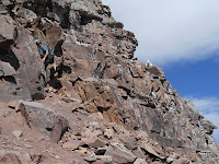
The Prow is one of the more interesting and unique features on any Colorado mountain. It is an exposed, aesthetic ridgeline that dances up typical Sangre conglomerate cobbles. While most of the route is 5.6 or easier, the crux comes as the first move, committing you to the route. Escape is difficult and the exposure is amazing. A true alpine classic.

RELATED ARTICLES
Ten Class 3 Colorado Classics- for those too timid or too inexperienced for the class 5 list, check out these classic class 3 scrambles.

Visit THE ARCHIVE: A list of most of our articles sorted by department

find us on facebook


Copyright notice: This website and all its contents are the intellectual property of www.coloradomountaineering.com and its authors. None of the content can be used or reproduced without the approval of www.coloradomountaineering.com.

Climbing and mountaineering are dangerous!! Please see the DISCLAIMER page
For information about how to contact us, visit this link


Tuesday, June 25, 2013

NEWS: Another Climber Killed in the Elks (6/25/13)

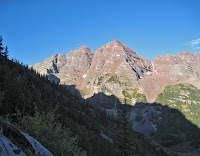
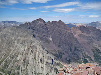
Pyramid Peak and the Maroon Bells
Pyramid Peak (left) and the Maroon Bells (right).
"Thunder Pyramid" lies behind Pyramid Peak in this photo
The Elk Range claimed the life of experienced mountaineer Steve Gladbach, 52, on Sunday. Gladbach went missing after summiting the notorious Thunder Pyramid with some companions. According to a person who was with him, Gladbach had successfully summited Thunder Pyramid and separated from his companions to side-hill traverse out onto "Lightning Pyramid" where the accident occurred. 

Gladbach was a highly experienced mountaineer who had climbed all 584 of Colorado's 13ers, and all of Colorado's 14ers during wintertime. He was also a father of two and a high school math teacher. Gladbach resided in Pueblo, Colorado.

Both "Thunder Pyramid" and "Lightning Pyramid" are regarded as some of Colorado's most dangerous mountains. The massif has been site of several deadly accidents over the years, including that of David Morano in September 2011. At 13,932 feet, Thunder Pyramid is Colorado's 65th highest mountain and "Lightning Pyramid" is Colorado's 137th highest peak. They are both located along the same ridge as 14er Pyramid Peak and near famous mountains, the Maroon Bells.

NOTE: The original story when posted included several incorrect details, including that the accident occurred on Thunder Pyramid when in fact Mr. Gladbach was actually on "Lightning Pyramid" when he fell. His group had summited Thunder Pyramid earlier that day and were on descent when he decided to traverse off Thunder Pyramid towards its neighboring peak. We also originally reported that he had "wanted to check out a waterfall he was interested in climbing in the winter." Though he was interested in climbing Thunder Pyramid during winter, no "waterfall" exists on this aspect of the mountain nor was he scouting one as a potential route at the time. We regret the errors.

RELATED STORIES
-Climber Killed on Thunder Pyramid
-Statistical Analysis of Deaths on 14ers This Decade
-Sixty Highest Peaks in the Elk Range

Visit THE ARCHIVE: A list of most of our articles sorted by department
find us on facebook


Copyright notice: This website and all its contents are the intellectual property of www.coloradomountaineering.com and its authors. None of the content can be used or reproduced without the approval of www.coloradomountaineering.com.

Climbing and mountaineering are dangerous!! Please see the DISCLAIMER page
For information about how to contact us, visit this link


Monday, June 24, 2013

NEWS: Colorado Mountaineer Killed on Grand Teton (6/24/13)

Grand Teton Pastoral View
Grand Teton, site of a fatal accident Thursday
55 year-old Gary Miller, from Colorado Springs, died Thursday as a result of a fall while on a guided climbing trip of Grand Teton near Jackson, Wyoming. According to reports, Miller was a client with Exum Mountain guides and  his group had successfully reached the summit. The accident occurred near the Lower Saddle on descent when Miller slipped and fell on a snowfield, sliding into an "icy water moat." Despite rescue attempts from both Exum guides and Grand Teton rangers, Miller was pronounced dead at 8:35 p.m. The exact cause of death is still under investigation.

Grand Teton is Wyoming's second-highest mountain and is popular internationally with hikers and mountaineers.


Visit THE ARCHIVE: A list of most of our articles sorted by department

find us on facebook


Copyright notice: This website and all its contents are the intellectual property of www.coloradomountaineering.com and its authors. None of the content can be used or reproduced without the approval of www.coloradomountaineering.com.

Climbing and mountaineering are dangerous!! Please see the DISCLAIMER page
For information about how to contact us, visit this link


Sunday, June 16, 2013

Featured Route: Pyramid Peak, Northeast Ridge

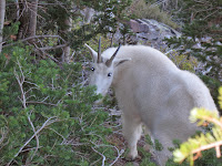
Mountain Goat climbing Pyramid Peak in the Elks
The view from the summit of Pyramid Peak in the Elk Mountain Range
Length: 8 miles
Elevation gain: 4,420 feet
Difficulty: class 4 (loose steep rock, moderate route finding challenges)
Exposure: moderate

From Maroon Lake, follow the Crater Lake trail for 1.5 miles to a level clearing filled with glacial moraine boulders. Find a trail on the left (south) side of the trail marked by a large cairn. Follow this trail as it switchbacks through the forest and across some scree slopes to a notch left of a large pinnacle. The trail end at the terminus of a large rock glacier that empties an “amphitheater” at the bottom of Pyramid’s North Face. Follow the path of least resistance up the rock glacier to the bottom of the face, turn left (east) to the bottom of a scree slope left of the main difficulties of the North Face. The approach is over.

A view of the Maroon Bells
A mountain goat up close
Climb steep, loose scree on a well-trodden climbers trail 1,000’ to a saddle a little less than 13,000’. The rest of the route is visible above you. Ascend the ridge, staying mostly on its right side past another, smaller saddle up to a notch with a steep headwall. Descend through some boulders to the left side of the ridge. Find a climbers trail that traverses over a couple rock ribs and across the “Cliff Traverse”, a narrow ledge that pinches down to a narrow crux in the middle. Continue on a strong climber’s trail past another rock rib, across a dirty gully until you reach the Green Couloir.

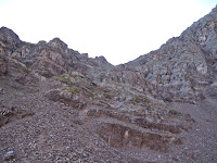
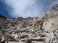
The gully that leads to the saddle
The Cliff Traverse on Pyramid Peak

Now the fun part begins. Climb the Green Couloir for a couple hundred feet, being very cautious with loose rock (class 3). It might be best to climb this one at a time to avoid knocking rocks on each other. Exit the green rock left at some cairns and climb steepening rock through several cliffbands. There are several ways to negotiate this section, the path of least resistance climbs a small chimney and cliffband crux that are both class 4. Keep in mind that downclimbing is harder for most people. Stay left of the ridge itself and make a few class 3 moves just before breaking loose onto the amazing summit. Enjoy one of my favorite summit platforms.

The Green Couloir
A mountain goat watches a human mountain goat on Pyramid Peak
The narrow summit of Pyramid Peak
The Maroon Bells from the summit of Pyramid Peak


Visit THE ARCHIVE: A list of most of our articles sorted by department

find us on facebook

Copyright notice: This website and all its contents are the intellectual property of www.coloradomountaineering.com and its authors. None of the content can be used or reproduced without the approval of www.coloradomountaineering.com.

Climbing and mountaineering are dangerous!! Please see the DISCLAIMER page
For information about how to contact us, visit this link


Monday, June 3, 2013

Featured Route: Snowmass Mountain East Slopes

EAST SLOPES OF SNOWMASS MOUNTAIN
Length: 22 miles
Total Elevation gain: 5,700'
Difficulty: class 3

OVERVIEW
Snowmass Peak and Snowmass Lake
The East Slopes (standard) route on Snowmass Mountain is one of Colorado's most spectacular 14er adventures. At 22 miles, it is a very long hike, and I recommend 2 days. Though the hike in and out will be more difficult with the extra gear, the extra time will allow you to take your time and enjoy this beautiful place. Although Snowmass Lake is very likely one of the busiest lakes in the Colorado's backcountry, it is quite beautiful and offers numerous opportunities for places to camp.

Like most climbs in the Elk Range, the East Slopes of Snowmass Mountain is steep, loose and dangerous. It has proven fatal for several mountaineers over the years. Almost the entire route once you have passed the Snowmass Lake is one slippery scree and once you have pass around 13,500' the route becomes particularly dangerous. Wear a helmet, use caution, and be careful not to climb directly underneath another party.

THE ROUTE
Snowmass Lake at sunrise
The long approach to the East Slopes of Snowmass Mountain is one of the longest for any standard route on a 14er in Colorado. The approach alone is over 8 miles and gains over 2,500' in elevation. The hike is long an provides some beautiful views. After 6.5 miles you must cross the creek. This can be a challenge at high spring runoff levels. Depending on the flow level/wood conditions people usually tiptoe across a log jam. If the water is low you can sometimes cross the creek directly below the jam. Not far after negotiating this obstacle, you reach the lake itself. There are many good campsites here. Beware, however, of rules against camping too close to the lake and against fire in general.

the East Slopes of Snowmass Mountain
Hike along the east and south sides of the lake and find a climber's trail that starts up the loose rock on the lake's west end. The approach is over. Climb up the steepening slope along a vague climber's trail into the huge basin on Snowmass Peak's east slopes. Depending on the time of year and conditions there may be some snow to climb at the top of this basin. The usual route veers a bit south as you approach the ridge and finds a notch through the cliffs to reach the summit ridge. In dry, late-summer conditions, or if the snow covering is complete, you can hike more directly towards the summit, finding a breach in the cliffs and reaching the summit ridge near 13,900'. From here you traverse slightly onto the west side of the mountain and pick your way through some class 3 boulders to the summit.

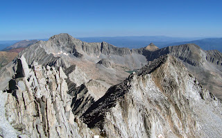
From the summit of Snowmass Mountain looking towards Capitol Peak
 Looking across to Capitol Peak from Snowmass's summit
DIRECTIONS
From Highway 82 28 miles south of Glenwood Springs (or 13 miles north of the roundabout in Aspen) turn west at the town of Old Snowmass (not to be confused with Snowmass Village, the ski area) onto Snowmass Creek Road. Turn left at a T-junction after a mile and a half (right will take you to Capitol). You hit the dirt road seven miles after turning off Hwy 82 and cross the creek at mile 10.5. Take a right at another intersection a half mile later and the trailhead is only about a quarter-mile beyond that.

TRIP REPORTS
the summit area of Snowmass Mountain in the Elk Mountains of Colorado
The summit of Snowmass Mtn
Geneva Lake, Snowmass Mountain, and the Four Pass Loop- A seven day backpack trip following the Four Pass Loop but also with extensions to Geneva Lake and an ascent of the East Slopes (standard) route of Snowmass Mountain.

LINKS
East Slopes on Summitpost.org

East slopes on 14ers.com


Visit THE ARCHIVE: A list of most of our articles sorted by department

find us on facebook


Copyright notice: This website and all its contents are the intellectual property of www.coloradomountaineering.com and its authors. None of the content can be used or reproduced without the approval of www.coloradomountaineering.com.

Climbing and mountaineering are dangerous!! Please see the DISCLAIMER page
For information about how to contact us, visit this link