Independence Monument in Colorado National Monument
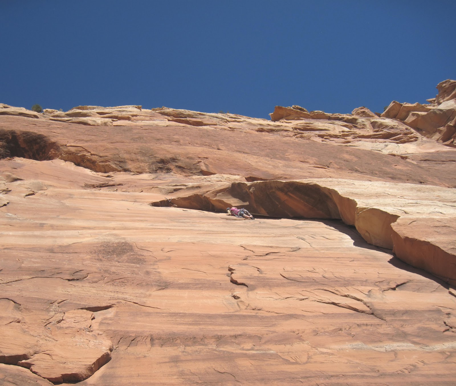
On a windy exposed prow high above the iron-rusted desert floor, I climbed nervously toward the first piton. It is the infamous runout of pitch four of Otto’s Route on Independence Tower in Colorado National Monument. Sixty feet of un-protected climbing on a narrow, slick spire. My heart was roaring in my chest, palms damp from adrenaline. One slip now would send me careening over the edge one hundred and fifty feet to the Lunchbox Ledge below.
“You’re doing
great!” Ella, my belayer and wife, yelled up in my direction. I wanted to
believe her, but how could she be so sure? The hardest part was still ahead. I placed
each foot with intense care, battling the sensation I was tap dancing with
disaster. Finally, the first piton was in front of me and the carabiner snapped shut as the rope dropped into place. An elephant of anxiety fell from my shoulders.
“I’m in,” I yelled down. The summit was tantalizingly close, but between me and success was twenty feel of over-hanging sandstone pocked with big but slippery holds.
The spire’s phallic exposure caught up to me all at once. For a moment I could have been floating. It seemed like nothing but air was all around. The desert’s exhale filled my ears. Relax, I commanded myself. But instead of taking my own advice, I peered nervously down the sheer, three-hundred foot drops to each side.
With a deep exhale,
I climbed towards the infamous and exposed crux.
*
Approaching the crux of Otto's Route
On Independence Day 1911 a man named John Otto planted the American flag atop the tallest free-standing feature in the newly minted Colorado National Monument. He’d reached the top of Independence Tower by chipping steps and drilling two-inch holes to install a serpentine pipe-ladder all the way up the majestic maroon pinnacle. Without a belayer but occasionally using a hemp rope as an anchor, Otto completed the astounding feat using a miner’s hand drill, a hammer and a set of cowboy boots. Little did he know as he chopped his way skyward, that not only was he cementing his own place in Colorado history, he was creating what would later become one of western Colorado’s most classic multi-pitch rock climbs.
But the feature that drew his eye more than any other was the impressive 300-foot spire that sat alone and proud in the open basin between Monument and Wedding Canyons. Sticking with his fervently patriotic theme, Otto named the feature Independence Monument and lived for some time in a tent at its base. By then Otto had already developed a taste for expressing his strongly American sentiment by planting flags atop other park features, such as Liberty Cap, a rounded, petrified sand dune stationed prominently in the park’s center, east of Monument Canyon. But Otto’s eye had already been turning upward for something greater.
*
Higher still, I clipped the second piton. Just a few more moves and I would be on top. The rock was getting steeper, angling towards the overhanging summit cap ten feet higher. Hesitating on a large handhold, I worked my feet high on the sandy pockets and pulled myself up toward overhanging bulge.
Sitting on top of the tower as Ella gets ready to follow
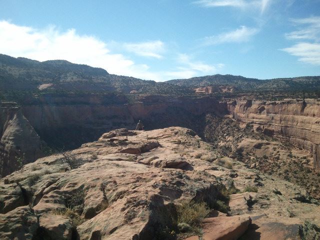
“I’m in!” I yelled down, clipping in my daisy chain to the safety of the steel bolts.As Ella prepared to climb, I basked in the magic of the place where I stood. All the hard work, the two-and-a-half mile hike, the four pitches of climbing, had led to this. Standing to the south was the Kissing Couple, perhaps the most distinguishable formation in the canyon other than Independence. And to the west the Coke Ovens, another impressive collection of sandstone spires. The wind was blowing but the sun was out. And since most of the route had been in the shade, it felt good to warm my bones under the October sun.
“Okay! On belay!” I tugged the rope through the belay device as Ella picked her way up the prow to join me.
There are people that call Otto’s Route a classic. And those who considered it a sandy, chipped abomination. Every year hundreds, perhaps thousands, of rock climbers climb their way up the shaded face of Independence Monument, following in the literal footsteps of an American pioneer. But many more avoid the route as if it were contagious, cursing the crowds, the relatively modest 5.8 grade and the overly manufactured and unnatural essence of the climb.
As for myself, I think of Otto’s Route as history. In modern days, such climbing ethics would be blasphemous. But 104 years ago, when Otto first stepped atop this astonishing pinnacle, the world was a far different place.
“Woo-hoo!” Ella cheered as she mantled over the summit cap to join me. I reeled in the last of her slack.
“What do you think?” I asked as she tied herself in to the anchor.
She looked around with a smile. “It’s amazing!”
Surrounded by an ocean of cliffs and pinnacles, “amazing” sounded just about right.
Note: This article first appeared in Volume 10, Issue Three (July 2015) of Our Backyard, published by The Nickel and Nickads.com
Visit THE ARCHIVE: A list of most of our articles sorted by department
Copyright notice: This website and all its contents are the intellectual property of www.coloradomountaineering.com and its authors. None of the content can be used or reproduced without the approval of www.coloradomountaineering.com.
Climbing and mountaineering are dangerous!! Please see the DISCLAIMER page
For information about how to contact us, visit this link
OVERVIEW
Independence Tower is not a mountain, nor is it alpine. It is a desert tower, which makes it somewhat rare for Colorado. And this is Otto's Route, a classic of Colorado climbing established in an age before climbing was set in its course towards what we know today.
Some people are against this route because it follows of line of chipped pipe holds the entire way. In a sense, I see their point. By modern standards this route would be an abomination. But John Otto, the man who drilled the holes in 1911 so he could insert pipe handholds, was considered a steward of nature and the forefront figure for establishing protection for the Colorado National Monument. He was an adventurer who loved these desert formations. If while climbing this route you are upset by the unnatural jugs throughout, consider a couple of things first: John Otto led this climb with a hemp rope in cowboy boots, without the chipped holds this route would probably go in the 5.11 range, and the chipping occurred over 100 years ago.
I encourage people, and I feel like most climbers who have climbed this route agree, to view Otto's as a historical route and not be bothered by its manufactured feel. It is still a great climb and the climbing itself despite everything is still fun. The positions are spectacular and the exposure is invigorating. Each pitch, not just the legendary pitch 4, has sections that are runout and hard to protect.
THE ROUTE
Approach: From the Lower Monument Trail, hike 2.5 miles (gaining 800 feet) to the base of Independence Monument. The route is on the northwest side of the tower following an obvious crack system. You will have to climb a small talus cone to get to the bottom.
Pitch 1: climb a 5.easy step to a junky 5.6 corner. Pass this to a nice finger crack with chopped steps. Climb up and left and gain a large ledge with a bolted belay. 130 feet (5.6)
You might have an audience...
Starting pitch 1
Pitch 2: move the belay to the right and scale a funky, over-hanging off-width. This would be a tricky pitch without the chopped holds. Here you will probably want a #4 and possibly a #5 too, though you can get away with less if you have good technique and a go-for-it attitude. There is some ledgefall potential pulling through the OW without big pieces. Pull, claw, thrutch through the OW and gain another huge belay ledge. Once you have belayed everyone up, most people with de-rope to pass through the next section. 70 feet (5.8+).
Climbing the overhanging OW on Pitch 2
The Time Tunnel between pitches 2 & 3
Scramble: Squeeze through the Time Tunnel, a tight gap between a the main tower and a detached spire. It is a little scrambly in one spot, maybe some minor, non-exposed class 3. At the other side is another massive belay ledge called the Lunch Box Ledge. Here you can leave most of your gear behind for the rest of the climb. All you need to get through the last 2 pitches are draws, maybe a few slings, optional tri-cams and gear to tie into the chain anchors at every belay.
Pitch 3: Pitch three is not hard or exposed, but it is runout between pitons. Tricams can be used in several spots but just trust those slightly sandy chopped buckets and the pitch will be over in no time. Climb up a seam and move up and right following the pipe holds through spaced pitons. Mantle a ledge and arrive at a bolted belay on Sundeck Ledge, where you might see get direct sunlight for the first time. Here the exposure might hit you for the first time. While this belay ledge is also large and comfortable, pitch 4 looms above you, and for some it can look pretty intimidating. 80 feet (5.7)
Pitch 3 follows this seam then goes up and right (the chopped holds can be seen in the center). Pitch 4 can be seen top left
Pitches 3 & 4 seen from the Lunch Box Ledge
Pitch 4: This is the classic money pitch and a great lead for the grade. The position is spectacular and the exposure is tremendous. Leave the belay on the right-ish side of the fin and climb fifty feet of unprotected but easy climbing (5.3 R/X). Pay attention to your footwork and your hands on this sandy, dangerous section and keep your mind focused on careful movement. The climbing is easy and it's over in no time. There is potential to use a few tricams to moderate the danger somewhat. Clip a couple of solid pitons and arrive at the route's excellent crux: a fun overhang on massive, bucket holds. This section is well protected by pitons and there is potential for a couple cams to back them up if you want. It may be useful to extend a draw or two at the crux to reduce drag while top-belaying your follower. 90 feet (5.9)
Pulling the crux on P4 of Otto's Route
Looking down from the top of Independence Tower
Pitch 5: This "pitch" is really just a couple of moves from the big belay ledge at the top of P4. There is no protection, and the climbing is probably about 5.8. Some people "aid" through the botto by standing on the old flagpole base and/or the chains. What makes it a bit scary is that you are fully exposed at the top of the tower with air all around and no protection. Some choose to do this on belay. The top is spacious. On Independence Day you will find many people up here. You also have to downclimb P5, it is hard not to use the flagpole now.... Some people will want to be on belay for the downclimb too. NOTE: The flagpole has since been removed. You will have to climb the rock. There are still chopped holds, however, making it exciting because it is so exposed but not too difficult.
Panorama from the summit of Independence Tower
A shaky but mostly comprehensive helmet cam look at this route from Youtube:
Descent: Double-rope rap from the summit to the Lunch Box Ledge (the bottom of P3). Scramble back through the Time Tunnel. From the bolted anchor you can do a double rope rap (180') from these anchors straight to the ground or rap the route to the anchors of P1 (70 feet), then from these anchors to the ground (110 feet).
The first rappel to the Lunch Box Ledge
The last rappel
Rack: This could be debated and depends largely on your comfort. If you wanted to protect it as well as it can be, bring a full rack of cams to BD #4 Camalot (and possibly even a #5) with extras in the small to mid size, a set of tricams, slings, possible stoppers (though we didn't use any), 6-8 slings and 6-8 quickdraws.
DIRECTIONS
Otto's Route follows the crack system right of center then the top via the right skyline
Follow Grand Avenue from downtown Grand Junction west where it turns into Broadway and crosses the Colorado River. Continue on this road 8 miles through a neighbrhood and past many intersections (the road becomes Highway 340) until you reach a small dirt road marked with a sign for Lower Monument Canyon. This turnoff is notoriously easy to miss so be alert. There is a small parking lot here at this popular trailhead.
TRIP REPORTS What does Independence Mean to You? Four days climbing in western Colorado including Unaweep Canyon, Monument Canyon, bouldering, and an ascent of Otto's Route on Independence Monument in the Colorado National Monument.
LINKS
Check out this helmet cam video guide for Otto's Route
Monument Canyon- more info on climbing/hiking in Monument Canyon
Visit THE ARCHIVE: A list of most of our articles sorted by department
Copyright notice: This website and all its contents are the intellectual property of www.coloradomountaineering.com and its authors. None of the content can be used or reproduced without the approval of www.coloradomountaineering.com.
Climbing and mountaineering are dangerous!! Please see the DISCLAIMER page
For information about how to contact us, visit this link
Monument Canyon is one of the premier destinations for hiking, climbing, and canyoneering in Colorado National Monument. The broad, sandstone canyon is home to many amazing rock formations and towers such as the Kissing Couple, the Coke Ovens, and, most famous of all, Independence Monument. This canyon is also home to a wealth of sport and trad routes ranging from moderately difficult to expert only. For the less technically-adept Monument Canyon offers simple hiking, bouldering, and scrambling in a pristine sandstone setting. This is a playground of recreational opportunity in a classic southwestern setting. The Colorado National Monument feels like a displaced (albeit far less-expansive) version of the Castle Valley area in Utah and the climbs more resemble what you would expect to find there than typical Colorado climbing areas.
GETTING THERE Upper Monument Canyon Trailhead: on Rim Rock Road in the Colorado National Monument, 8.1 miles from the park's west entrance.
Lower Monument Canyon Trailhead: Follow Grand Avenue from downtown Grand Junction west where it turns into Broadway and crosses the Colorado River. Continue on this road 8 miles through a neighbrhood and past many intersections (the road becomes Highway 340) until you reach a small dirt road marked with a sign for Lower Monument Canyon. This turnoff is notoriously easy to miss so be alert. There is a small parking lot here at this popular trailhead.
HISTORY
The history of the Colorado National Monument and Monument Canyon inevitably begins with John Otto. It was thanks largely to Otto's efforts that the government recognized the Monument's value and placed it under national protection in 1911. Otto was named the park's first "custodian". Among other things, Otto established many trails through the park. He was also fond of bolting and chiseling into the rock when the climbing was too difficult. Though this, of course, is not an accepted practice in this part of the world now, Otto pioneered these routes during a different age. Signs of his work are visible on Liberty Cap trail, in Devil's Kitchen, and, most notably, on Independence Monument here in Monument Canyon. Otto's bolted rebar routes are sometimes jokingly called "Otto Ferrata".
The route Otto established on Independence Monument is still the easiest and standard route today. Named after its developer, Otto's Route is a four-pitch, 5.8+ Grade III. It is one of Colorado's few notable sandstone towers.
HIKING
Monument Canyon offers a variety of hiking options, all stemming from the Monument Canyon trail. This 5.2 mile route gains almost 1,500’ of elevation as it winds along the broad shoulder of Monument Canyon. At various locations along its length it offers access to many side adventures, including Independence Monument, Wedding Canyon, numerous sport-climbing routes, and other features. While hiking in Monument Canyon, please try to stay on the trail. For all its ruggedness, the desert is a remarkably fragile environment.
The main trail is one of the more popular routes in the Monument. The trail contours along the western cliffs of Monument Canyon. The usually dry creekbed is almost always far below and away from you. The trail can be accessed from either the upper trailhead off Rim Drive or from the Lower Trailhead off Highway 340. The lower trailhead is popular for casual day hikers and is also the normal approach to Independence Monument and the climbs of the lower canyon. A fun day trip is to start at the upper trailhead and hike through to the bottom with a vehicle shuttle.
From the lower trailhead, it is 1 mile to the first climbing wall where the popular First Dihedral route is located. The second main wall comes around 1.3 or so and Independence Monument is at mile 2.3.
CLIMBING
Monument Canyon offers some of the best climbing in the Grand Junction area. Everything from tall, multi-pitch desert towers to technical sport climbs are available. There are some serious classics in Monument Canyon. Otto's Route on Independence Monument is the most obvious example but other routes such as First Dihedral, Get a Life, Desert Solitaire,and others are also excellent quality. The nearby Kissing Couple and Sentinel Spire also provide excellent, challenging and adventurous tower climbing.
Here are just a few of the routes in the Monument Canyon area:
Trad
Tower (by easiest route):
Independence Monument (4 pitches, 5.8+, Grade III)
Kissing Couple (5 pitches 5.11a, Grade III)
Pipe Organ (5 pitches 5.11+)
Sentinel Spire (3 pitches 5.10)
Get a Life (Clueless Tower) (5 pitches, 5.12c, Grade III)
Wall:
Left Dihedral (2 pitches, 5.12- or 5.8+ for first pitch only)
Right Dihedral (1 pitch; 5.9)
Out of the Fryingpan (1 pitch, 5.9)
Route 2 (1 pitch, 5.9)
Route 4 (1 pitch, 5.9+)
Desert Solitaire (6 pitches, 5.11a A1, Grade III)
Sport
Circle, Square, and the Triangle (5.10a)
Wingate Warrior (5.11a)
Higher Mind Dynamics (5.11)
Friends Cant Be Trusted (5.12b)
(note: there is a bolting ban in the Monument. For full climbing regulations please check this link to the National Park Service website.)
A topo of the main wall in Lower Monument Canyon:
The routes in this photo:
1- Circle, Square, and the Triangle [Sport, 100 feet, 5.10a] **
2- Luhr's Route aka Right Dihedral [Trad, 90 feet, 5.8+] **
3- Higher Mind Dynamics [Sport, 100 feet, 5.11] *
4- Friends Can't Be Trusted [Sport, 110 feet, 5.12b] **
5- First Dihedral aka Left Dihedral (first pitch) [Trad, 50 feet, 5.8+] ***
6- First Dihedral aka Left Dihedral (second pitch) [Trad/aid, 70 feet, 5.10+ C2 or 5.12a] **
7- Carter Route [Trad, 100 feet, 5.9] *
8- Euro Route [Trad, 100 feet, 5.11 (class 4 scramble just to get to base)]*
other photos:
This is only a small sample of the climbing in the area and there is likely still potential for development in the Canyon's hidden corners (which are numerous). This place is vast; the more effort you are willing to put in the more you are going to get out. For a deeper discussion of the trad and sport climbing in Monument Canyon check out the Mountain Project link in the external links section.
SPECIAL CONSIDERATIONS
Monument Canyon is within the borders of the Colorado National Monument. Check with the National Park Service for special regulations One important rule for climbers is that bolting is no longer allowed within that canyon except to replace old dangerous hardware. The addition of new bolts is forbidden. Season raptor closures also affect several walls. Check with the National Park Service to find out when they are in effect.
What Does Independence Mean to You?- A weekend climbing in Unaweep and the Colorado National Monument, including a day at the Lower Monument Canyon slabs and an ascent of Otto's Route on Independence Tower.
Visit THE ARCHIVE: A list of most of our articles sorted by department
Copyright notice: This website and all its contents are the intellectual property of www.coloradomountaineering.com and its authors. None of the content can be used or reproduced without the approval of www.coloradomountaineering.com.
Climbing and mountaineering are dangerous!! Please see the DISCLAIMER page
For information about how to contact us, visit this link
Independence…. The word conjures up notions of patriotism, revolution, the American Dream. Since 1776 Americans have claimed the word as if it was our own creation. To me, however, at least for one weekend, the word came to mean something entirely different. It meant sandstone, pitons, and exposure. Off-widths, overhangs, and, of course, Otto.
It is October in an election year. Everyone wants to talk about politics. Some might say that this is an especially important election, a crucial and vital turning point for our country. Now I won’t say “I don’t care”, even though I might be tempted some days, but I will say that during this election season my mind has been a bit distracted, and the importance of the perpetual Elephant vs. Donkey boxing match has fallen a distant second to my final push to get as much rock and alpine climbing in as possible before Old Man Winter brings his inevitable complications. Next on our list was a climb we had been looking at for awhile: Independence Tower.
A BRIEF HISTORY
Otto’s Route is a classic of American Rock Climbing. While some may say that the climbing on Otto’s Route is too sandy, gnarled and unnatural to be even considered on the same level as other desert tower classics like Castleton, the Priest, or the Fisher Towers, I believe that the route’s unique history makes it more appealing rather than less.
In 1911 a man named John Otto chopped steps and drilled pockets for artificial pipe holds on the west side of the formation. On Independence Day he completed the climb donning cowboy boots and erected an American Flag on its summit. Now John Otto loved this monument. It is hard to judge him today by modern standards when over a hundred years have now passed since his accomplishment. To this day I know people that refuse to climb this route because it is “chipped”. But it’s not like some unworthy climber hacked their way up it by moonlight in the mid 1990’s, Otto’s Route is a rare example of very early North American rock climbing history.
PREPARATIONS
My girlfriend Ella and I decided to make a base camp in Grand Junction, Colorado for a four-day climbing stint culminating in our attempt of Independence Tower. My old college roommate lived in Grand Junction, and with a little libation-related bribery, we convinced him to host our Fall weekend in the desert.
The first day we thought we would warm-up with a little bouldering at a small but well-featured bouldering area just outside of Grand Junction on the border of the Colorado National Monument. This area, known as “Dynamite Shacks”, is home to several area classics, but the best and most famous is an amazingly shaped rock called the Millennium Falcon with a namesake problem that is probably the best juggy roof problem I have ever seen.
Millennium Falcon silhouette
Mt. Garfield in background
Manik sending the Millennium Falcon:
On the second day we decided to step it up and headed up to Unaweep to do some trad climbing. Unaweep is one of my favorite granite playgrounds. I am especially fond of it because of sentimental attachment. While I won’t say “I learned to climb there” (I am still learning to climb), it is where I did some of my first climbing. First on top rope, then later I did my first trad lead there. On this trip we headed to the Sunday Wall. Joined by friends, we decided to spend a relaxing day climbing single pitch.
After taking turns leading a few pitches we packed up our gear and drove down to Nine Mile Hill to spend the rest of our forearms bouldering in Unaweep’s vast fields of Dakota and Burro Canyon sandstone boulders.
On day 3, it seemed like a good idea to get back into sandstone, so we started up Monument trail to climb the Lower Monument Canyon slabs, a fun set of slabby dihedrals and face climbs. We were joined again by a group of friends, this time bringing our number up to five. Sandstone is one of my favorite types of rock. We climbed Luhr’s Route (5.8), First Dihedral (5.8), and onsighted a slabby sport climb just to the right called Circle, Square, and Triangle (5.10a). With five people, it took the better part of the afternoon shuttling each of us up, reloading for each climber to have their shot at leading. As the sun set after a perfect fall day in the high desert, we decided to finish off the rest of our forearms back at the Dynamite Shacks’ boulders.
Left Dihedral (5.8+)
Luhr's Route (5.8)
Leading Luhr's Route
Circle, Square and Triangle (5.10a)
After a dinner and a few beers at a local brewery by my alma mater (now called Colorado Mesa University) we settled in for the evening and organized our rack for the main event the following morning: Independence Tower.
THE CLIMB
I was awake early with excitement, and after breakfast we made our way back to the Lower Monument Canyon trailhead for the climb. Not long after starting the hike, we encountered a Bighorn Sheep ram and accompanying harem at very close range. We snapped a few pictures and continued, excited by this excellent omen. A great start to what we hoped was going to be a great day.
It is a two and a half mile approach to the Tower, and with a backpack laden with a full trad rack and a stomach with two cups of dark coffee, we arrived at the base of the climb with our hearts hammering in our chests and sweat dripping from our brows. I made the decision to leave my long sleeve shirt behind in my backpack at the route’s base.
Bighorn Sheep in Monument Canyon
Proud Bighorn ram
We quickly sorted out the rack, tied in, and got ready to begin the climb.
Ella and I had struck a deal. She was anxious about the exposed and overhanging crux on pitch 4, so I offered to lead it as long as she battled through the off-width crux of pitch 2. She had just sent a gnarly off-width at the Sunday Wall called Three’s Company two days earlier. While no Pamela Pack, her dexterous climbing style has allowed her to fight through gnarly and awkward off-widths that battered and/or rejected me. Also joining us for the climb was a sport-climbing friend of ours who, having no experience with trad gear or with multi-pitch, was relegated to following and carrying the backpack (something he grumbled about more than once).
Having sorted out the logistics and affixed all the cams, slings and caribiners to my harness that I could possibly need on the climb, I called out “On Belay?” and having received a satisfying answer, took a deep breath and started up the first pitch.
Starting Pitch 1
For those of you who aren’t familiar with the route, pitch one is the longest pitch of the climb. It started with and easy ramp to a mini-chimney followed by a good crack made easy by numerous chopped steps, the first signs of Otto’s legacy. The long pitch in easy and well-protected, clocking in somewhere around 5.5/5.6. I ran it out twenty feet at times and cruised up to the belay ledge in good time.
Since Otto’s Route is almost entirely in the shade, and it being October, I quickly regretted leaving my long-sleeve behind. By the time all three of us had climbed and were on the belay ledge I was cold.
Next up was the off-width. It loomed ahead looking a bit ugly. Ella took the sharp end and started up an easy ramp leading to the bottom of the most difficult part. The off-width, as it t urns out, is not as bad as it looks. Though there was some groveling and thrutching and swearing, Ella found Otto’s chopped holds and pulled through without undue troubles. She belayed us up to the ledge.
Otto’s Route is a friendly multi-pitch in the sense that all the belays are on huge ledges, often big enough to feel quite comfortable de-roping. We coiled our ropes here and passed through a skinny passage known as the Time Tunnel, which was narrow enough that I had to shift sideways to get my shoulders through.
Pitch 2 Off-width
The Time Tunnel
We emerged on a huge ledge that was partially bathed in sunshine, and I spent the next ten minutes warming up on the sandstone, enjoying a break.
Pitch 3 and the crux at the top of pitch 4 towered impressively above us. The top was almost within reach, yet it was clear that things were about to get more interesting. While the rest of the route is essentially a sport climb, it is famous for its exposure and runouts.
The first obstacle was a twenty-foot runout to clip the first piton on pitch 3. This was the place for the tri-cams we didn’t have. Otto had drilled holes in the rock, however, to install via ferrata style aluminum pipe holds. While the pipes are gone, the remaining holes make for perfect two-finger pockets. Climbing carefully, Ella clipped the first piton, paused for a deep breath, and climbed past two more somewhat widely spaced pitons to a crux mantle before the anchors at the bottom of pitch 4.
P3 & top P4
Pitch 3
I arrived second on the Sun Deck Ledge and started anxiously up at the famous/infamous pitch 4 and Ella belayed Manik up pitch 3. The first piton was very high and the exposure was impressive. I was more nervous than I thought I would be. We arranged everything for the final pitch and I remember blathering a bit nervously about a sudden lack of confidence I was experiencing, almost hoping that someone else would step up and lead, but feeling suddenly calm, I started slowly and cautiously up the prow towards the summit cap.
No Falls mode is familiar to anyone who climbs class 3 or above in the alpine realm. Knowing that any slip, any mistake at all, could cost you very dearly, perhaps even with your life, is part of adventure climbing and mountaineering. It is not that we venture to these places recklessly with some sort of “death wish”, as some might believe. To me it is more the experience of the total focus and confidence you can achieve when placed in such a situation that requires such utter control. For every accomplishment there is risk. Without the risk and without achievement, there is no going forward. Or in this case, up….
In reality, it didn’t take long to climb the fifty feet of ~5.3 to the first piton. And although the exposure is intense, with 400 feet of air on both sides, when you focus on your climbing you don’t really notice it. The climbing became steeper after the piton. Otto’s drilled pockets, however, were always present right where you needed them. And the worn chipped steps provided decent, albeit slippery, footholds. Resting on a pocket, I made an easy clip of the second piton. Although the crux move was still ahead, the fall potential was basically controlled on the overhanging terrain. Moving up on insecure feet, I clipped the final piton, hesitated a moment, and made an airy and excellent move to the final ledge and pulled the overhang with confidence. I heard Ella and Manik cheer below.
The final pitch
Crux moves
I top-belayed them both up and we mantled onto the summit. This is an amazing perch: a throne amongst a giant cathedral of sandstone spires and walls. We could here the voices of tourists and road bikers at various overlooks along Rim Road in the Park talking about us echoing through the canyon. “Look! There are people on top!” “What are they doing?!?” “How did they get up there?”
summit
From the top
We took in the moment and the scenery for fifteen to twenty minutes then decided it was time to get started on the descent. Descents are always anxious. Most accidents, after all, occurring on the way down. The downclimb off the summit block is a bit scary. Although there are really good handholds it is hard to see your feet, and the exposure is tremendous. From there we did a double-rope rap to the bottom of the third pitch, scrambled down the Time Tunnel, rapped from the top of pitch 2 to the top of pitch 1 (not sure if we could trust beta that you can rap to the ground from the top of P2 with doubled 60ms—which I am told now by several sources now that you can). From the top of pitch 1 we double-rope rapped to the ground and it was done. We had climbed Independence.
One last move for freedom
Story by: Brian Wright
Photos: Brian Wright, Manik Johnson Visit THE ARCHIVE: A list of most of our articles sorted by department
Copyright notice: This website and all its contents are the intellectual property of www.coloradomountaineering.com and its authors. None of the content can be used or reproduced without the approval of www.coloradomountaineering.com.
Climbing and mountaineering are dangerous!! Please see the DISCLAIMER page
For information about how to contact us, visit this link