Showing posts with label alpine climbing. Show all posts

Monday, July 6, 2015

HOT ROUTE: Two Ears-Zanzibar Dihedral (300', 5.8+)

Trailhead: Weller Lake Campground
Distance: 1 mile
Elevation gain: 800 feet
Difficulty: 2 pitches, 5.8+

OVERVIEW
While not a summit-reaching climb, Independence Pass's Two Ears- Zanzibar Dihedral is one route that any intermediate, technical alpine climber might be interested in. This 300' climb highlights two long pitches on superb granite with good protection in a spectacular alpine setting. While a steep and rough talus approach may deter some climbers, those who brave the rocky beginning are rewarded with an excellent climb that finishes in the classic 150' dihedral pitch the "Zanzibar Dihedral."

THE ROUTE
Approach- From the Weller Campground find a climber's trail behind campsite number 6 and wind (briefly) through the pine and Aspen trails. Follow a series of cairns for the path of least resistance or pick your own way up to the base of the obvious 300' wall.

Zanzibar Dihedral, used courtesy of Mountainproject.com
Pitch One- "Two Ears" (5.7)- This long pitch is often regarded as a climb unto itself. Start just right of a pine tree on some obvious jugs. Work up and right to a series of broken cracks. The protection is good and solid throughout. There are many possibilities for cams and nuts. Small cams finger size and less are most useful. Work past two old pitons to a good splitter that ends in a pod. Work up and right to a two-bolt anchor just off a large ledge at the base of the dihedral.

Pitch 2- "Zanibar Dihedral" (5.8+)- This long, excellent pitch scales an overhanging dihedral with great protection and plentiful face holds to make it through. Several layers of cracks allow a variety of gear to protect. At the final bulge, step right on face holds and back left to easier ground at the top. A classic, granite dihedral!

DESCENT
Two double-rope raps from chain anchors will lead you to the ground. It will require two 60 meter ropes to make the descent.

DIRECTIONS
From the "S-Turn" in downtown Aspen, Colorado, follow Highway 82 south towards Independence Pass for 7.8 miles. Park either on the right side of road (heading from Aspen to Indy Pass) at the Weller Lake TH or set-up a basecamp in the excellent campground across the road.

LINKS
Zanzibar Dihedral on Mountainprojet.com

Visit THE ARCHIVE: A list of most of our articles sorted by department

find us on facebook


Copyright notice: This website and all its contents are the intellectual property of www.coloradomountaineering.com and its authors. None of the content can be used or reproduced without the approval of www.coloradomountaineering.com.

Climbing and mountaineering are dangerous!! Please see the DISCLAIMER page
For information about how to contact us, visit this link


Sunday, January 26, 2014

VIDEO: Finding and Climbing the Petit Grepon

This entertaining video documents one couple's quest to summit Petit Grepon in Rocky Mountain National Park. Petit Grepon was made famous after its inclusion in Steve Roper and Allen Steck's famous 1979 book Fifty Classic Climbs of North America.


Visit THE ARCHIVE: A list of most of our articles sorted by department

find us on facebook


Copyright notice: This website and all its contents are the intellectual property of www.coloradomountaineering.com and its authors. None of the content can be used or reproduced without the approval of www.coloradomountaineering.com.

Climbing and mountaineering are dangerous!! Please see the DISCLAIMER page
For information about how to contact us, visit this link


Monday, October 14, 2013

LIST: Ranked Class 5 Peaks over 13,000 feet

There are seven "ranked" peaks over 13,000 feet that require class 5 climbing to reach the top. In other words, by their easiest route, these seven mountains are the most difficult high peaks in the state. Mountains like Longs Peak or Crestone Needle which have difficult class 5 routes but easier hikes or scrambles as well would not be included. This list also does not include mountains like "Coffeepot" which require fifth-class climbing to reach their summit but do not meet the requirements for being "ranked" (i.e. they have less than 300 feet of topographical prominence).

There are three peaks in the Centennial list (100 highest) that require 5th class climbing. As you will see below, there are four other 13ers that also fall in this intimidating category. It is interesting, though not altogether surprising, that all of the mountains on this list (except the debatable "Whitney Peak") are found in the San Juan Range.

NOTE: I believe this list is complete but there are 637 mountains in Colorado that are above 13,000 feet and have more than 300 feet of topographical prominence. Many of these peaks are quite obscure and have seen only a handful of ascents. If you know of a ranked summit that requires 5th class rock climbing by its easiest route than please let me know!

Dallas Peak
Dallas Peak from Blue Lake Pass
1. Jagged Mountain (13,824 feet) (5.2)
Deep in the Weminuche Wildnerness lies one of Colorado's most reclusive and inaccessible mountains. Jagged Mountain is a jewel of Colorado mountaineering and deserves a larger reputation than it has. This hard-to-reach mountain is one of the few in the state that requires more than one day to climb. The route itself is a winding, complicated multi-pitch climb with dangerous scrambling, loose rock, tricky routefinding, and several technical cruxes that probably necessitate the use of a rope. There is a great deal of exposure, including a narrow ledge traverse with thousands of feet of air whipping at your ankles.

2. Teakettle Mountain (13,819 feet) (class 5.2)
Teakettle is part of a rugged portion of the San Juans that includes several challenging peaks: Sneffels, Coffeepot, Dallas, and Teakettle. Of the three Centennials on this list, Teakettle is probably the easiest summit to reach. There is a 50-foot 5.2-5.3 summit pitch leading up the unique summit cap (hmmm...why did this mountain get its name?) to an exhilarating and tiny summit.

3. Dallas Peak (13,809 feet) (class 5.3)
Dallas Peak is often cited as the most difficult of Colorado's 100 highest peaks. Dallas's challenging summit cap is generally given a high-end 5.3 rating. The last two hundred feet on Dallas are steep, junky and full of class 4 and 5 terrain. The most difficult moves are just below the summit. You can rappel from near the summit directly past most of the hardest difficulties.

4. Peak Fifteen (13,700) (class 5.2)
Peak Fifteen is the next-door neighbor to more famous 13er Turret Peak and both of these rugged mountains lie in Weminuche Wilderness Area in the San Juans. This technical and committing route is one of the hardest all-around climbs of all the standard routes in the state and most people bring a rope. Peak Sixteen, Peak Fifteen's unranked neighbor, is also a technical mountaineering goal requiring 5th class climbing to reach its summit and together these three mountains for an amazing and impressive massif.

5. Coxcomb Peak (13,656 feet) (class 5.3)
Probably the easiest peak on this list, Coxcomb involves just a short section of class 5 climbing. This flat-topped peak is not particularly imposing but can surprise you. Coxcomb is known for loose rock, poor protection, and some exposure on the summit ridge. Be prepared to rappel.

6. Whitney Peak (13,276') (class 5.6)
Inclusion of this peak is up for debate, as the "class 5" section of it is one boulder. Apparently, however, this boulder is the highest point on the peak and thus to truly climb the peak in the eyes of some you must stand on the top of the boulder. Apparently, scaling this boulder takes a few moves of class 5.6 "climbing."

7. Lizard's Head (13,113 feet) (5.8+ R/X)
Lizard Head Peak- Colorado's most difficult summit over 13,000'
Simply put, Lizard's Head is Colorado's hardest ranked peak above 13,000 feet. This intimidating spire is a rotten, exposed nightmare and thus is rarely climbed. The easiest route is the Southwest Chimney, a three-pitch climb on runout choss. There are other possibilities too, all of which are going to require equally or more difficult technical climbing.

Honorable mention:
Sunlight Spire (13,995 feet) (5.10c)
Though it does not meet the criteria to be a ranked peak as it has only 215 feet of topographical prominence, Sunlight Spire is one of Colorado's most dramatic and difficult summits to reach. To add to its allure, the summit pitch is a beautiful and bomber splitter-crack that clocks in at the high 5.10 level. This crack can be freeclimbed or aided (see this photograph for a good view of the amazing summit cap). Based on the more accurate but less syndicated 1988 datum, Sunlight Spire just overtops 14,000 feet, possibly making it the most difficult 14,000 foot summit in the contiguous 48, even more difficult than the famous summit cap on California's Thunderbolt Peak, which, by the way, is also "unranked" by Colorado standards yet considered one of the must-do California 14ers.

Visit THE ARCHIVE: A list of most of our articles sorted by department

find us on facebook

Follow us on Twitter!

Copyright notice: This website and all its contents are the intellectual property of www.coloradomountaineering.com and its authors. None of the content can be used or reproduced without the approval of www.coloradomountaineering.com.

Climbing and mountaineering are dangerous!! Please see the DISCLAIMER page
For information about how to contact us, visit this link


Wednesday, October 9, 2013

Peak of the Week: Crestone Peak (14,294 feet)

INTRO
Crestone Peak and Crestone Needle
Late fall dusting of snow of Crestone Peak and
its neighbor Crestone Needle
Without question, Crestone Peak is one of Colorado's most spectacular mountains. It is the anchor of the Sangre De Cristo Range, and its crown jewel. It is rugged, picturesque and intimidating. In terms of mountaineering, climbers will find that "The Peak" is one of the most challenging and technically difficult of Colorado's 14ers. But for the advanced mountaineer, more options are available on the rugged peaks of this massif than almost anywhere else in the state.

Crestone Peak is a classic mountain, one that Colorado can be proud of. The Sangres in general leap from the surrounding valleys with abrupt and awe-inspiring sharpness. These mountains define what it means to be rugged. As Colorado's 7th highest peak, Crestone Peak is the tallest mountain in the state that requires class 3 scrambling to obtain its summit.

Composed of cobbled, conglomerate rock, Crestone Peak and its neighbors are unique to Colorado geology, and climbing them is an experience that no mountaineer, either native or visiting, could ever forget. It is a mountain and a range with a unique personality.

DIRECTIONS
South Colony Lake Trailhead- South Colony Lake is the ideal and most popular base camp for the majority of Crestone Peak routes. It is a good base of operations, in fact, for most of the neighboring peaks as well, making multiple-summit trips logistically viable. From Westcliffe, follow Highway 69 for 4.5 miles south. Veer south (right) onto Colfax Lane (County Road 119). Follow this road straight until you reach a T-intersection with Country Road 120 (South Colony Road). Turn right and follow this road 1.5 miles to the trailhead. 4WD vehicles can continue for as many as four more miles to a high trailhead at 11,000 feet. This road is notoriously bad and sometimes a gate may block it off at 9,800 feet.

ROUTES
South Face (class 3, moderate snow)-
The South Face route on Crestone Peak is almost always the easiest route on the peak. However, this route is long, complicated and almost always entails ascending some moderate sections of snow. From South Colony Lakes, climb a couloir to Broken Hand Pass. Descend to Cottonwood Lake (accessible via a long trail through private property with permission) and climb a vague couloir up the south face to a notch between the main summit and a sub-summit. Scramble a couple hundred more feet to the top.

Northwest Couloir (class 3, steep snow/ice)-
Crestone Peak stands proud
This route is more straightforward and entails less elevation gain than the South Face route, but is generally more difficult and dangerous. Depending on conditions, the couloir with either be a steep but good snow climb, or a mess of icy, rubble-infested ledges. A helmet, crampons and ice axe are recommended in almost any season.

Peak to Needle Traverse (class 5.2, moderate snow)- This popular and challenging traverse is listed in Gerry Roach's guidebook Colorado's Fourteeners: From Hikes to Climbs as "one of Colorado's four great Fourteener traverses" and for good reason. This route is a spectacular way to visit both of these astounding Colorado peaks. Though originally listed as class 4, standard consensus these days is that there is some limited low class 5 terrain on this route. The most popular way to tackle this route is by climbing Crestone Peak's Northwest Couloir route first, traversing from Peak to Needle, and descending Crestone Needle's South Face. Arguments have been made for doing the traverse in the opposite direction of for starting on the Peak's South Face route instead. This all depends on your skill and mountain conditions. One thing is for sure that this route is long, committing and complicated so plan accordingly.

North Pillar (class 5.8)-
This is the premier technical route on Crestone Peak, and one of the harder alpine climbing in the Sangres. It is not as popular or well-known as the Ellingwood Arete (see a video of climbers on the Ellingwood Arete) on Crestone Needle but is still worth mentioning here. The North Pillar is a ten-pitch climb on the mountain's northeast face, with the crux 5.8 pitch coming about two-thirds of the way up. Be prepared for runouts, complicated route-finding, and some unforgettable knob-pulling on the famous Sangre conglomerate!

SPECIAL CONSIDERATIONS
The South Colony Lakes are in the Sangre De Cristo Wilderness Area and special regulations apply. These mostly focus on the carryout of waste. Check out the fact sheet for the Sangre De Cristo Wilderness Area for more information.

LINKS
Crestone Peak on 14ers.com

The Crestones on mountainproject.com

Crestone Peak on Summitpost.org

Visit THE ARCHIVE: A list of most of our articles sorted by department

find us on facebook


Copyright notice: This website and all its contents are the intellectual property of www.coloradomountaineering.com and its authors. None of the content can be used or reproduced without the approval of www.coloradomountaineering.com.

Climbing and mountaineering are dangerous!! Please see the DISCLAIMER page
For information about how to contact us, visit this link


Tuesday, October 8, 2013

VIDEO: Ellingwood Arete

A comprehensive look at the Ellingwood Arete (also called the Ellingwood Ledges) on Crestone Needle. The Ellingwood Arete was included in the famous guideboook Fifty Classic Climbs of North America and thus maintains a certain dignity and respect in the climbing community abroad. This is a good and challenging climb and this gives you an idea what it entails:


Visit THE ARCHIVE: A list of most of our articles sorted by department

find us on facebook


Copyright notice: This website and all its contents are the intellectual property of www.coloradomountaineering.com and its authors. None of the content can be used or reproduced without the approval of www.coloradomountaineering.com.

Climbing and mountaineering are dangerous!! Please see the DISCLAIMER page
For information about how to contact us, visit this link


Monday, September 16, 2013

The Next Level: The Future of Climbing and Mountaineering

Chris Sharma on La Dura Dura (5.15c).
Screenshot from BigUp's Reel Rock 7.
When Adam Ondra sent Change at Flatanger, Norway, the 20-year-old Czech climber had just pushed the of world climbing to a whole new level... or so it seemed. It was the first climb rated 5.15c (9b+), a grade that had once seemed impossible. Just a few months later, he and climbing legend Chris Sharma were sparring to redpoint something even harder: La Dura Dura. It was a climb that even Sharma, who at 20 years of age established the world's first 5.15a (9a+) when he sent Realization, had once called impossible. Though it was Ondra who first sent this futuristic climb, Sharma soon followed with a send of his own. The climbers set the rating at 5.15c (9b+). Both Ondra and Sharma agreed that La Dura Dura was probably the hardest rock climb in the world. Some have speculated that La Dura Dura may actually prove to be the world's first 5.15d.

There are only a handful of climbers in the world who can climb 5.15. The list is limited to names like Alex Megos, Ramon Julian, Dave Graham, Adam Ondra and, of course, Chris Sharma. Undoubtedly there are a few others, but this very small list shows just how hard the grade is. If these climbers, people like Sharma and Ondra, find these climbs to be at the very limits of their abilities, taking months of rehearsal and many many attempts to complete, just how much more difficult can climbing get? Have humans now reached the limits of physical capacity where, short of developing sticky pads on our fingers or some improbable gear innovation, we simply are not able to climb anything harder? Will we ever see a 5.15d or even a 5.16? How about bouldering? V16? V17? The alpine realm seems more open, with many peaks out there that still have yet to be climbed. But eventually, it seems, humans will soon have stood on every high point in this wide world. What then? Are the sports of climbing and mountaineering destined to fall in decrepit mediocrity without the excitement of progress? Already here in Colorado there are no exciting peaks still awaiting a first ascent. Even finding a new line on any of the major peaks is going to be hard to impossible (though Tommy Caldwell and Joe Mills did establish the first 5.14 line on the Diamond one month ago). Or will someone in the next generation prove that what is considered possible is never capped?

Cerro Torre
Cerro Torre, where Hayden Kennedy and 
Jason Kruk made the first "fair means"
ascent of the in famous Compressor Route.
Photo courtesy Wikimedia Commons.
Despite that the sports of climbing and mountaineering seem limited by the capacity of human physiology, new levels of achievement have been reached in recent years. Hayden Kennedy and Jason Kruk made the first "fair means" ascent of the legendary Compressor Route on Cerro Torre in the Torres Del Paine region of Patagonia in January of 2012. The Compressor Route is infamous in the history of mountaineering and considered by some the biggest atrocity in alpinism due to its excessive bolts and the abandonment of a heavy air-compressor on top of the mountain used to create the bolt ladder on the 1970 first ascent. Kennedy and Kruk decided, however, to chop the bolts off as they descended from the mountain after their ascent. A few days later, David Llama climbed the route completely free calling it 8a (5.13b). Though the chopping of the bolts was controversial, these two ascents show that what people believe to be possible in alpine climbing world has changed over the decades.

Another young climber who is proving that there are other ways than just pure difficulty which the sports of climbing and mountaineering can expand is Alex Honnold. In 2008 Honnold made the first free solo ascent of the Regular Northwest Face of Half Dome (VI 5.12b), climbing the 23-pitch route without a rope. Honnold's achievements have proven that newer generations of climbers are still willing to push the sport in "bold" directions. In 2012 Honnold managed to achieve a solo link-up Half Dome, the Nose and Mt. Watkins in a single day.

Modern Yosemite pioneer Tommy Caldwell also continues to push the sport of climbing. At 35 years of age, Caldwell has done more to push the sport of rock climbing to new levels than almost any one. In 2003 he put several months of hard work into a massive, overhanging cave on a remote wall in western Colorado, establishing Kryptonite, the country's first 5.14d (9a), and Flex Luthor, quite likely the first 5.15 in North America though it remains unrepeated and unconfirmed to this day. In recent years, Caldwell has been back where he feels most comfortable, on big walls, freeing old aid lines on Colorado's Diamond and Yosemite's Half Dome and El Capitan. Caldwell's free version of Mescalito on El Capitan, if completed, could be the hardest big-wall free climb in the world.

And what about the next generation? Young climbers today are better than ever. A crop of super-young, highly talented climbers are already scaling the best rock in the world, threatening to push the boundaries of a sport that has been accused of stagnation. 12-year-olds Mirko Caballero and Ashima Shiraishia have both climbed V13. Ashima, in fact, became the youngest person to climb that grade when she sent Crown of Aragorn at Hueco Tanks State Park, Texas at the age of 11. Other young climbers like Brooke Raboutou and Kai Lightner and others are all also climbing 5.14 and are all under 14 years of age.

The Ruth Glacier in Alaska. Photo courtesy
Wikimedia Commons.
And in the mountains, the great peaks of Karakoram and Chamonix continue to prove to be the forefront in the world of mountaineering, as new lines are found and ascended. Hard mixed routes and ice climbs are established each season. The popularity of the Ouray Ice Climbing Festival grows every year. Way up north, along the Great Gorge of the Ruth Glacier in Denali National Park, climbers have been climbing new faces and establishing brutal link-ups and traverses that nobody before had ever imagined. There are still many pitches of rock, ice and snow in this world that have yet to be climbed. These hotspots continue to produce neo-classic alpine routes that will entice and challenge mountaineers for generations to come. And there is more to be found. After all, 24,836-foot Gangkhar Puensum is generally considered the highest unclimbed mountain remaining in the world, and it is likely to stay that way for the time being, as climbing it is against the rules of the local governments. There are several other 7000m peaks that have yet to see a first ascent.

With all the growth in the sports of climbing and mountaineering, it is easy to think that we are reaching the limits of what is possible for a human. There are only so many mountains to explore. Someday soon we will have climbed them all. On the other hand, progressing into harder and harder difficulty too seems capped by simple human physiology. We can only hold onto to holds so small. Yet, despite these constraints, it seems that a new generation continues to surprise, finding and sending harder and harder climbs, or re-hashing old climbs in new style. Though maybe someday we will find that limit, for now the world of climbing and mountaineering continues to thrive.

Check out this video of Adam Ondra and Chris Sharma battling for the first ascent of La Dura Dura (5.15c):


Visit THE ARCHIVE: A list of most of our articles sorted by department

find us on facebook

Follow us on Twitter!

Copyright notice: This website and all its contents are the intellectual property of www.coloradomountaineering.com and its authors. None of the content can be used or reproduced without the approval of www.coloradomountaineering.com.

Climbing and mountaineering are dangerous!! Please see the DISCLAIMER page
For information about how to contact us, visit this link


Tuesday, September 10, 2013

Peak of the Week: Arrow Peak (13,803 feet or 4207 m)

INTRO
There are those in the Colorado mountaineering community who are convinced that the best mountains to climb in our great state are not the ultra-popular 14ers but the lesser-known but just as mighty 13ers. Arrow Peak, in the heart of the San Juan Mountains, is a testament to this.

At 13,803 feet, Arrow Peak falls just shy of hitting the "Centennial" List (Colorado's 100 highest peaks). In terms of rock quality, route aesthetics, and general fun potential, there is hardly a peak anywhere in the state that is more dramatic and fun to climb than Arrow.

When seen from the Colorado Trail alongside its more-famous companion, Vestal Peak, Arrow looks like a peak removed perhaps from the Tetons or one of the rugged ranges of Europe. Arrow Peak is a mountain Colorado can be proud of.

What makes Arrow even more enticing is that its foreboding slopes are not easy to climb. The easiest route, the Northeast Face, is a class 3-4 scramble with many thoughtful and complicated vertical feet. Luckily, the climb is on surprisingly solid quartzite which is unique to the San Juans. Though this route does not require a rope, it is exposed and intricate and not for the beginner.

Not surprisingly, Arrow's rugged escarpments are also home to several technical climbs, especially the North Ridge, a high-quality class 5.6 alpine route.

Arrow Peak in the Grenadier Range
The Northeast Face of Arrow Peak
DIRECTIONS
The trailhead at Elk Park at the edge of the Weminuche Wilderness Area is accessible either by taking the Durango-Silverton Narrow Gauge Railroad from Durango or by hiking in from the Molas Pass Trailhead. The Molas Pass trailhead is two miles north of Molas Pass on Highway 550 in-between the turnoffs for Molas and Little Molas Lake campgrounds. This large dirt lot and trailhead is five miles south of Silverton.

ROUTES
Northeast Face (class 3)
This is the standard and easiest route on Arrow Peak. It is an amazing scramble up remarkably solid rock with amazing positions and views. Most people establish a base camp near 11,500 feet in Vestal Basin right at the foot of this route. From basecamp, follow the spiraling ramp up the northeast face of Arrow peak through some sustained and excellent scrambling to the summit.

North Ridge (class 5.6)
Though not as famous and not as aesthetic as its neighbor Wham Ridge, many argue that the North Ridge of Arrow is quite possibly the better climb of the two. It is longer and more sustained and a bit more difficult than its Vestal Peak sibling. The quartzite is as good as any in the San Juans, and the pitches and high quality and generally fairly well protected.

Arrow and Vestal Peak
Arrow and Vestal Peak from the Colorado Trail
Arrow Spire (class 5.8)
An incredible route that climbs a buttress on the peak's west side. This incredible spire to a sub-summit can be see from the Beaver Ponds at 10,000 feet on the Colorado Trail. This is perhaps the most rugged and spectacular of all the Grenadier routes.

SPECIAL CONSIDERATIONS
Arrow Peak is in the Weminuche Wilderness. As with all wilderness areas, special regulations apply. Arrow Peak has some unique features worth noting. Taking the train from Durango to the Elk Park station will cut off over 6 miles and 1,800 feet of additional gain and loss of elevation. This is helpful but costs $85 one way. Visit durangotrain.com for more information.

TRIP REPORTS
Dirty (Wet) 30: An Attempt at Arrow and Vestal Peaks to celebrate turning 30.

LINKS
Arrow Peak on summitpost.org

North Ridge on mountainproject.com

Northeast Face on summitpost.org

Arrow Spire on mountainproject.com

Visit THE ARCHIVE: A list of most of our articles sorted by department

find us on facebook


Copyright notice: This website and all its contents are the intellectual property of www.coloradomountaineering.com and its authors. None of the content can be used or reproduced without the approval of www.coloradomountaineering.com.

Climbing and mountaineering are dangerous!! Please see the DISCLAIMER page
For information about how to contact us, visit this link


Thursday, August 22, 2013

NEWS: Tommy Caldwell and Joe Mills Establish Diamond's Hardest Line (5.14a)

Longs Peak and the Diamond
Longs Peak, Mt. Meeker and the Diamond
Tommy Caldwell and Joe Mills have established the hardest line on the Diamond, rating their free version of Dunn-Westbay 5.14a. They climbed the route in four long pitches from Broadway, the major ledge that forms the bottom of the Diamond proper. According to the report on climbing.com, the four pitches went at 5.10+, 5.14a, 5.13a, and 5.12b.

The original Dunn-Westbay route was put up in 1972 and graded 5.10 A3. Two years ago, Josh Wharton freed the line at 5.13b, though he took substantial variations on the first pitch. Caldwell and Mills wanted to free climb a line that was more true to the original conception of the route.

Visit this link to watch a video of Caldwell working the route

Visit THE ARCHIVE: A list of most of our articles sorted by department

find us on facebook


Copyright notice: This website and all its contents are the intellectual property of www.coloradomountaineering.com and its authors. None of the content can be used or reproduced without the approval of www.coloradomountaineering.com.

Climbing and mountaineering are dangerous!! Please see the DISCLAIMER page
For information about how to contact us, visit this link


Friday, August 2, 2013

Featured Route: Wham Ridge (III 5.4) of Vestal Peak

A topo Wham Ridge
An approximate topo of Wham Ridge on Vestal Peak
Blue= standard version (5.4); Green="Center Shift" (5.6)
Molas Pass Trailhead          
Length: 19 miles
Difficulty: II 5.4 (III 5.6 for "Center Shift")
Elevation gain: 7,000 feet
Exposure: Moderate/high 
          Elk Park Trailhead
          Length: 12 miles
          Difficulty: II 5.4 (III 5.6 for "Center Shift")
          Elevation gain: 5,200 feet
          Exposure: Moderate/high

OVERVIEW
Vestal peak in the  rain
Vestal Peak towers above Vestal Basin
Wham Ridge is one of Colorado's most unique and best known technical alpine climbs. The rock is moderate, but the position and the surroundings are very rugged and dramatic. This portion of the San Juans is one of the most dramatic mountainous destinations in the entire state. Some of Colorado's most famous/infamous mountaineering peaks like in this ten square mile section of the Weminuche Wilderness, including but not limited to 14ers Eolus, North Eolus, Windom, and Sunlight, as well as thirteeners Pigeon Peak, Turret Peak, Jagged Mountain, Trinity Peak, Arrow Peak, and, of course, Vestal Peak. The Weminuche is the largest wilderness area in Colorado, and is teeming with wildlife, and beautiful flora. From both a backpacking and a mountaineering standpoint this is one of the most rugged and astounding places in the state.

Wham is a popular route for a technical alpine climb. It's moderate difficulty and ultra-aesthetic setting have made it one of the premier destinations for a first technical route for aspiring mountaineers. While it has a reputation of being easy, there are a few hazards that are worth mentioning that make any attempt at Wham become more than you bargained for.

First, Wham consists of quartzite. While it makes for some of the most solid rock in the entire range, it is akin to lubricated glass when it is wet. This stuff is slick. Play around on it even at camp after storm and you will see what I mean. This is no place to be in a storm.

Second, the descent is long and complicated. While it is only rated class 2+, it is long, loose and steep. It is easy to get sucked into class 3 terrain. Many people, too, have tried to descend directly south from the summit, only to find themselves pulled into even steeper and looser class 4.

Third, the San Juans are notorious for violent, long-lived storms. Their position on the western edge of the Rocky Mountains means that they are the first mountains to receive any weather systems blowing in with the trade winds. San Juan ski areas like Wolf Creek and Purgatory (Durango Mountain Resort) get some of the most snow in the state. The San Juans in turn get some of the most rain and some of the most violent weather of all the ranges in Colorado.

All of this being said, this one amazing part of the state, and any journey in is bound to be both challenging and rewarding. Wham Ridge of Vestal Peak is certainly worthy of its designation as a classic, and worth any trip for the mountaineer who is experienced and adventurous enough for the challenge.

THE ROUTE
The San Juans from Molas Trailhead
The Grenadiers from the Molas Trailhead
From Molas Trailhead, descend into the Animas River Canyon for five-hundred feet to an overlook at 10,100 feet. You can see the mountains in the distance, looking very far away. Still a long ways down.... Descend down the infamous 37 switchbacks (we counted 35). This arduous section drops over 1,300 feet to a very well-constructed footbridge over the Animas River at 8,800 feet. There is some limited camping in this area but the train tracks for the Durango and Silverton Narrow Gauge Railroad are only a few yards away.

Cross the tracks and find a good trail that starts to gently climb up the slopes on the east side of the river. After about half a mile, you join Elk Creek trail and come to a kiosk and register. It is a good idea, always, to take the moment to fill out the register. if you took the train in and got off at Elk Park, you will have walked an easy half mile to get to this point.

The next portion of the trail climbs a little under 1,000 feet in about two and half miles to a beautiful and obvious Beaver Pond at 9,900 feet. Arrow and Vestal can be seen up the basin from here to the south and there is good camping in the area of the beaver pond. On our last trip, we saw a moose here at the Beaver Pond.

The next section of the route is a bit arduous, especially if you are carrying a heavy backpack....

Ducking under logs heading to Vestal Basin
Ducking under logs on the way to Vestal Basin
At the east end of the beaver pond, leave Elk Creek trail and follow a strong climbers trail around a huge boulder on the east end of the pond. Follow this trail through a short wooded section with some good camping to a steep slope that drops down to Elk Creek. Crossing this creek in runoff seasons can be a bit treacherous depending on the presence/absence of a log bridge that is sometimes built here.

Cross the creek and start up what we dubbed "Hell Hill." The hill itself is only about 2 miles and gains just over 1,500 feet in elevation, but the trail is littered with downed trees and potential wrong turns. Stay high and stick to the main trail. Trying to stay closer to the creek will result only in rougher and steeper terrain you will have to negotiate.

At last you make it to the meadow at 11,500 feet in Vestal Basin. There are a couple of good campsites in the area, the best probably being on the left (east) side of the trail almost directly across from Wham itself. The mountains are beautiful and dramatic from this basin.

Climb up a steepening talus slope to the right of the obvious waterfall at the end of the meadow, and make your way to the bottom left corner of Wham Ridge (actually the peak's entire north face). Scramble up to a grassy ledge and do a rising traverse up and right to the face's west side just over 12,500 feet. So far the terrain shouldn't have exceeded class 3.

Scramble up the steepening face along its right side, roping up when and if you start feeling uncomfortable. There are a couple of decent splitter crack systems you can follow. The angle and difficulty steepen to low class 5 but just when it seems things are going to get really good, the rock becomes fractured and the climbing broken. Most people de-rope here and scramble the last few hundred feet on gunky class 4 to 5.easy to the summit.

Having fun with Wham
The Descent:
The descent is considered class 2+ but many people consider in class 3. It is long, loose and steep and not a great route to be on in a storm. From the summit descend southeast (not directly south, this leads to steep class 4 terrain) into a gully system on loose rock. Traverse when possible, following cairns for guidance, across the peak's south face, ultimately reaching the saddle between Vestal and Arrow Peaks. All that stand between you and the meadow is a gnarly downclimb down the slope Gerry Roach calls "Dues Collector" in his guidebook Colorado's Thirteeners: 13,800 to 13,999 feet. Back at the meadow you can relax (unless you have a train to catch) and be proud: you have just climbed one of Colorado's most aesthetic and classic mountaineering lines.

DIRECTIONS
The trailhead is found two miles north of Molas Pass on Highway 550 and five miles south of the town of Silverton. It is found in-between the turn offs for Molas and Little Molas Lake Campgrounds. The trailhead is a large dirt parking lot just off the highway on the canyon/mountain side.

TRIP REPORTS
Dirty (Wet) 30: or Five Rainy Days in the San Juans
Our attempt at Vestal and Arrow runs afoul of rain storms, bad navigation, and a general lack of time, but the trip was still one to remember.

LINKS
Mountainproject.com- Page on Wham Ridge standard route.

Summitpost.org- An information page on Wham Ridge (standard) route.


Visit THE ARCHIVE: A list of most of our articles sorted by department

find us on facebook

Follow us on Twitter!

Copyright notice: This website and all its contents are the intellectual property of www.coloradomountaineering.com and its authors. None of the content can be used or reproduced without the approval of www.coloradomountaineering.com.

Climbing and mountaineering are dangerous!! Please see the DISCLAIMER page
For information about how to contact us, visit this link


Sunday, July 28, 2013

Dirty (Wet) 30 or A Journal Account of Five Rainy Days in the San Juans

Vestal Peak and Arrow Peak
Vestal Peak (left) and Arrow Peak (right)
Turning 30 isn't a bad thing. Of course not. It is something to celebrate. So how should I celebrate mine? Climbing Wham Ridge on Vestal Peak in the Grenadier Range of the San Juans sounds about right. Wham Ridge was one of my dream climbs, and one of the most important routes on my fiancee and I's personal summit list. Coordinating our time off from work, we had a week-long shot at a destination that had been on our radar for some time.

As it would turn out, June of 2013 was one of the driest months on record. My hometown of Glenwood Springs, which is located at 5,700 feet and sandwiched in-between the Elk Mountains to the south and the Flat Top Mountains to the north, received precisely zero measurable precipitation during the month, and though the San Juans fared slightly better, hardly anyone could remember so many bluebird days on top of each other. As our luck would have it, a few days before our trip was set to begin, a peculiar, backwards-moving (east to west) low pressure system drew moist, Gulf air directly over the state of Colorado, and our long dry-spell was quickly brought to an end. There were flash floods in Grand Junction, and rain and lightning all-across the state. We knew, watching the forecast as the days of our trip appeared on the extended outlook, what we were likely in for.

DAY 0
So here we are... Today is my birthday. My 30th birthday. And my fiancee, Ella, and I are are camped at Molas Pass awaiting morning so we can begin our backpack trip into the Grenadier Range. It is raining, hard. I get the feeling this is something we will have to get used to.
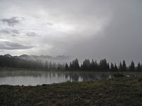
Little Molas Lake in the fog
Little Molas Lake
Today was a travel day but not without some fun and excitement. The rain started not long after we arrived, lasting 30 minutes or so. After that, we were able to take a short walk around the lake. The fog was tremendous, and we captured some amazing photos in the storm's aftermath. When the rain threatened again, we made the 5-mile trip to Silverton where we ate pizza and strolled down Main Street examining the shops and galleries. When we returned to camp, the rain returned. It is even harder and more sustained this time. I don't think it would feel harder against our tent if someone were spraying it with hose.

DAY 1
It was foggy this morning, and damn cold. We made breakfast, took down our tent and packed up our bags before 8:30 am. Hardly anything could be seen through the fog as we drove down to the trailhead, wished our car goodbye and got to it.

Fog over the San Juans
Heavy fog and rain ahead...
The whole day we were chased by sprinkles and the darker threat of rain. However, we were able to make it to camp at 9,900 feet at the "Beaver Ponds" without getting too wet. At least there was NO THUNDER!

The Beaver Ponds are a small series of, well, beaver ponds located at the turn for Vestal Basin. To start our day, we had to descend 1,800 feet from the 10,700-foot Molas Pass trailhead to 8,900 feet at the Animas River, then re-climb 1,000 feet to get here. With the added weight of the climbing gear it had felt horrific near the end.

A moose came strolling into camp earlier.Came up the trail and walked right past us before settling in at the Beaver Pond, where she fed on moss and drank the water for over an hour. At first I was intimidated, being
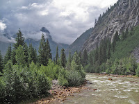
The Animas River in the San Juans
The Animas River (8,900')
so close. But after staring us down, she seemed to decide we weren't a threat. After that we co-existed without concern, even pumping water not fifty feet from where she drank.

We have found a beautiful place here, though some of it has been concealed by this stubborn fog. Who knows what we will be able to see in the coming days. Will we be able to climb Wham? Will it stay socked in with weather? Will there be wildlife and amazing scenery? I am anxious to find out.

DAY 2
After a good, maybe overly long night of sleep, we awoke to another foggy, overcast morning. At first, the dramatic aiguilles of Arrow and Vestal were partially visible through the billowing fog. Soon, however, they vanished once again completely behind a veil of white clouds.

Arrow Peak and Vestal Peak
Arrow Peak (right) and Vestal Peak (left) from camp
We decided to use the day to rest and recover our tired bodies. We figure we can still climb Wham tomorrow using this campsite as a basecamp. After all, we are at 10,200 feet [note: This was a mistake. We were actually at 9,900'] and it's only 3,600 feet to the summit, a comparatively modest amount. Regardless, it will still be a long day tomorrow.

It is hard to say what the weather will be like. Today it is unsettled, though with a seemingly low chance of rain.

After going for a three-mile hike and taking an hour nap, the weather has cleared somewhat and is now about the nicest we have seen. Large patches of blue sky have come to accompany about half the heavens, and it seems possible that, as each day has been minorly better than the last,  tomorrow could prove to be a good day for a shot at the summit.
Arrow Peak in the Fog
Arrow Peak coming out of the fog

Just talked to a group who attempted Wham today and were not able to get very far. As Ella and I have been saying, just being back here has been treat enough to make this trip more than worthwhile, even if the flies are getting bad. Still nothing could compare to the nightmare situation with mosquitoes two years ago in Wyoming.

This evening the rain came back, coming down off and on for several hours. At times it was light enough that we were able to sitting under the protective needles of a tall pine by the lake, hardly feeling even a drop. We watched the rain patterns on the lake surface, and the fog rolling up and down on the hillside. Despite everything being so damp, it was calm and mild.
Red flowers
The storms are coming in from the wrong way. It took me awhile to figure this out but storms have been moving in very slowly from the northeast. They are moving so slowly, however, almost imperceptibly, that it is hard at time to see them move at all. A weather system must be sitting directly over the mountains. Though it means these storms are long, damp and protracted, it also seems that they have no energy and therefore no real lightning. At least, not yet....

DAY 3
Certainly the most interesting day yet. We woke around 5 a.m. after a rather pitiful night's sleep. I couldn't rouse myself for an attempt at Wham. When we awoke fully a few hours later, there was not a cloud in the sky. This made me a bit upset.

To see Arrow and Vestal bathed in sunlight, beckoning with its beautiful, quartzite north face was almost enough to make me want to cry with disappointment. I had wanted to do this climb for so many years and here I was within touching distance and the only thing that kept me off of it was myself.

This severe disappointment was enough to prompt us to pack up and move basecamp up into Vestal Basin for a chance tomorrow. Looking back now from day's end, the jury is still out on whether that was a mistake.
ducking under a log with backpack
Ducking logs was the norm
en route to Vestal Basin. Hard with
a 65-pound pack

Though the hike was short and gained only about 1,500 vertical feet, it was perhaps the most grueling day of backpacking i have experienced. The "trail" was in bad shape with countless logs to duck under and climb around. With a fully stocked pack, this took a lot of energy. It was steep, loose, overgrown and very frustrating. Of course, we also got off, in one point, on the wrong path and had to battle up a steep scree gully.

Then there was the storm....

Almost immediately upon reaching Vestal Basin, the rain began. We were beat, barely able to carry our packs another foot. We picked a campsite and set-up hastily, noting the evidence that our tentsite had recently had water running through it. We built a levee against the possibility that it would happen again.

The rain/hail/lightning came, our worst storm yet. Some violent lightning for a solid hour, with never more that 10 seconds between rumbles of thunder. It did, however, seem like most of the lightning was cloud-to-cloud. The occasional ground strike really gets your attention when you are at 11,500 feet in a broad meadow with only sparse trees for protection.

Vestal Peak in the rain
Vestal peak at last, but in the rain....
Our levee failed somehow and water seeped in from the bottom of the tent. It was Geneva Lake all over again (we experienced by far the scariest lightning storm of my life in 2010 there and it lasted literally all night). The thought of having to endure another night like that was almost too much to bear. I found myself longing, for the first time really, for the safety of civilization.

But now the storm has passed and the weather has stabilized. We have realized that the possibility of doing Wham tomorrow is almost impossible. We are simply too low on energy now, too waterlogged, and the weather is too unstable for such a long committing climb. It just seems like it wasnt the right week for an attempt. To matters less appealing, we have a long hike out capped by an 1,800 foot slog out at the very end. At least, I try to convince myself, that part of the trail wont be as unstable as what we did today.

Backpacking is rugged, that is the bottom line. Especially with a full, alpine rack weighing you down from the dark depths of your pack. Type two fun for the vast majority of the time.But it is always good for the soul, and later the pack seems less heavy and the rain storms less soggy when time softens the memories. There is no doubt, however, that at times backpacking is trying and even scary on occasion. Those moments help me appreciate the comforts of home. Maybe in some ways that is the main reason why we come here.

Despite the hardships, this is one hell of a place. One of the most spectacular basins I have visited in Colorado, really. We are at the very toe of Arrow Peak, and earlier had a perfect view of Wham. While it seems that we wont get to climb, those views alone were worth the trip.

DAY 4
Having fun with the Grenadiers
Ella has some fun with Wham
Crazy day! After waking to another beautiful morning, we hiked up to get one more good look at Wham, taking some goofy photos in the process. We might as well have fun with the mountain since we weren't able to climb it.

Next it was time to head down Hell Hill, which earned its moniker today even more than yesterday. Not far into the hike, I sat down to wait for Ella, who I'd gotten ahead of while she was taking pictures of flowers in a field by the creek just behind me. After about fifteen minutes I started getting impatient, whistling and calling out.Frustrated now, I shrugged off my pack and stomped back to look for her. But she had vanished.

Panic ensued. For the next half an hour at least I was running back and forth up and down the trail yelling her name. I couldn't fathom what had happened. After running back and forth three times, the third time going almost all the way back to the turn for camp, I was thoroughly exhausted and decided the only possibility was that she had somehow gotten ahead of me. But how could she get off on the wrong trail like that?

Putting my pack on, I started down the trail only to realize that it was me who had gotten off trail. A little dead end spur, the real trail switchbacking higher up the hill and an almost imperceptibly junction. I was once again fooled by the un-maintained trail.

Wham Ridge
Wham Ridge in rare sun
Ella and I made a happy reunion at the bottom where she had frantically been running up and down the hill searching for me. We rested and ate lunch at the lake to recover from the ordeal. We felt exhausted now, but had made the goal to a reach a campsite by the Animas River where we had eaten lunch on Day 1. If we made it there, all that stood between us and the car (and a big meal in Silverton) was that last hill. After a half our at the Beaver Pond, we shouldered our packs once again and stumbled down the long hill.

My ankle was hurting now, after the second even-more-gnarly battle with Hell Hill, and I had to shift my stride to keep from further aggravating it. I took an ibuprofen, something I almost never do, to ease the journey.

The weather was still mostly nice when we reached the Animas. Storms were rumbling over the basin we had left but the low valley was sunny and hot. We spread out all of our clothes and tarps and rain gear to dry for the first time in days.
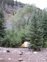
Animas River camp
Animas camp last night
Not willing to pump from the silty, heavy-metal-looking waters of the Animas, we walked a short distance to Molas Creek to fill our empty water bottles. Our pump was starting to move slow, and it took us a good half hour to get half way through. About the time it was my second turn, I felt the first splashes of raindrops. I cursed myself for not bringing my rain pants, but tightened my rain jacket around me and kept pumping. It started to rain a little harder so we took a break under a tree that was mostly keeping us dry.

"We should move," I said to Ella. "We will just get soaked out here and who knows how long it is going to last. Ella agreed and we started heading back to the tent. That was when it started really coming down. None of the "T word," but just hard, slamming rain. By the time we got back to the tent we were drenched and muddy. To make matters worse, the bottom of the tent had flooded once again.

After using the vestibule to attempt to separate what was dry with what was muddy, we used an old t-shirt to dry off the floor as much as possible. Now we were soaked again, almost everything we had was completely drenched. And the rain came down, pinning us inside that tiny, bright-yellow "shelter." We played a game of travel chess, which ended in a tie as the storm built around us. The lightning started after about a half hour. Spread out but all close ground strikes within five seconds, flash-to-bang (i.e. less than one mile).

footbridge over the Animas River
Footbridge over the Animas River
It was the longest, most sustained storm yet, lasting for well over two hours. Finally it tapered off and we were able to go outside in the soggy campsite and feed our hungry bellies. We ate mashed potatoes and gravy then followed that with mac and cheese, eating our extra meal for the hell of it. What a feast it seemed like. For perhaps the first time in what has turned out to be a surprisingly grueling backpack trip, I feel full!

So now I sit here beside the murky Animas, a river I have long dreamed of kayaking I might add as an aside, writing as night closes in. Tomorrow we will make the long hike out. I am both glad, as rain and thunder and a 70-pound pack have begun to take their toll, but also a bit sad.

For now I will make the most of what we have left. Tomorrow we might be out of the wild but we will still be on vacation. We have earned a few indulgences!

DAY 5
We have escaped. An escape is what it feel like indeed. Battered, tired, hungry, limping, we stumbled out of the Weminuche humbled by our experience. We woke up in the morning to nice weather. We took down camp with some extra excitement, knowing that we were going to get to sleep in a bed and eat a big meal today.

The Animas River crossing
The Animas crossing on Day 5
The hike out was long and difficult. Though the trail was solid, the hill was relentless. It did not take long to climb the 2.5 miles and 1,800 feet of elevation gain, but by the time we got to the top we were exhausted. A week's worth of difficult journeys had begun to take their toll. After taking the wrong trail at the last fork not half a mile from the end, we were forced to hike almost a half mile of unnecessary terrain. I collapsed next to the car when we reached it at last. We came time to unlock, however, I made two simultaneous, alarming discoveries: the car was unlocked and the the electronic door look didn't work. This of course meant only one thing, dead battery.

It seemed fitting to end the trip this way. Maybe our adventure wasn't quite over.

Luckily, we were able to flag down a group from Virginia off the highway who, after myriad advice about car maintenance, were able to get my engine to turn over and start. We were in Silverton ten minutes later, feeling famished. Out of the wild.

Staying now at a cabin in Durango, there is time to reflect on our trip and why we were unsuccessful in making our summit(s). If there was a failure, it was in not moving our camp from the Beaver Ponds at 9,900 feet and into Vestal Basin at 11,500 feet on day two. It was a hard decision to make, as the basin was sock in with fog and rain for nearly the entire day. Had we moved camp through what turned out to be almost an entire day of rain and lightning we would have been in position to capitalize on the weather window on Thursday (day three) morning. Our decision to try to climb Vestal from the Beaver Ponds was foolhardy, as Hell Hill turned out to be proved quite the challenge. But we abandoned this idea at 5:00 am after hours of rain the night before.
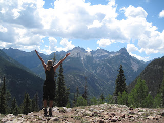
Mountain Pose in the San Juans
Mountain pose at the end
But everything had looked so perfect on Thursday morning, we had to try for Friday. So we lugged all of our crap up Hell Hill. And we got wet.... Oh yes. A massive hailstorm almost immediately after setting up the tent (a theme for the week, it happened three times that rain came within 15 minutes of setting up our tent. The floor breached for some reason, and 90% of our stuff got wet. After enduring that hail/thunderstorm, we were just about spent. Any question of attempting the peak was basically answered.

On Friday there was a window and we were in perfect position, but we also knew we had to start making our way out of there, and it was a long journey. Ultimately, the worst storm of the week moved in by 3 pm on Friday.

At least know we know the land, and we will be much more prepared the next time we come here. I have concluded we should do a few things different.

1) Take the train. The $85 would have been worth it, as that first 1,800 foot hill was a major drain on energy and resources. It adds 6.5 miles and a lot of elevation to the journey.

2) Get into Vestal Basin as quick as possible. While the Beaver Ponds were a pleasant place to linger, getting Hell Hill over and behind early in the trip rather than later would have been helpful. A one-day shot from the Beaver Ponds is ambitious at best.

3)Perhaps go in September when the weather is more stable. Even the windows to climb that did exist were short for such a long, committing route.

4)Be better conditioned! My body did not react well to the ultra-heavy pack.

Oh well, we had fun and had a challenging experience. We are out now and already civilization is back to its mundane familiarity. But I am glad not to be cowering in the tent from a storm. I feel good and will leave with my head high. It was overall a positive experience.

Visit THE ARCHIVE: A list of most of our articles sorted by department

find us on facebook

Copyright notice: This website and all its contents are the intellectual property of www.coloradomountaineering.com and its authors. None of the content can be used or reproduced without the approval of www.coloradomountaineering.com.

Climbing and mountaineering are dangerous!! Please see the DISCLAIMER page
For information about how to contact us, visit this link