Showing posts with label hot route. Show all posts

Monday, July 6, 2015

HOT ROUTE: Two Ears-Zanzibar Dihedral (300', 5.8+)

Trailhead: Weller Lake Campground
Distance: 1 mile
Elevation gain: 800 feet
Difficulty: 2 pitches, 5.8+

OVERVIEW
While not a summit-reaching climb, Independence Pass's Two Ears- Zanzibar Dihedral is one route that any intermediate, technical alpine climber might be interested in. This 300' climb highlights two long pitches on superb granite with good protection in a spectacular alpine setting. While a steep and rough talus approach may deter some climbers, those who brave the rocky beginning are rewarded with an excellent climb that finishes in the classic 150' dihedral pitch the "Zanzibar Dihedral."

THE ROUTE
Approach- From the Weller Campground find a climber's trail behind campsite number 6 and wind (briefly) through the pine and Aspen trails. Follow a series of cairns for the path of least resistance or pick your own way up to the base of the obvious 300' wall.

Zanzibar Dihedral, used courtesy of Mountainproject.com
Pitch One- "Two Ears" (5.7)- This long pitch is often regarded as a climb unto itself. Start just right of a pine tree on some obvious jugs. Work up and right to a series of broken cracks. The protection is good and solid throughout. There are many possibilities for cams and nuts. Small cams finger size and less are most useful. Work past two old pitons to a good splitter that ends in a pod. Work up and right to a two-bolt anchor just off a large ledge at the base of the dihedral.

Pitch 2- "Zanibar Dihedral" (5.8+)- This long, excellent pitch scales an overhanging dihedral with great protection and plentiful face holds to make it through. Several layers of cracks allow a variety of gear to protect. At the final bulge, step right on face holds and back left to easier ground at the top. A classic, granite dihedral!

DESCENT
Two double-rope raps from chain anchors will lead you to the ground. It will require two 60 meter ropes to make the descent.

DIRECTIONS
From the "S-Turn" in downtown Aspen, Colorado, follow Highway 82 south towards Independence Pass for 7.8 miles. Park either on the right side of road (heading from Aspen to Indy Pass) at the Weller Lake TH or set-up a basecamp in the excellent campground across the road.

LINKS
Zanzibar Dihedral on Mountainprojet.com

Visit THE ARCHIVE: A list of most of our articles sorted by department

find us on facebook


Copyright notice: This website and all its contents are the intellectual property of www.coloradomountaineering.com and its authors. None of the content can be used or reproduced without the approval of www.coloradomountaineering.com.

Climbing and mountaineering are dangerous!! Please see the DISCLAIMER page
For information about how to contact us, visit this link


Monday, January 27, 2014

Hot Route: Thomas Lakes (Mount Sopris)

INTRO
Mount Sopris from the north
Mount Sopris seen from the north
Mount Sopris is probably one of the most picturesque and most frequently climbed 12,000-foot peaks in the state, certainly in the west slope. Despite clocking in at only 12,953 feet, Sopris is a powerful mountain. When viewed from the north it has astonishing prominence, towering more than 6,000 feet above the valley floor below. Another unique feature of Mount Sopris is that each of its twin summits measure in at exactly the same elevation, creating a sort of conundrum for peak baggers. Many choose to just stand on the east summit, which is logical when climbing the standard Thomas Lakes route, as it is the first summit you come to. I would strongly suggest, however, making the out-and-back to the west summit, which provides a better view of Glenwood and allows you the confidence knowing that you truly toured this magnificent peak's amazing top.

DIRECTIONS
From the intersection of Highway 133 and Main Street in Carbondale, follow Hwy 133 south for about 1.6 miles and turn left (east) on Prince Creek Rd. After cruising through some small open ranch properties, continue along the road as it veers east. Veer right at a confusing, triangle-shaped intersection about 7.8 miles after the 133/Main Street intersection. Continue along the narrowing dirt road for a little less than two more miles to a large parking lot with a bathroom on the left. It should be passable in the summer for most passenger cars though some clearance might be recommended. Can be tough in the winter.

ROUTES
Thomas Lakes
Mount Sopris in the Elk Range of Colorado
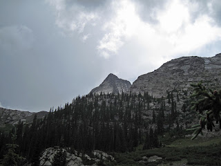
Storm over Sopris from the meadow at 9,500 feet
This is the standard route and though there are several more rugged possibilities on the peak's south and west aspects, 99.9% of summer ascents on Mount Sopris are done this way. It can be done in one day though a night at the beautiful Thomas Lakes makes hauling a light backpack well worth it. Start up the wide trail up a mild incline for .6 miles to the first major switchback. At mile 1 the trail turns south and emerges from the trees shortly after. At mile 1.4 you reach a common "shortcut" that climbs directly south up a steeper slopes. This shortcut cuts off a large switchback. Taking the shortcut will save you almost half a mile and both have a well-beaten trail. Taking the old road, however, you will wind around a hill, and climb up a short steep section to reach a meadow at mile 2. There is a beautiful view of the mountain from here at 9,500 feet. Ahead you re-enter the trees and wind though a beautiful aspen-pine area with a trickling stream. At mile 3.4 you reach the first pond, and at mile 3.7 you reach the first lake. There are several number campsites in this area.

Mount Sopris from Thomas Lakes
Hike between and around Thomas Lakes and follow the well-defined trail as it switchbacks up a hill and reaches the northeast ridge proper at 10,600 feet. The trees are noticeably thinning here and you will get the feeling you are nearing treeline. The trail levels out briefly before starting up the meat of the climb. Pick your way through the talus along the beaten path as the route steepens. Some amazing views of capitol open to the southeast. Pass the hardest steepest section (class 2) at mile 5.7 (~12,000 feet), veer westerly, still following the beaten climber's trail and the ridge. Bypass a false summit on the left (south) to reach a spot we always called "the Grassy Knoll," a peaceful patch of flat grass at 12,400 feet. There isn't much left so we always took advantage of a good rest here.

Follow the ramp up mostly stable talus as it makes the final climb to a bump at 12,900 feet. You are very close. Hike another .15  of a mile (6.6 miles total) gradually up to the east summit. Enjoy the view.

The final ramp to the East summit
For those that want to get the full twin-summit Sopris experience, be prepared to add 1.5 miles and 560 feet of total elevation gain onto your already lengthy day. From the east summit, hike .3 miles to the 12,660-foot saddle between the two summits (making it just shy of qualifying as two separate "ranked" peaks), and back up 280 feet and .35 miles to the west summit. Pat yourself on the back. Though you may feel tired, take heart knowing you got the full Sopris experience.

SPECIAL CONSIDERATIONS
Part of the route lies in the Snowmass-Maroon Bells Wilderness Area and special wilderness regulations apply. Please only camp in the designated and numbered spots around the lakes. There are some very good sites here and if you are climbing the peak on a weekend or any day when there is a chance that all of these sites might be full, get there early or consider doing just the single day method.

LINKS
Mount Sopris: A Mountain and a Totem- A look back on my first climb of Mount Sopris, a summit that launched my mountain-climbing career.

 Just Say No! to John Denver Peak- an article against the fizzled-out movement to rename the East summit of Mount Sopris John Denver Peak

Visit THE ARCHIVE: A list of most of our articles sorted by department

find us on facebook


Copyright notice: This website and all its contents are the intellectual property of www.coloradomountaineering.com and its authors. None of the content can be used or reproduced without the approval of www.coloradomountaineering.com.

Climbing and mountaineering are dangerous!! Please see the DISCLAIMER page
For information about how to contact us, visit this link


Wednesday, September 4, 2013

Hot Route: The DeCaLiBron (The Democrat, Cameron, Lincoln, Bross Loop)

Kite Lake Trailhead          
Length: 7 miles
Difficulty: class 2
Elevation gain: 3,500 feet
Exposure: Mild

OVERVIEW
Mt. Lincoln from Mt. Cameron
Mt. Lincoln in late spring
**NOTE** As of now the summit of Mt. Bross is closed to public access. Climbers that choose to o to the summit anyway could jeopardize future access, which the CFI (Colorado Fourteener Initiative) and CMC (Colorado Mountain Club) are currently fighting to obtain. The Bross portions of this historic route are included only for reference and in the hope that future access is restored.

The Decalibron is by far the easiest route in the state that allows you to collect four of the 59 fourteeners on the extended "59 List", and 3 of the 53 fourteeners on the standard list. In one big loop you can make a ring around this large cirque and collect Democrat, Cameron, Lincoln, and Bross. Since the trailhead at Kite Lake is over 12,000 feet and can be reached by a passenger car, this four-summit tour is highly abridged and quite popular.

Though the technical difficulty on this climb never exceeds class 2, the amount of time you are above 13,000 feet is substantial as is your exposure to weather. At the deepest points of the route the fastest way off is to simply continue around the cirque. As we discovered on a 2010 attempt of this ridge when we climbed in 80 mph winds, getting caught in the wrong conditions can be an unpleasant and even dangerous proposition.

THE ROUTE

The saddle between Colorado 14ers Mount Democrat and Mount Cameron
The saddle between Cameron
and Democrat from Democrat's
summit
From the Kite Lake trailhead, cross the creek and find a strong trail that heads north from the lake. Ascend the easy but winding class 1 trail to the 13,300 foot saddle between Democrat and Cameron. Turn left (west) and climb Mt. Democrat on a low class 2 trail. After enjoying Democrat's summit, descend back to the 13,300 foot saddle. Climb east to the rotund summit of Mt. Cameron, which is not ranked but usually included as one of the six unranked summits to be included in the 59 list.

From Cameron descend gently south to the saddle and it is only a short ways to Lincoln, the tallest route of the group. Lincoln's summit cap involves a small amount of boulder hopping. When you are done with Lincoln descend back to the saddle between Lincoln and Cameron and traverse to Cameron's east side to avoid having to re-climb to the top. Continue aroun the cirque to Bross and make a decision.

Mt. Bross on the Decalibron
Mt. Bross from Mt. Cameron
Currently, it is illegal to climb Mt. Bross, which is located on private property. It is legal to get within a few hundred feet of the summit and traverse on around to descend the West Slopes of Bross. Many people, eager to check off all of Colorado's 14ers, will quickly, quietly and respectfully make the out-and-back to Bross's summit and quietly move on. While it may be tempting to do so, you could jeopardize future access to the peak. Tread lightly!

The descent down Bross is steep and a bit gravelly at times, but very quickly you will be back down at your car.

DIRECTIONS
In the center of Alma turn west (right if coming from Hoosier Pass, left if coming from Fairplay) off Highway 9 onto Kite Lake Rd. Follow this mostly smooth dirt road for 6 miles to Kite Lake. In some conditions lower clearance cars will sometimes park a few turns below the lake but I've seen sports cars come rolling into the parking lot before. There is limited camping available here.

Mount Democrat in the snow
The last few, snowy feet on Democrat
TRIP REPORTS
Decalibron: How to Climb in a Hurricane- Eighty mile-per-hour winds and snowy conditions on the Democrat, Cameron, Lincoln, and Bross loop.

LINKS
Decalibron on 14ers.com

Decalibron on Summitpost.org

Colorado's Fourteeners: From Hikes to Climbs by Gerry Roach on Amazon.com- Better yet, buy this helpful and entertaining guidebook at your local gear shop or bookstore.

Visit THE ARCHIVE: A list of most of our articles sorted by department

find us on facebook

Follow us on Twitter!

Copyright notice: This website and all its contents are the intellectual property of www.coloradomountaineering.com and its authors. None of the content can be used or reproduced without the approval of www.coloradomountaineering.com.

Climbing and mountaineering are dangerous!! Please see the DISCLAIMER page
For information about how to contact us, visit this link


Friday, August 2, 2013

Featured Route: Wham Ridge (III 5.4) of Vestal Peak

A topo Wham Ridge
An approximate topo of Wham Ridge on Vestal Peak
Blue= standard version (5.4); Green="Center Shift" (5.6)
Molas Pass Trailhead          
Length: 19 miles
Difficulty: II 5.4 (III 5.6 for "Center Shift")
Elevation gain: 7,000 feet
Exposure: Moderate/high 
          Elk Park Trailhead
          Length: 12 miles
          Difficulty: II 5.4 (III 5.6 for "Center Shift")
          Elevation gain: 5,200 feet
          Exposure: Moderate/high

OVERVIEW
Vestal peak in the  rain
Vestal Peak towers above Vestal Basin
Wham Ridge is one of Colorado's most unique and best known technical alpine climbs. The rock is moderate, but the position and the surroundings are very rugged and dramatic. This portion of the San Juans is one of the most dramatic mountainous destinations in the entire state. Some of Colorado's most famous/infamous mountaineering peaks like in this ten square mile section of the Weminuche Wilderness, including but not limited to 14ers Eolus, North Eolus, Windom, and Sunlight, as well as thirteeners Pigeon Peak, Turret Peak, Jagged Mountain, Trinity Peak, Arrow Peak, and, of course, Vestal Peak. The Weminuche is the largest wilderness area in Colorado, and is teeming with wildlife, and beautiful flora. From both a backpacking and a mountaineering standpoint this is one of the most rugged and astounding places in the state.

Wham is a popular route for a technical alpine climb. It's moderate difficulty and ultra-aesthetic setting have made it one of the premier destinations for a first technical route for aspiring mountaineers. While it has a reputation of being easy, there are a few hazards that are worth mentioning that make any attempt at Wham become more than you bargained for.

First, Wham consists of quartzite. While it makes for some of the most solid rock in the entire range, it is akin to lubricated glass when it is wet. This stuff is slick. Play around on it even at camp after storm and you will see what I mean. This is no place to be in a storm.

Second, the descent is long and complicated. While it is only rated class 2+, it is long, loose and steep. It is easy to get sucked into class 3 terrain. Many people, too, have tried to descend directly south from the summit, only to find themselves pulled into even steeper and looser class 4.

Third, the San Juans are notorious for violent, long-lived storms. Their position on the western edge of the Rocky Mountains means that they are the first mountains to receive any weather systems blowing in with the trade winds. San Juan ski areas like Wolf Creek and Purgatory (Durango Mountain Resort) get some of the most snow in the state. The San Juans in turn get some of the most rain and some of the most violent weather of all the ranges in Colorado.

All of this being said, this one amazing part of the state, and any journey in is bound to be both challenging and rewarding. Wham Ridge of Vestal Peak is certainly worthy of its designation as a classic, and worth any trip for the mountaineer who is experienced and adventurous enough for the challenge.

THE ROUTE
The San Juans from Molas Trailhead
The Grenadiers from the Molas Trailhead
From Molas Trailhead, descend into the Animas River Canyon for five-hundred feet to an overlook at 10,100 feet. You can see the mountains in the distance, looking very far away. Still a long ways down.... Descend down the infamous 37 switchbacks (we counted 35). This arduous section drops over 1,300 feet to a very well-constructed footbridge over the Animas River at 8,800 feet. There is some limited camping in this area but the train tracks for the Durango and Silverton Narrow Gauge Railroad are only a few yards away.

Cross the tracks and find a good trail that starts to gently climb up the slopes on the east side of the river. After about half a mile, you join Elk Creek trail and come to a kiosk and register. It is a good idea, always, to take the moment to fill out the register. if you took the train in and got off at Elk Park, you will have walked an easy half mile to get to this point.

The next portion of the trail climbs a little under 1,000 feet in about two and half miles to a beautiful and obvious Beaver Pond at 9,900 feet. Arrow and Vestal can be seen up the basin from here to the south and there is good camping in the area of the beaver pond. On our last trip, we saw a moose here at the Beaver Pond.

The next section of the route is a bit arduous, especially if you are carrying a heavy backpack....
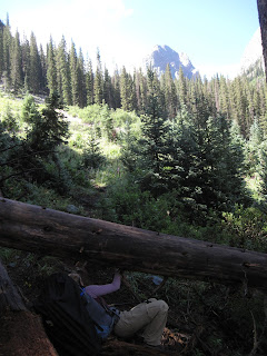
Ducking under logs heading to Vestal Basin
Ducking under logs on the way to Vestal Basin
At the east end of the beaver pond, leave Elk Creek trail and follow a strong climbers trail around a huge boulder on the east end of the pond. Follow this trail through a short wooded section with some good camping to a steep slope that drops down to Elk Creek. Crossing this creek in runoff seasons can be a bit treacherous depending on the presence/absence of a log bridge that is sometimes built here.

Cross the creek and start up what we dubbed "Hell Hill." The hill itself is only about 2 miles and gains just over 1,500 feet in elevation, but the trail is littered with downed trees and potential wrong turns. Stay high and stick to the main trail. Trying to stay closer to the creek will result only in rougher and steeper terrain you will have to negotiate.

At last you make it to the meadow at 11,500 feet in Vestal Basin. There are a couple of good campsites in the area, the best probably being on the left (east) side of the trail almost directly across from Wham itself. The mountains are beautiful and dramatic from this basin.

Climb up a steepening talus slope to the right of the obvious waterfall at the end of the meadow, and make your way to the bottom left corner of Wham Ridge (actually the peak's entire north face). Scramble up to a grassy ledge and do a rising traverse up and right to the face's west side just over 12,500 feet. So far the terrain shouldn't have exceeded class 3.

Scramble up the steepening face along its right side, roping up when and if you start feeling uncomfortable. There are a couple of decent splitter crack systems you can follow. The angle and difficulty steepen to low class 5 but just when it seems things are going to get really good, the rock becomes fractured and the climbing broken. Most people de-rope here and scramble the last few hundred feet on gunky class 4 to 5.easy to the summit.

Having fun with Wham
The Descent:
The descent is considered class 2+ but many people consider in class 3. It is long, loose and steep and not a great route to be on in a storm. From the summit descend southeast (not directly south, this leads to steep class 4 terrain) into a gully system on loose rock. Traverse when possible, following cairns for guidance, across the peak's south face, ultimately reaching the saddle between Vestal and Arrow Peaks. All that stand between you and the meadow is a gnarly downclimb down the slope Gerry Roach calls "Dues Collector" in his guidebook Colorado's Thirteeners: 13,800 to 13,999 feet. Back at the meadow you can relax (unless you have a train to catch) and be proud: you have just climbed one of Colorado's most aesthetic and classic mountaineering lines.

DIRECTIONS
The trailhead is found two miles north of Molas Pass on Highway 550 and five miles south of the town of Silverton. It is found in-between the turn offs for Molas and Little Molas Lake Campgrounds. The trailhead is a large dirt parking lot just off the highway on the canyon/mountain side.

TRIP REPORTS
Dirty (Wet) 30: or Five Rainy Days in the San Juans
Our attempt at Vestal and Arrow runs afoul of rain storms, bad navigation, and a general lack of time, but the trip was still one to remember.

LINKS
Mountainproject.com- Page on Wham Ridge standard route.

Summitpost.org- An information page on Wham Ridge (standard) route.


Visit THE ARCHIVE: A list of most of our articles sorted by department

find us on facebook

Follow us on Twitter!

Copyright notice: This website and all its contents are the intellectual property of www.coloradomountaineering.com and its authors. None of the content can be used or reproduced without the approval of www.coloradomountaineering.com.

Climbing and mountaineering are dangerous!! Please see the DISCLAIMER page
For information about how to contact us, visit this link