Showing posts with label trip report. Show all posts

Sunday, November 12, 2017

Tempting Fate on McGregor Mountain in RMNP

Five-hundred feet up a slick rock face with a storm moving in and I was about to die….

McGregor Mountain looms of the Fall River entrance
of Rocky Mountain National Park
At least that’s how it seemed as I clung desperately to the blank slab of granite, legs gyrating in fear, with crackles of thunder drawing closer. I’d forgotten how fast blue skies could turn to slate-gray in Rocky Mountain National Park in July above treeline. But frightening as it was being exposed to lightning, the impending storm was the last thing on my mind. I needed focus. Somewhere on the supposedly easy three-pitch 5.5 rock climb on McGregor Mountain, my wife, Ella, and I had gotten lost. Off-route and fifty feet above the last marginal piece of protection that might arrest a potential fall, I was stuck.

Best case scenario a drop now would entail one-hundred feet of sliding, scraping and tumbling down the mountain. With plenty of ledges and sporadic trees to smash into, the consequences of such a fall were too terrible to imagination. The less I tried to think about them, however, the more readily the images come to mind: broken limbs, snapped vertebrae. I doubt even my helmet would do much good.

Above, the rock steepened. The terrain was closer to 5.9 than 5.5 and slippery with the loam of disuse. Great cracks where I could install gear to catch a fall were tantalizingly close on both sides, but getting to them looked nearly impossible. How could this have happened? The whole situation, the very real possibility of disaster on what should have been a fun, mild afternoon outing, was starting to seem surreal, like one of those bad dreams from which you shake yourself awake and laugh. 

Panic nearly choked me. With Ella somewhere out of sight far below me and well beyond earshot, I was quite alone. How much longer could my quaking legs hold on before they shook me off the rock and sent me caroming down to face my doom? Climbing any direction was dangerous, but I could only hold on for so long. That one-hundred-foot tumbling whipper was drawing closer. 

An ill-timed crack of thunder, the closest yet, echoed off the tall, rugged peaks. The storm would soon be upon us.

*
In 2012 the Rocky Mountain Rescue Group, an organization of all-volunteer responders who specialize in rescues on mountainous terrain in Boulder County, published a report with analysis of all incidents in Boulder County involving rock climbing and hiking over a 14-year period. Although RMRG does not cover Rocky Mountain National Park, the group services nearby Boulder Canon, Eldorado Canyon and the Flatirons, some of the most popular climbing areas in the state. This large sample size provides a unique cross section of climbing-related injuries and fatalities.

Although the potential of falling while lead climbing is a predominant fear in the mind of most rock climbers, as it turns out it is not nearly the most common cause of injury or death. While RMRG was called to assist 428 rock climbing accidents in this period, only 5 were fatal incidents involving roped lead climbing. A much higher ratio (12%) were involved in belayer-error incidents and an even higher number (as much as 45%) involved rappelling and/or getting lost on the descent. 

Although the inglorious “whipper,” as a roped lead fall is often called, tends to dominate the Youtube videos and rock climbing tales of woe, it seems the things often taken for granted (i.e. your belay partner or your ability to get safely off the mountain) more often than not prove to be more treacherous. Knowing the relative safety of lead climbing, however, does little to calm quaking nerves when faced with the possibility of a dangerous fall on a difficult rock climb.

*
Time was up. I could delay no longer. Action had to be taken before I simply peeled off the mountain in exhaustion. 

Belaying Ella up the first ptich
I was tempted again by the safe crack system some twenty feet to my left. Getting there, however, involved crossing a strip of impossibly blank rock, no hand or foot holds in sight. A ridiculous part of my mind considered just lunging for it. Going right looked steeper and even more dangerous. Downclimbing was an option, but leading with your feet was always considerably more difficult than with your hands, so I quickly ruled it out.

The only real choice that remained was to go up. Although every bit I climbed would increase the length and danger of a fall, it seemed that in order to find safety I would have to swim through the belly of the beast.

The smooth shield of granite above was broken only by a thin seam. Though it was not deep enough to sink in spring-loaded cams capable of catching a fall, it provided just enough texture for my fingers and toes to scale upward. I pulled higher and higher, increasing the fall potential with every move. I climbed ten feet. Twenty feet. I was so far above my protection now it was almost comical. My life depended on the grip of my fingers, and the friction between my rubber shoes on the slick granite. The slightest slip or broken rock and my worst nightmare would rush upward to meet me. Would it hurt to take a fall like that? Or would it happen so fast the lights would simply go out in a blink?

I was eighty feet above my last cam. Then one-hundred. It had to end eventually. This rock couldn’t go on forever.

Then abruptly, almost magically, a crack appeared in front of my eyes. I was so focused I nearly climbed past it. Shocked I had made it, I plugged in a cam and clipped in my rope with disbelief. I was safe. I installed a second cam just to be sure. The earthquake in my legs slowed. I wasn’t going to die today.

Not long after, the angle of the wall flattened and I found myself standing on the top. The storm I had thought was building had swung far to the north. I constructed an anchor and began to belay Ella up to join me. 

Already my fear from just a few minutes before was beginning to fade. Surely, I had not been in nearly as much danger as I’d thought. Here I was, not injured or lost or stranded. In every sense of the word the climb was a complete success. I stood atop a mountain with a sea of beautiful ridges and notched spines all around. Blue sky broke through the clouds.

It was a perfect day.

NOTE: This article originally appeared in the August 2017 issue of Our Backyard, a regional publication focused on outdoor stories of intrigue and woe
-------------------------------------------------------------------------------------------------------
Visit THE ARCHIVE: A list of most of our articles sorted by department

find us on facebook


Copyright notice: This website and all its contents are the intellectual property of www.coloradomountaineering.com and its authors. None of the content can be used or reproduced without the approval of www.coloradomountaineering.com.

Climbing and mountaineering are dangerous!! Please see the DISCLAIMER page
For information about how to contact us, visit this link


Friday, July 7, 2017

Not Conquerors, Merely Survivors

The Elk Range holds some of the deadliest mountains in Colorado
The Maroon Bells, Snowmass Mountain, and Capitol
as seen from the summit of Pyramid Peak
The broken faces of the Maroon Bells and their sister mountain, Pyramid Peak, towered over us as we wended up the serpentine trail. It was a brisk early morning, the first glance of the sun was just edging the tips of the three 14,000-foot peaks. The skies were clear, however, and the wind was still. It seemed like a perfect day to climb one of Colorado’s most difficult and dangerous mountains. 

“Where climbers fear to tread,” a sign had warned us at the trailhead. “The Deadly Bells, and their neighbor Pyramid Peak, have claimed many lives in the past few years.” Chilling words to read while gearing up to defy the very advice given. “Expert climbers who did not know the proper routes have died on these peaks. Don’t repeat their mistakes, for only rarely have these mountains given a second chance,” the sign concludes.

After staggering up the winding approach through the early hours of morning, dodging audacious mountain goats and the occasional stray mosquito, we ascended at last into a dramatic basin at the skirt of Pyramid Peak’s nearly vertical North Face. My wife, Ella, and I gaped at the full majesty of the mountain: its shattered fissures and serrated crenellations, it's foreboding ramparts and pointed summit. An ominous silence loomed over everything. All of the words and warnings about this infamous mountain echoed in my mind.

“What do you think?” Ella asked, feeling the need to whisper in the inhuman silence. Her forehead was furrowed with wariness.

“I think it’s going to be...exciting.” 

We selected a flat rock for a few moments’ rest and choked down a mouthful of trail mix. I picked the first section of our intended line from the slopes and gullies above us. It was brutally steep and broken. My mouth became nearly too dry to swallow. 

“We should get started,” said Ella after too many minutes of nervous snacking. She is always my crutch of courage and I lean on her extensively.

“Yes,” I said tentatively. “We should.”

*          *          *

Pyramid Peak a 14er in Colorado's Elk Range
A mountain goat perched precariously near the summit of
Pyramid Peak
On a windy, numbingly cold morning in early March 2017, a pair of bicyclists cruising up Maroon Creek Road to enjoy the late-winter beauty of these same peaks happened upon a most alarming sight: a man—frostbitten, pelvis broken, dislocated elbow—staggering down the road away from the snowclad summit of Pyramid Peak. Ryan Montoya, a 23-year-old mountaineer from Arvada, Colorado who’d been missing for two days, had been found. 

The highly syndicated effort to locate Montoya had involved a large number of rescuers and a great deal of publicity. Frigid temperatures coupled with nearly 100-mph winds had quickly drained the hopes of a happy ending to this missing climber story. Against all odds, however, here he was, battered and frozen but alive.

Pyramid Peak and the Maroon Bells have developed a fearsome reputation over the years and for good reason. For decades, they have terrorized the mountaineering community, claiming an inordinate number of lives and filling the media with stories of woe and tragedy. They are not the steepest nor the most technically difficult of Colorado’s many mountains, but over the years the “Deadly Bells” have lived up to their infamous moniker. Hardly a year passes without at least one tragedy unfolding on their slopes. The stark beauty of these mountains conceals an ugly truth, these three peaks own some of the most treacherous, loose rock in the state of Colorado. Too broken and unstable to use ropes safely, these mountains force climbers to rely on deft movement, their skills with route-finding, and a good stroke of luck to ascend them successfully.

The story of Ryan Montoya is one of the most engaging and inspirational survival narratives in modern 14er history. After a 2,000-foot tumble down the precipitous slopes of Pyramid Peak and two nights spent exposed to the elements making snail-like progress out of the frozen wilderness, Montoya was miraculously rescued, and expected to make a full recovery. 

Not all Maroon Bells-Pyramid Peak incidents turn out so well, however. Since 2010, at least seven people have lost their lives trying to climb these peaks, that’s an average of one per year. Only the far more popular Longs Peak in Rocky Mountain National Park has seen more fatal accidents in that same period. As some of the most photographed peaks in the state, these mountains’ picturesque beauty beckons like the call of a siren to many, luring them into what can prove for some to be a nightmare. 

On September 20, 2016, Dave Cook, a mountaineer from Corrales, New Mexico, went missing while on a solo trip with the intent of climbing the Maroon Bells and Pyramid Peak. His story, which starts similarly to Ryan Montoya’s, ends with a vastly different and far-more-tragic conclusion. After an exhaustive eight-day search by ground and by helicopter, the rescue effort was called off. Dave Cook was never found, and what happened to him in those deadly mountains remains a mystery.

*          *          *

The author on top of Pyramid Peak in Colorado's Elk Range
We hauled ourselves up the final, broken ledges and collapsed ecstatically on the summit of Pyramid Peak. For a few breathless minutes, we indulged our pride in the accomplishment. A sea of beauty surrounded us. The twin fangs of North and South Maroon Peaks rose up to the north. The distant spires of Capitol Peak and Snowmass Mountain loomed behind them in the distance. Without question, we had reached one of the roofs in the heart of Colorado’s central mountains. 

“We made it!” Ella proclaimed and we shared an embrace. 

Moments like these are the fruits of life. No greater metaphor for life’s challenges exists than scaling mountains: hard work endured, exhaustion overcome, obstacles bested, and at the conclusion, the stunning view from the top. 

Ella and I never fall into the trap of saying we “conquered” the mountain. These peaks were here long before us, and they will remain for millions of years after we are gone. We are but miniscule grains that manage to survive the harsh lessons of these great peaks for a geologic blink. Our time on top makes us not conquerors but lucky survivors. Luck that not everyone who sets out with our goals shares. It is hard not to think of those who ventured into these mountains in the hope of finding something but instead lost everything. 

As we backtrack carefully down the ridge and the summit recedes behind us, we put our backs to one of Colorado’s most breathtaking places. Finally, at the parking lot some hours later, we gaze back in exhausted wonder as the afternoon light bathes the Elk Mountains in a dazzling glow. I salute these mighty peaks in reverence, and thank them for letting us pass once again. 

NOTE: This article originally appeared in Our Backyard, July 2017 issue. The link to the digital version can be found here

RELATED STORIES
-Climber Found Alive After Being Missing for Two Days on Pyramid Peak
-Peak of the Week: Pyramid Peak
-Are We Just Mountain Goats?

Visit THE ARCHIVE: A list of most of our articles sorted by department

find us on facebook

Follow us on Twitter!

Copyright notice: This website and all its contents are the intellectual property of www.coloradomountaineering.com and its authors. None of the content can be used or reproduced without the approval of www.coloradomountaineering.com.

Climbing and mountaineering are dangerous!! Please see the DISCLAIMER page
For information about how to contact us, visit this link


Tuesday, July 12, 2016

Stranded on Monitor Rock Near Independence Pass

Monitor Rock. Trooper Traverse follows the prominent
 ramp/crack system in the center of the main face

We’re going to be on the news….

It was the only thought my panicked mind could summon. “Three rock climbers had to be rescued last night off Monitor Rock near Twin Lakes just east of Independence Pass. Reportedly, the group was stranded when their rope became stuck as they were rappelling from the 450-foot-tall rock.” Something like that. People on their couches at home would guffaw and grumble “idiots” before clicking around for something better. Now that we’d been in our predicament for over an hour, this scenario seemed not just possible, but likely.

On the positive side, we were on a solid ledge that had not one but two bolted anchors. At ten feet long, two feet wide and 350 feet off the ground, was it comfortable? No. But at least we were in no danger of falling. It was autumn, however, and evening was approaching. Though it had been a warm, bluebird day, once that sun went down, it was going to get cold.

“We can think this through,” said my wife, Ella, sounding much calmer than I felt.

“There is no reason to panic.”

“I also have this,” added my friend and often climbing partner, Trent. He reached into his backpack and retrieved a Spot Satellite GPS messenger. With one touch of the panic button, this little device would transmit an S.O.S along with our coordinates to emergency dispatch, and the finest in backcountry rescue services would be deployed to save us. But how long would it take them to arrive? Monitor Rock was 26 miles from Leadville, where it was likely any such rescue operation would be staged. The amount of time it would take to mobilize and travel here alone could be hours. Then they would have to climb to us, and get us down, and do whatever follow-up was required. I was guessing we’d be lucky to get home by midnight.

“Are we at that point?” I asked, watching his finger edge closer to the button. The three of us were silent. There was only so much pulling one could do on a stuck rope before giving in to the harsh reality.

Ella sighed. “We might be.”
The author leads the pitch 4 traverse pitch

I swore out loud, which didn’t help anything. The climb itself, a historical multi-pitch traditional route known as the Trooper Traverse (5 pitches, 5.8+) had been smooth. We’d swapped leads and made our way up the enjoyable line in decent time, even taking the more-difficult 5.9 crux variation for the final pitch. The setting for Monitor Rock was breathtaking, especially with the golds, oranges and yellows of fall at their peak. The cobalt sky was dotted with friendly, paintbrush clouds and the perfectly warm air was so still we could hear calls of “take” and “lowering” from the climbers cragging on other routes far below us at the base of the wall. I hated the stark juxtaposition of all that beauty against our current predicament.

“All right,” I said to Trent with a deep breath. “I guess we have to do it.”

Trent’s thumb hovered over the panic button.

* * *

It’s a common mountaineering axiom that the way down is the most dangerous part of an expedition. The descent occurs later in the day when we are exhausted and weather is more likely. And while going down, we are leading with our feet instead of our heads. Then there is complacency. Feeling that the summit, and the worst, is behind us, we lower our guard.

Rappelling is a special type of descent that can speed up our progress and allow us to cruise past gnarly sections that would be difficult or impossible to downclimb. Duane Raleigh, publisher of Rock & Ice magazine and first ascensionist of many Western Colorado rock climbs, asserts in his article “Rappelling-Surviving Climbing’s Diciest Business” that “of the myriad ways to kill yourself climbing, rappelling is the quickest.” This grim truism echoes through my head every time I fix myself to a rope to begin a rappel descent.

When done properly, however, rappelling is quite simple, easy and generally safe, but the consequences of any broken link in the chain are disastrous. There are many ways rappelling can go wrong, including anchor failure, knot failure, improper connections with the belay device, loss of brake-hand control, failure to tie backup knots, rappelling off the end of the rope, and more. One of the most common rappelling faux pas, however, is getting a rope stuck when pulling it.

Now, there is an advantage to this mistake over the others: you are at the bottom of the rappel when it happens. If it were just a single rappel then at worst you have to leave your expensive rope behind and hope you can come back for it later.

On a multi-rappel descent, getting your rope stuck up high can leave you stranded with hundreds, sometimes thousands, of feet still to the ground.
*               *               *
“Let me try it one more time,” said Trent, slipping the GPS tracker back into his bag. Taking both ends of the rope, he began to saw the two lines back and forth.

At first, nothing would budge. Then suddenly, a hundred feet above us, the knot popped free from whatever it had been stuck on and began pulling through the anchor. A minute later it hissed down the smooth granite and landed at our feet.

We stared at it with our mouths hanging open in shock. After more than an hour being stranded, we were free. We cheered. We hugged. We celebrated. No hours-long rescue. No Channel 5 News story. No being benighted on a two-foot-wide ledge at 10,000 feet elevation. We were going home.
Ella Wright just before the rope
became stuck

There were still two rappels to go however, and we couldn’t lose focus. The last thing we wanted was to get out of one bad situation by the skin of our teeth only to end up in a worse one. The best moment, however, of any rappel is when your feet and rope are back on the ground, and an hour later we were there. At the bottom of the rock we laid in the grass and gravel and tried to laugh off what had just happened. It seemed surreal, the sudden transition from danger to safety.

“Let’s get out of here,” Ella said after we packed up our bags. She started the march down the trail in the direction of our car.

“I couldn’t agree more,” added Trent and followed.

I looked back at sweeping heights of Monitor Rock. Evening was already almost at hand and the glistening gray rock was falling into shadow. I could still pick out the ledge where we had spent an hour stranded. I couldn’t help but think how close we’d come to still being up there.

“Maybe we need to go get a beer,” I added. I turned away from the rock to follow the others, and didn’t look back.

NOTE: This article was originally published in Our Backyard (Volume 11, Issue 3, June 2016), an outdoor publication that is inserted in The Nickel and the Moab Times-Independent. 


Visit THE ARCHIVE: A list of most of our articles sorted by department

find us on facebook

Follow us on Twitter!

Copyright notice: This website and all its contents are the intellectual property of www.coloradomountaineering.com and its authors. None of the content can be used or reproduced without the approval of www.coloradomountaineering.com.

Climbing and mountaineering are dangerous!! Please see the DISCLAIMER page
For information about how to contact us, visit this link


Sunday, July 28, 2013

Dirty (Wet) 30 or A Journal Account of Five Rainy Days in the San Juans

Vestal Peak and Arrow Peak
Vestal Peak (left) and Arrow Peak (right)
Turning 30 isn't a bad thing. Of course not. It is something to celebrate. So how should I celebrate mine? Climbing Wham Ridge on Vestal Peak in the Grenadier Range of the San Juans sounds about right. Wham Ridge was one of my dream climbs, and one of the most important routes on my fiancee and I's personal summit list. Coordinating our time off from work, we had a week-long shot at a destination that had been on our radar for some time.

As it would turn out, June of 2013 was one of the driest months on record. My hometown of Glenwood Springs, which is located at 5,700 feet and sandwiched in-between the Elk Mountains to the south and the Flat Top Mountains to the north, received precisely zero measurable precipitation during the month, and though the San Juans fared slightly better, hardly anyone could remember so many bluebird days on top of each other. As our luck would have it, a few days before our trip was set to begin, a peculiar, backwards-moving (east to west) low pressure system drew moist, Gulf air directly over the state of Colorado, and our long dry-spell was quickly brought to an end. There were flash floods in Grand Junction, and rain and lightning all-across the state. We knew, watching the forecast as the days of our trip appeared on the extended outlook, what we were likely in for.

DAY 0
So here we are... Today is my birthday. My 30th birthday. And my fiancee, Ella, and I are are camped at Molas Pass awaiting morning so we can begin our backpack trip into the Grenadier Range. It is raining, hard. I get the feeling this is something we will have to get used to.
Little Molas Lake in the fog
Little Molas Lake
Today was a travel day but not without some fun and excitement. The rain started not long after we arrived, lasting 30 minutes or so. After that, we were able to take a short walk around the lake. The fog was tremendous, and we captured some amazing photos in the storm's aftermath. When the rain threatened again, we made the 5-mile trip to Silverton where we ate pizza and strolled down Main Street examining the shops and galleries. When we returned to camp, the rain returned. It is even harder and more sustained this time. I don't think it would feel harder against our tent if someone were spraying it with hose.

DAY 1
It was foggy this morning, and damn cold. We made breakfast, took down our tent and packed up our bags before 8:30 am. Hardly anything could be seen through the fog as we drove down to the trailhead, wished our car goodbye and got to it.

Fog over the San Juans
Heavy fog and rain ahead...
The whole day we were chased by sprinkles and the darker threat of rain. However, we were able to make it to camp at 9,900 feet at the "Beaver Ponds" without getting too wet. At least there was NO THUNDER!

The Beaver Ponds are a small series of, well, beaver ponds located at the turn for Vestal Basin. To start our day, we had to descend 1,800 feet from the 10,700-foot Molas Pass trailhead to 8,900 feet at the Animas River, then re-climb 1,000 feet to get here. With the added weight of the climbing gear it had felt horrific near the end.

A moose came strolling into camp earlier.Came up the trail and walked right past us before settling in at the Beaver Pond, where she fed on moss and drank the water for over an hour. At first I was intimidated, being
The Animas River in the San Juans
The Animas River (8,900')
so close. But after staring us down, she seemed to decide we weren't a threat. After that we co-existed without concern, even pumping water not fifty feet from where she drank.

We have found a beautiful place here, though some of it has been concealed by this stubborn fog. Who knows what we will be able to see in the coming days. Will we be able to climb Wham? Will it stay socked in with weather? Will there be wildlife and amazing scenery? I am anxious to find out.

DAY 2
After a good, maybe overly long night of sleep, we awoke to another foggy, overcast morning. At first, the dramatic aiguilles of Arrow and Vestal were partially visible through the billowing fog. Soon, however, they vanished once again completely behind a veil of white clouds.

Arrow Peak and Vestal Peak
Arrow Peak (right) and Vestal Peak (left) from camp
We decided to use the day to rest and recover our tired bodies. We figure we can still climb Wham tomorrow using this campsite as a basecamp. After all, we are at 10,200 feet [note: This was a mistake. We were actually at 9,900'] and it's only 3,600 feet to the summit, a comparatively modest amount. Regardless, it will still be a long day tomorrow.

It is hard to say what the weather will be like. Today it is unsettled, though with a seemingly low chance of rain.

After going for a three-mile hike and taking an hour nap, the weather has cleared somewhat and is now about the nicest we have seen. Large patches of blue sky have come to accompany about half the heavens, and it seems possible that, as each day has been minorly better than the last,  tomorrow could prove to be a good day for a shot at the summit.
Arrow Peak in the Fog
Arrow Peak coming out of the fog

Just talked to a group who attempted Wham today and were not able to get very far. As Ella and I have been saying, just being back here has been treat enough to make this trip more than worthwhile, even if the flies are getting bad. Still nothing could compare to the nightmare situation with mosquitoes two years ago in Wyoming.

This evening the rain came back, coming down off and on for several hours. At times it was light enough that we were able to sitting under the protective needles of a tall pine by the lake, hardly feeling even a drop. We watched the rain patterns on the lake surface, and the fog rolling up and down on the hillside. Despite everything being so damp, it was calm and mild.
Red flowers
The storms are coming in from the wrong way. It took me awhile to figure this out but storms have been moving in very slowly from the northeast. They are moving so slowly, however, almost imperceptibly, that it is hard at time to see them move at all. A weather system must be sitting directly over the mountains. Though it means these storms are long, damp and protracted, it also seems that they have no energy and therefore no real lightning. At least, not yet....

DAY 3
Certainly the most interesting day yet. We woke around 5 a.m. after a rather pitiful night's sleep. I couldn't rouse myself for an attempt at Wham. When we awoke fully a few hours later, there was not a cloud in the sky. This made me a bit upset.

To see Arrow and Vestal bathed in sunlight, beckoning with its beautiful, quartzite north face was almost enough to make me want to cry with disappointment. I had wanted to do this climb for so many years and here I was within touching distance and the only thing that kept me off of it was myself.

This severe disappointment was enough to prompt us to pack up and move basecamp up into Vestal Basin for a chance tomorrow. Looking back now from day's end, the jury is still out on whether that was a mistake.
ducking under a log with backpack
Ducking logs was the norm
en route to Vestal Basin. Hard with
a 65-pound pack

Though the hike was short and gained only about 1,500 vertical feet, it was perhaps the most grueling day of backpacking i have experienced. The "trail" was in bad shape with countless logs to duck under and climb around. With a fully stocked pack, this took a lot of energy. It was steep, loose, overgrown and very frustrating. Of course, we also got off, in one point, on the wrong path and had to battle up a steep scree gully.

Then there was the storm....

Almost immediately upon reaching Vestal Basin, the rain began. We were beat, barely able to carry our packs another foot. We picked a campsite and set-up hastily, noting the evidence that our tentsite had recently had water running through it. We built a levee against the possibility that it would happen again.

The rain/hail/lightning came, our worst storm yet. Some violent lightning for a solid hour, with never more that 10 seconds between rumbles of thunder. It did, however, seem like most of the lightning was cloud-to-cloud. The occasional ground strike really gets your attention when you are at 11,500 feet in a broad meadow with only sparse trees for protection.

Vestal Peak in the rain
Vestal peak at last, but in the rain....
Our levee failed somehow and water seeped in from the bottom of the tent. It was Geneva Lake all over again (we experienced by far the scariest lightning storm of my life in 2010 there and it lasted literally all night). The thought of having to endure another night like that was almost too much to bear. I found myself longing, for the first time really, for the safety of civilization.

But now the storm has passed and the weather has stabilized. We have realized that the possibility of doing Wham tomorrow is almost impossible. We are simply too low on energy now, too waterlogged, and the weather is too unstable for such a long committing climb. It just seems like it wasnt the right week for an attempt. To matters less appealing, we have a long hike out capped by an 1,800 foot slog out at the very end. At least, I try to convince myself, that part of the trail wont be as unstable as what we did today.

Backpacking is rugged, that is the bottom line. Especially with a full, alpine rack weighing you down from the dark depths of your pack. Type two fun for the vast majority of the time.But it is always good for the soul, and later the pack seems less heavy and the rain storms less soggy when time softens the memories. There is no doubt, however, that at times backpacking is trying and even scary on occasion. Those moments help me appreciate the comforts of home. Maybe in some ways that is the main reason why we come here.

Despite the hardships, this is one hell of a place. One of the most spectacular basins I have visited in Colorado, really. We are at the very toe of Arrow Peak, and earlier had a perfect view of Wham. While it seems that we wont get to climb, those views alone were worth the trip.

DAY 4
Having fun with the Grenadiers
Ella has some fun with Wham
Crazy day! After waking to another beautiful morning, we hiked up to get one more good look at Wham, taking some goofy photos in the process. We might as well have fun with the mountain since we weren't able to climb it.

Next it was time to head down Hell Hill, which earned its moniker today even more than yesterday. Not far into the hike, I sat down to wait for Ella, who I'd gotten ahead of while she was taking pictures of flowers in a field by the creek just behind me. After about fifteen minutes I started getting impatient, whistling and calling out.Frustrated now, I shrugged off my pack and stomped back to look for her. But she had vanished.

Panic ensued. For the next half an hour at least I was running back and forth up and down the trail yelling her name. I couldn't fathom what had happened. After running back and forth three times, the third time going almost all the way back to the turn for camp, I was thoroughly exhausted and decided the only possibility was that she had somehow gotten ahead of me. But how could she get off on the wrong trail like that?

Putting my pack on, I started down the trail only to realize that it was me who had gotten off trail. A little dead end spur, the real trail switchbacking higher up the hill and an almost imperceptibly junction. I was once again fooled by the un-maintained trail.

Wham Ridge
Wham Ridge in rare sun
Ella and I made a happy reunion at the bottom where she had frantically been running up and down the hill searching for me. We rested and ate lunch at the lake to recover from the ordeal. We felt exhausted now, but had made the goal to a reach a campsite by the Animas River where we had eaten lunch on Day 1. If we made it there, all that stood between us and the car (and a big meal in Silverton) was that last hill. After a half our at the Beaver Pond, we shouldered our packs once again and stumbled down the long hill.

My ankle was hurting now, after the second even-more-gnarly battle with Hell Hill, and I had to shift my stride to keep from further aggravating it. I took an ibuprofen, something I almost never do, to ease the journey.

The weather was still mostly nice when we reached the Animas. Storms were rumbling over the basin we had left but the low valley was sunny and hot. We spread out all of our clothes and tarps and rain gear to dry for the first time in days.
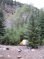
Animas River camp
Animas camp last night
Not willing to pump from the silty, heavy-metal-looking waters of the Animas, we walked a short distance to Molas Creek to fill our empty water bottles. Our pump was starting to move slow, and it took us a good half hour to get half way through. About the time it was my second turn, I felt the first splashes of raindrops. I cursed myself for not bringing my rain pants, but tightened my rain jacket around me and kept pumping. It started to rain a little harder so we took a break under a tree that was mostly keeping us dry.

"We should move," I said to Ella. "We will just get soaked out here and who knows how long it is going to last. Ella agreed and we started heading back to the tent. That was when it started really coming down. None of the "T word," but just hard, slamming rain. By the time we got back to the tent we were drenched and muddy. To make matters worse, the bottom of the tent had flooded once again.

After using the vestibule to attempt to separate what was dry with what was muddy, we used an old t-shirt to dry off the floor as much as possible. Now we were soaked again, almost everything we had was completely drenched. And the rain came down, pinning us inside that tiny, bright-yellow "shelter." We played a game of travel chess, which ended in a tie as the storm built around us. The lightning started after about a half hour. Spread out but all close ground strikes within five seconds, flash-to-bang (i.e. less than one mile).

footbridge over the Animas River
Footbridge over the Animas River
It was the longest, most sustained storm yet, lasting for well over two hours. Finally it tapered off and we were able to go outside in the soggy campsite and feed our hungry bellies. We ate mashed potatoes and gravy then followed that with mac and cheese, eating our extra meal for the hell of it. What a feast it seemed like. For perhaps the first time in what has turned out to be a surprisingly grueling backpack trip, I feel full!

So now I sit here beside the murky Animas, a river I have long dreamed of kayaking I might add as an aside, writing as night closes in. Tomorrow we will make the long hike out. I am both glad, as rain and thunder and a 70-pound pack have begun to take their toll, but also a bit sad.

For now I will make the most of what we have left. Tomorrow we might be out of the wild but we will still be on vacation. We have earned a few indulgences!

DAY 5
We have escaped. An escape is what it feel like indeed. Battered, tired, hungry, limping, we stumbled out of the Weminuche humbled by our experience. We woke up in the morning to nice weather. We took down camp with some extra excitement, knowing that we were going to get to sleep in a bed and eat a big meal today.

The Animas River crossing
The Animas crossing on Day 5
The hike out was long and difficult. Though the trail was solid, the hill was relentless. It did not take long to climb the 2.5 miles and 1,800 feet of elevation gain, but by the time we got to the top we were exhausted. A week's worth of difficult journeys had begun to take their toll. After taking the wrong trail at the last fork not half a mile from the end, we were forced to hike almost a half mile of unnecessary terrain. I collapsed next to the car when we reached it at last. We came time to unlock, however, I made two simultaneous, alarming discoveries: the car was unlocked and the the electronic door look didn't work. This of course meant only one thing, dead battery.

It seemed fitting to end the trip this way. Maybe our adventure wasn't quite over.

Luckily, we were able to flag down a group from Virginia off the highway who, after myriad advice about car maintenance, were able to get my engine to turn over and start. We were in Silverton ten minutes later, feeling famished. Out of the wild.

Staying now at a cabin in Durango, there is time to reflect on our trip and why we were unsuccessful in making our summit(s). If there was a failure, it was in not moving our camp from the Beaver Ponds at 9,900 feet and into Vestal Basin at 11,500 feet on day two. It was a hard decision to make, as the basin was sock in with fog and rain for nearly the entire day. Had we moved camp through what turned out to be almost an entire day of rain and lightning we would have been in position to capitalize on the weather window on Thursday (day three) morning. Our decision to try to climb Vestal from the Beaver Ponds was foolhardy, as Hell Hill turned out to be proved quite the challenge. But we abandoned this idea at 5:00 am after hours of rain the night before.
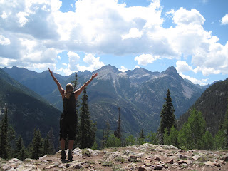
Mountain Pose in the San Juans
Mountain pose at the end
But everything had looked so perfect on Thursday morning, we had to try for Friday. So we lugged all of our crap up Hell Hill. And we got wet.... Oh yes. A massive hailstorm almost immediately after setting up the tent (a theme for the week, it happened three times that rain came within 15 minutes of setting up our tent. The floor breached for some reason, and 90% of our stuff got wet. After enduring that hail/thunderstorm, we were just about spent. Any question of attempting the peak was basically answered.

On Friday there was a window and we were in perfect position, but we also knew we had to start making our way out of there, and it was a long journey. Ultimately, the worst storm of the week moved in by 3 pm on Friday.

At least know we know the land, and we will be much more prepared the next time we come here. I have concluded we should do a few things different.

1) Take the train. The $85 would have been worth it, as that first 1,800 foot hill was a major drain on energy and resources. It adds 6.5 miles and a lot of elevation to the journey.

2) Get into Vestal Basin as quick as possible. While the Beaver Ponds were a pleasant place to linger, getting Hell Hill over and behind early in the trip rather than later would have been helpful. A one-day shot from the Beaver Ponds is ambitious at best.

3)Perhaps go in September when the weather is more stable. Even the windows to climb that did exist were short for such a long, committing route.

4)Be better conditioned! My body did not react well to the ultra-heavy pack.

Oh well, we had fun and had a challenging experience. We are out now and already civilization is back to its mundane familiarity. But I am glad not to be cowering in the tent from a storm. I feel good and will leave with my head high. It was overall a positive experience.

Visit THE ARCHIVE: A list of most of our articles sorted by department

find us on facebook

Copyright notice: This website and all its contents are the intellectual property of www.coloradomountaineering.com and its authors. None of the content can be used or reproduced without the approval of www.coloradomountaineering.com.

Climbing and mountaineering are dangerous!! Please see the DISCLAIMER page
For information about how to contact us, visit this link


Sunday, July 21, 2013

A Grand Adventure: The Four Pass Loop

The Maroon Bells
Maroon Lake at the beginning
The world-famous Maroon Bells were reflected perfectly on the placid surface of Maroon Lake. Every detail rendered in full high-definition, though upside down, in front of us: the twin summit, the rusted-red color, the U-shaped glacial valley frame. Even the cotton-ball clouds high overhead were perfectly visible on the still waters of the lake. We shrugged on our packs, grunting as the weight of seven days worth of clothes, food and gear settled onto our shoulders. Yanking the straps tight, I took one last look at my car. If all went well it would be over a week before we saw it again.

“Woo-hoo!” my fiancée Ella agreed. We paused to take a photo of the classic Maroon Lake vantage, without a doubt one of the most photographed spots in the state. After a few final adjustments to our backpacks and a sip of water, we started up the trail.

The Four Pass Loop is an excellent backcountry route that courses 25 miles through the heart of the Maroon Bells-Snowmass Wilderness Area. Despite the relatively modest length, the Four Pass Loop is a treasure trove of backcountry wonders. As implied by the name, the route crosses over four passes, all between 12,400 and 12,500 feet in elevation.

Going clockwise, we started up the Maroon Creek basin, camping the first night at the base of Maroon Peak not far below treeline. After sitting out a short rain shower in our tent, we spent the evening swinging in our backpacker’s hammocks, watching a marmot scamper though the talus by the creek’s edge. A pair of dippers—one of my favorite Colorado birds—jockeyed for the best rock to use as a diving board for their dinner search. Lazy clouds swirled around the peaks above us and half a dozen mountain goats could be seen working slowly down the slopes of the mountain to the valley floor. As evening faded into night, the glacial-carved valley was cast in colorful shafts of light.

The next day entailed one of the most difficult sections of the journey: Maroon and Frigid Air Passes. It was nearly noon by the time we reached the boulder-strewn saddle at the summit of Maroon Pass, which was busy with hikers, backpackers and even a bachelorette party traversing from Aspen to Crested Butte. We eyed the swelling clouds, gauging the chances of a thunder shower. Almost a thousand feet above treeline, this was no place to be should the weather turn.

Two hours and 2.5 miles later we had descended down the other side of Maroon Pass and re-climbed to the top of Frigid Air Pass. The Fravert Basin, one of the quietest and most remote corners of the 4-Pass Loop, spread out below us in a sea of blue columbines and other multi-colored flowers. The backside of the Maroon Bells, a sight reserved only for those who venture this deep in the backcountry, towered above. That night we camped just upstream of a two hundred foot waterfall.
*                                              *                                              *
For the experienced backpacker, the 4-Pass Loop is a relatively short but magnificent adventure that can be undertaken comfortably in 3 or 4 days. Trail runners and ultra marathoners regularly run this route in an afternoon while training for the Leadville or Hard Rock 100. Other than the usual backpacking accoutrements, the route requires no special equipment. The trail is generally easy to follow. At most intersections, informative signs keep you from drifting astray. A map and basic orienteering skills should see you confidently around the loop and safely back to your car.

Though in normal seasons the Four Pass Loop requires no particular technical expertise, there are several special considerations to bear in mind when undertaking this grand adventure. There are several stream crossings that can be treacherous in the spring and early summer. Some people bring special shoes just for the task, others prefer to go barefoot. On this topic, the Forest Service states on their website that “sandals or boat shoes are strongly recommended. Wading barefoot can be extremely dangerous. Be sure to unbuckle your pack when navigating any stream crossing.” It is also important to remember that strong thunderstorms are common in the afternoon at these high altitudes, and to avoid the danger of lightning strikes you should do the bulk of your hiking before noon and avoid the high passes above treeline if the weather is building. It is also required that dogs are leashed at all times in the wilderness area, that group size is limited no more than 10 people and 15 animals, and that human waste is buried at least six inches deep and 100 feet away from lakes and streams.
*                                              *                                              *
Snowmass Peak and Lake
Snowmass Peak and Snowmass Lake
After navigating through a long, tricky section of downed lumber (which may or may not have been cleared since our trip) we made a long ascent of Trail Rider Pass before descending to breathtaking Snowmass Lake. The jagged ramparts of Snowmass Peak loomed to the west and the lake’s calm surface was broken occasionally by leaping trout. We reached the climax of our adventure the following day with an exciting and exhausting class 3 ascent of 14,092 foot Snowmass Mountain.

Exhausted, battered, and footsore, we climbed up and over Buckskin Pass on day 8, the last of the four passes and the last major obstacle of the journey. One of the beautiful things about the Four Pass Loop is the sheer number of options available for customization. We augmented the route with side trips to Geneva Lake and the summit of Snowmass Mountain. By the time we reached the top of Buckskin Pass, we had climbed nearly 14,500 vertical feet, most of which with over fifty pounds of gear lashed mercilessly to our backs. Throbbing red slashed had been worn into my shoulders, and my heels and knees ached deeply.

When we reached our car at last, we were overcome by a conflicting torrent of sensations. The smell of gasoline and the sound of revolving gears had become alien, almost supernatural. It was a Saturday in peak season, and the popular lake was crowded with people. After so much solitude the sudden noise and confusion was overwhelming. We paused to look back on the Maroon Bells with reverence, knowing that we had circled around them and seen them from all angles. We had discovered a new respect for these amazing mountains.

(Note: this article first appeared in print in Vol. 8 Issue 3 of Our Backyard)

Visit THE ARCHIVE: A list of most of our articles sorted by department

find us on facebook

Copyright notice: This website and all its contents are the intellectual property of www.coloradomountaineering.com and its authors. None of the content can be used or reproduced without the approval of www.coloradomountaineering.com.

Climbing and mountaineering are dangerous!! Please see the DISCLAIMER page
For information about how to contact us, visit this link


Tuesday, October 16, 2012

What Does Independence Mean to You?


INTRODUCTION

Independence…. The word conjures up notions of patriotism, revolution, the American Dream. Since 1776 Americans have claimed the word as if it was our own creation. To me, however, at least for one weekend, the word came to mean something entirely different. It meant sandstone, pitons, and exposure. Off-widths, overhangs, and, of course, Otto.

It is October in an election year. Everyone wants to talk about politics. Some might say that this is an especially important election, a crucial and vital turning point for our country. Now I won’t say “I don’t care”, even though I might be tempted some days, but I will say that during this election season my mind has been a bit distracted, and the importance of the perpetual Elephant vs. Donkey boxing match has fallen a distant second to my final push to get as much rock and alpine climbing in as possible before Old Man Winter brings his inevitable complications. Next on our list was a climb we had been looking at for awhile: Independence Tower.

A BRIEF HISTORY

Otto’s Route is a classic of American Rock Climbing. While some may say that the climbing on Otto’s Route is too sandy, gnarled and unnatural to be even considered on the same level as other desert tower classics like Castleton, the Priest, or the Fisher Towers, I believe that the route’s unique history makes it more appealing rather than less.

In 1911 a man named John Otto chopped steps and drilled pockets for artificial pipe holds on the west side of the formation. On Independence Day he completed the climb donning cowboy boots and erected an American Flag on its summit. Now John Otto loved this monument. It is hard to judge him today by modern standards when over a hundred years have now passed since his accomplishment. To this day I know people that refuse to climb this route because it is “chipped”. But it’s not like some unworthy climber hacked their way up it by moonlight in the mid 1990’s, Otto’s Route is a rare example of very early North American rock climbing history.

PREPARATIONS

My girlfriend Ella and I decided to make a base camp in Grand Junction, Colorado for a four-day climbing stint culminating in our attempt of Independence Tower. My old college roommate lived in Grand Junction, and with a little libation-related bribery, we convinced him to host our Fall weekend in the desert.

The first day we thought we would warm-up with a little bouldering at a small but well-featured bouldering area just outside of Grand Junction on the border of the Colorado National Monument. This area, known as “Dynamite Shacks”, is home to several area classics, but the best and most famous is an amazingly shaped rock called the Millennium Falcon with a namesake problem that is probably the best juggy roof problem I have ever seen.
Millennium Falcon silhouette

Mt. Garfield in background

Manik sending the Millennium Falcon:


On the second day we decided to step it up and headed up to Unaweep to do some trad climbing. Unaweep is one of my favorite granite playgrounds. I am especially fond of it because of sentimental attachment. While I won’t say “I learned to climb there” (I am still learning to climb), it is where I did some of my first climbing. First on top rope, then later I did my first trad lead there. On this trip we headed to the Sunday Wall. Joined by friends, we decided to spend a relaxing day climbing single pitch.

After taking turns leading a few pitches we packed up our gear and drove down to Nine Mile Hill to spend the rest of our forearms bouldering in Unaweep’s vast fields of Dakota and Burro Canyon sandstone boulders.

On day 3, it seemed like a good idea to get back into sandstone, so we started up Monument trail to climb the Lower Monument Canyon slabs, a fun set of slabby dihedrals and face climbs. We were joined again by a group of friends, this time bringing our number up to five. Sandstone is one of my favorite types of rock. We climbed Luhr’s Route (5.8), First Dihedral (5.8), and onsighted a slabby sport climb just to the right called Circle, Square, and Triangle (5.10a). With five people, it took the better part of the afternoon shuttling each of us up, reloading for each climber to have their shot at leading. As the sun set after a perfect fall day in the high desert, we decided to finish off the rest of our forearms back at the Dynamite Shacks’ boulders.

Left Dihedral (5.8+)

Luhr's Route (5.8)

Leading Luhr's Route

Circle, Square and Triangle (5.10a)

After a dinner and a few beers at a local brewery by my alma mater (now called Colorado Mesa University) we settled in for the evening and organized our rack for the main event the following morning: Independence Tower.

THE CLIMB

I was awake early with excitement, and after breakfast we made our way back to the Lower Monument Canyon trailhead for the climb. Not long after starting the hike, we encountered a Bighorn Sheep ram and accompanying harem at very close range. We snapped a few pictures and continued, excited by this excellent omen. A great start to what we hoped was going to be a great day. 

It is a two and a half mile approach to the Tower, and with a backpack laden with a full trad rack and a stomach with two cups of dark coffee, we arrived at the base of the climb with our hearts hammering in our chests and sweat dripping from our brows. I made the decision to leave my long sleeve shirt behind in my backpack at the route’s base.

Bighorn Sheep in Monument Canyon

Proud Bighorn ram

We quickly sorted out the rack, tied in, and got ready to begin the climb.

Ella and I had struck a deal. She was anxious about the exposed and overhanging crux on pitch 4, so I offered to lead it as long as she battled through the off-width crux of pitch 2. She had just sent a gnarly off-width at the Sunday Wall called Three’s Company two days earlier. While no Pamela Pack, her dexterous climbing style has allowed her to fight through gnarly and awkward off-widths that battered and/or rejected me. Also joining us for the climb was a sport-climbing friend of ours who, having no experience with trad gear or with multi-pitch, was relegated to following and carrying the backpack (something he grumbled about more than once).

Having sorted out the logistics and affixed all the cams, slings and caribiners to my harness that I could possibly need on the climb, I called out “On Belay?” and having received a satisfying answer, took a deep breath and started up the first pitch.

Starting Pitch 1
For those of you who aren’t familiar with the route, pitch one is the longest pitch of the climb. It started with and easy ramp to a mini-chimney followed by a good crack made easy by numerous chopped steps, the first signs of Otto’s legacy. The long pitch in easy and well-protected, clocking in somewhere around 5.5/5.6. I ran it out twenty feet at times and cruised up to the belay ledge in good time.

Since Otto’s Route is almost entirely in the shade, and it being October, I quickly regretted leaving my long-sleeve behind. By the time all three of us had climbed and were on the belay ledge I was cold.

 Next up was the off-width. It loomed ahead looking a bit ugly. Ella took the sharp end and started up an easy ramp leading to the bottom of the most difficult part. The off-width, as it t urns out, is not as bad as it looks. Though there was some groveling and thrutching and swearing, Ella found Otto’s chopped holds and pulled through without undue troubles. She belayed us up to the ledge.

Otto’s Route is a friendly multi-pitch in the sense that all the belays are on huge ledges, often big enough to feel quite comfortable de-roping. We coiled our ropes here and passed through a skinny passage known as the Time Tunnel, which was narrow enough that I had to shift sideways to get my shoulders through.

Pitch 2 Off-width
The Time Tunnel

We emerged on a huge ledge that was partially bathed in sunshine, and I spent the next ten minutes warming up on the sandstone, enjoying a break. Pitch 3 and the crux at the top of pitch 4 towered impressively above us. The top was almost within reach, yet it was clear that things were about to get more interesting. While the rest of the route is essentially a sport climb, it is famous for its exposure and runouts. The first obstacle was a twenty-foot runout to clip the first piton on pitch 3. This was the place for the tri-cams we didn’t have. Otto had drilled holes in the rock, however, to install via ferrata style aluminum pipe holds. While the pipes are gone, the remaining holes make for perfect two-finger pockets. Climbing carefully, Ella clipped the first piton, paused for a deep breath, and climbed past two more somewhat widely spaced pitons to a crux mantle before the anchors at the bottom of pitch 4.

P3 & top P4
Pitch 3
I arrived second on the Sun Deck Ledge and started anxiously up at the famous/infamous pitch 4 and Ella belayed Manik up pitch 3. The first piton was very high and the exposure was impressive. I was more nervous than I thought I would be. We arranged everything for the final pitch and I remember blathering a bit nervously about a sudden lack of confidence I was experiencing, almost hoping that someone else would step up and lead, but feeling suddenly calm, I started slowly and cautiously up the prow towards the summit cap.

No Falls mode is familiar to anyone who climbs class 3 or above in the alpine realm. Knowing that any slip, any mistake at all, could cost you very dearly, perhaps even with your life, is part of adventure climbing and mountaineering. It is not that we venture to these places recklessly with some sort of “death wish”, as some might believe. To me it is more the experience of the total focus and confidence you can achieve when placed in such a situation that requires such utter control. For every accomplishment there is risk. Without the risk and without achievement, there is no going forward. Or in this case, up….

In reality, it didn’t take long to climb the fifty feet of ~5.3 to the first piton. And although the exposure is intense, with 400 feet of air on both sides, when you focus on your climbing you don’t really notice it. The climbing became steeper after the piton. Otto’s drilled pockets, however, were always present right where you needed them. And the worn chipped steps provided decent, albeit slippery, footholds. Resting on a pocket, I made an easy clip of the second piton. Although the crux move was still ahead, the fall potential was basically controlled on the overhanging terrain. Moving up on insecure feet, I clipped the final piton, hesitated a moment, and made an airy and excellent move to the final ledge and pulled the overhang with confidence. I heard Ella and Manik cheer below.

The final pitch
Crux moves

I top-belayed them both up and we mantled onto the summit. This is an amazing perch: a throne amongst a giant cathedral of sandstone spires and walls. We could here the voices of tourists and road bikers at various overlooks along Rim Road in the Park talking about us echoing through the canyon. “Look! There are people on top!” “What are they doing?!?” “How did they get up there?”

summit

From the top
We took in the moment and the scenery for fifteen to twenty minutes then decided it was time to get started on the descent. Descents are always anxious. Most accidents, after all, occurring on the way down. The downclimb off the summit block is a bit scary. Although there are really good handholds it is hard to see your feet, and the exposure is tremendous. From there we did a double-rope rap to the bottom of the third pitch, scrambled down the Time Tunnel, rapped from the top of pitch 2 to the top of pitch 1 (not sure if we could trust beta that you can rap to the ground from the top of P2 with doubled 60ms—which I am told now by several sources now that you can). From the top of pitch 1 we double-rope rapped to the ground and it was done. We had climbed Independence.

One last move for freedom

Story by: Brian Wright
Photos: Brian Wright, Manik Johnson

Visit THE ARCHIVE: A list of most of our articles sorted by department

find us on facebook


Copyright notice: This website and all its contents are the intellectual property of www.coloradomountaineering.com and its authors. None of the content can be used or reproduced without the approval of www.coloradomountaineering.com.

Climbing and mountaineering are dangerous!! Please see the DISCLAIMER page
For information about how to contact us, visit this link