Showing posts with label Snowmass Mountain. Show all posts

Tuesday, February 21, 2017

Top 8 Least Busy 14ers in Colorado

The companion piece to last week's Top 8 Busiest 14ers post, this article takes data from the same sources (ListsofJohn.com, 14ers.com, and Summitpost.org) and approximates the least busy 14ers in Colorado.
Least popular mountains in Colorado
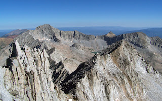
Capitol Peak in the distance from Snowmass Mtn, number
six on this list
Anybody who has climbed a 14er in the last 10 years knows they are popular, and getting more so all the time as "ticking" them off becomes more and more trendy. So which mountains see the least action? Which are you most likely to find some semblance of solitude?

Methodology
As with the "busiest 14ers" article, we took the summit logs and reported ascents from three popular mountaineering websites and gave each a score, 1 being the least number of reports, 2 the second least and so on. We averaged those scores to create an approximation of which peaks are the least busy of the 14ers.

Possibility for Error
It is important to note that the only way to know for sure how many people actually climb these peaks would be to count every single person who climbs every single peak on every single day. This, of course, is nearly impossible. There are many ways the data here could be skewed, including bias tilted towards which mountaineers are likely to sign up and report ascents on these three websites, as well as factors such as repeat ascents and others. Regardless, we feel this list gives a good estimation of which Colorado 14ers see the least amount of traffic.

If You Really Want Solitude
If solitude is your thing, we suggest NOT climbing the 14ers. Period. Or perhaps, climbing them in the off season, like the dead of winter. Sure they are great mountains, and climbing them gives you a certain amount of clout in social circles, but if your main goal is to climb great peaks with a sense of adventure, a wilderness experience, and enjoy solitude, we suggest aiming for 13ers and 12ers. In many cases, the climbing on these peaks is just as good, arguably better, and you still get the same satisfaction that climbing any high mountain can provide.

All of that being said, here are the eight least busy 14ers according to our calculations:

1. Culebra Peak
It was no surprise that the only 14er that you must pay heavily to climb had the fewest reports of people climbing it. I have never climbed Culebra, and though I have climbed almost all of the 14ers I have no plans to do so in the immediate future. Were it of outstanding aesthetic value, not merely average as most seem to consider it, perhaps Culebra would see more use.

2. Mount Wilson
This was a bit of a surprise. Clearly there is a direct correlation between a mountain's difficulty and its relative popularity, but to see Mt. Wilson land all the way at number 2 was more than expected. Mount Wilson is Colorado's 16th highest peak. It is highly prominent and has a stunning and highly visible position relative to the popular mountain town of Telluride. All of this, however, apparently is outweighed by its long standard route, class 4 difficulty and distance from Front Range cities.

Little Bear is oft-touted as Colorado's most dangerous, if not most difficult, 14er, therefore it came as no surprise  that it landed in the top 3. I know several people that put off Little Bear until they had just a few 14ers left before completion. Add in its distance from Front Range big cities, and the reason for its relative inactivity makes sense.

4. Mount Eolus
Eolus is a hard peak to get to and somewhat more difficult than most by its standard route (class 3). And frankly, it is not very famous. I've known some people who are fairly acquainted with Colorado's backcountry that are not even aware of a 14er that goes by that strange name, Eolus.

5. Wilson Peak
The Wilson group apparently are not very busy. The reason Wilson Peak is slightly busier than Mount Wilson is probably due to its shorter and technically easier standard route. Still, however, this little corner of Colorado magnificence is significantly less crowded than other comparable destinations.

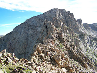
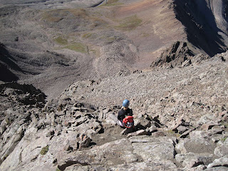
Snowmass Mountain is long, scrambly, far from Denver, and relatively low in stature for a 14er (ranked #31). We saw these factors repeating over and over while comprising this list and thus it is no surprise that Snowmass Mountain landed at #6.

Least climbed mountains in Colorado
The backside of the Maroon Bells from Frigid Air Pass
7. Sunlight Peak
The Chicago Basin 14ers are difficult to get to, and very far from Denver. The fame (or infamy) of Sunlight Peak's summit cap, however, may be the reason why it sees slightly more ascents than neighboring Eolus.

Maroon Peak is perhaps Colorado's most photographed mountain. It is a stunning and famous peak. It is also one of Colorado's most dangerous. Over half of all deaths reported on Colorado's 14ers so far this decade occurred on the Maroon Bells, the Crestones, and Longs Peak. Despite its fame, Maroon Peak apparently does not see near as much traffic as other 14ers.

Honorable Mentions
Capitol Peak, Ellingwood Point, Windom, and Pyramid Peak were all next up if we extended this list past eight. Also North Maroon, North Eolus, and El Diente would have made the top 8, but we did not include any "unranked" peaks that didn't have at least 300 feet of topographical prominence.

Analysis
There were a few surprises when the data was finally crunched to create this list. Some of these peaks, like the Maroon Bells, are quite famous, and  thus seem more popular than they are. If we were to create a list of most pageviews or photographs on these websites, a whole different set of mountains would have emerged. But popularity in terms of mythical status and internet fame did not equate to reported ascents. What wasn't surprising was that Culebra topped the list. There's one way to reduce a peak's use: charge $150 to climb it. It is also not surprising that some of the state's hardest peaks are the least busy: Sunlight, Mt. Wilson, Maroon Peak, Little Bear. And if we rounded out the list to 15, we would also have seen Pyramid Peak, Capitol Peak and both Crestones. In fact, all of these mountains here (except Culebra) are at least class 3 by their standard routes. Distance from Denver was also a clear factor, as every mountain in the top 8 is from the Sangre De Cristo, Elk and San Juan ranges. 

An interesting note that reinforced just how busy even these least popular 14ers are, Colorado's highest 13er, Grizzly Peak (which was once considered a 14er until a better survey proved otherwise) would have easily topped this list. In fact, even among the busiest 13ers we could think of (Silverheels, Meeker, Mt. Sheridan, etc.) we weren't able to find any with more reported ascents than Culebra.

Enjoy these peaks. Climb them, take care of them, but even on these mountains don't expect solitude on a summer weekend.

RELATED ARTICLES
-Ten Mountains You Probably Haven't Climbed But Should
-14ers the Hard Way
-Top 8 Busiest 14ers
-14ers are Dead

Visit THE ARCHIVE: A list of most of our articles sorted by department

find us on facebook

Follow us on Twitter!

Copyright notice: This website and all its contents are the intellectual property of www.coloradomountaineering.com and its authors. None of the content can be used or reproduced without the approval of www.coloradomountaineering.com.

Climbing and mountaineering are dangerous!! Please see the DISCLAIMER page
For information about how to contact us, visit this link


Monday, January 16, 2017

Sixty Highest Peaks in the Elk Range

Cathedral Peak in the Elk Range of Colorado
Cathedral Peak, the highest 13er in the Elk Range
The Elk Range is one of Colorado's most spectacular. It is home to some of our state's most breathtakingly beautiful (and breathtakingly dangerous) mountains. There are five ranked 14ers in the Elk Range, including some mega-classics like Maroon Peak and Capitol Peak. But there is a bevy of lower, also amazing peaks in this relatively small range. The following list takes a close look at this gem of a range, compiling its sixty highest "ranked" peaks. This covers every peak with over 300' of topographical prominence between 12,878' and 14,265'.

This would be a very focused, yet, impressive list of mountains to climb. The Elk Range is notorious for its rotten rock and treacherous exposure. As a group these peaks have attracted a large number of accidents in the past. The Maroon Bells are the main culprit, though Snowmass Mountain, Capitol Peak, and Thunder Pyramid have had a number of fatalities as well. Tread lightly in this beautiful but deadly range.

There are two class 4 peaks, 13 class 3 peaks, 42 class 2 peaks, and three class 1 peaks on this list.

(Note: elevations are given via the classic and familiar 1929 Sea Level Datum)

Peak Name ElevationRank Difficulty easiest route (YDS)
Castle Peak 14,265' 12 class 2
Maroon Peak 14,156'24 class 3
Capitol Peak 14,130' 29 class 4
Snowmass Mountain 14,092' 31 class 3
Pyramid Peak 14,018'47 class 4
Cathedral Peak 13,943' 62 class 3
"Thunder Pyramid" 13,932' 65 class 3
Hagerman Peak 13,841' 88 class 2
"Castleabra" 13,803' 105 class 2
"Lightning Pyramid" 13,722'137 class 3
“Electric Pass Peak” 13,635' 177 class 2
Point 13,631 13,631' 180 class 3
Clark Peak13,580' 200 class 3
Point 13,550 13,550' 220 class 2
White Rock Mountain  13,540' 224 class 2
Point 13,53713,537' 230 class 2
Treasure Mountain 13,528' 235 class 2
Star Peak 13,521'242 class 2
Keefe Peak 13,516' 245 class 2
Hunter Peak 13,497' 257 class 2
Treasury Mountain13,462' 278class 2
Sleeping Sexton 13,460' 283 class 3
Taylor Peak 13,435'294 class 2
“Siberia Peak” 13,420' 306 class 3
Hilliard Peak 13,409' 313 class 2
White Benchmark 13,401'320 class 2
Precarious Peak 13,380' 332 class 3
“Triangle Peak" 13,380' 335 class 2
Italian Mountain13,378' 337 class 2
Buckskin Benchmark 13,370' 343 class 2
Pearl Mountain 13,362'348 class 2
Malamute Peak13,348' 354 class 2
Point 13,336 13,336' 365 class 2
“Oyster Peak”13,312'383 class 2
Mt. Daly 13,300' 394 class 2
Point 13,260 13,260' 433 class 2
Point 13,24413,244' 444 class 2
Belleview Mountain 13,233' 450 class 2
"Cassi Peak"13,232' 452 class 2
Point 13,216 13,216' 470class 2
Teocalli Mtn 13,208'477 class 1
Point 13,180 13,180' 503 class 2
Point 13,162 13,162'513 class 2
Willoughby Mtn 13,142' 532 class 2
Point 13,140 13,140' 533 class 2
Point 13,062 13,062' 599 class 2
Point 13,060 13,060' 602 class 3
Mount Owen 13,058'603 class 2
Point 13,03913,039' 615 class 3
West Elk Peak 13,035' 617 class 1
Point 13,02013,020'627 class 1
Purple Mountain 12,958' 662 class 2
Mt. Sopris 12,954' 668 class 2
Point 12,942 12,942' 677 class 2
Point 12,940 12,940' 684 class 2
Point 12,934 12,934' 689 class 2
"Trail Rider Peak" 12,931' 695 class 2
Point 12,903 12,903' 712 class 3
Point 12,902 12,902' 714 class 2
“Christiana Peak” 12,878' 733 class 2

RELATED ARTICLES

-The Ranked 14er's
-Centennial Peaks (100 Highest)
-The 200 Highest
-Colorado's Most Prominent Mountains

Visit THE ARCHIVE: A list of most of our articles sorted by department

find us on facebook

Follow us on Twitter!

Copyright notice: This website and all its contents are the intellectual property of www.coloradomountaineering.com and its authors. None of the content can be used or reproduced without the approval of www.coloradomountaineering.com.

Climbing and mountaineering are dangerous!! Please see the DISCLAIMER page
For information about how to contact us, visit this link


Sunday, July 21, 2013

A Grand Adventure: The Four Pass Loop

The Maroon Bells
Maroon Lake at the beginning
The world-famous Maroon Bells were reflected perfectly on the placid surface of Maroon Lake. Every detail rendered in full high-definition, though upside down, in front of us: the twin summit, the rusted-red color, the U-shaped glacial valley frame. Even the cotton-ball clouds high overhead were perfectly visible on the still waters of the lake. We shrugged on our packs, grunting as the weight of seven days worth of clothes, food and gear settled onto our shoulders. Yanking the straps tight, I took one last look at my car. If all went well it would be over a week before we saw it again.

“Woo-hoo!” my fiancĂ©e Ella agreed. We paused to take a photo of the classic Maroon Lake vantage, without a doubt one of the most photographed spots in the state. After a few final adjustments to our backpacks and a sip of water, we started up the trail.

The Four Pass Loop is an excellent backcountry route that courses 25 miles through the heart of the Maroon Bells-Snowmass Wilderness Area. Despite the relatively modest length, the Four Pass Loop is a treasure trove of backcountry wonders. As implied by the name, the route crosses over four passes, all between 12,400 and 12,500 feet in elevation.

Going clockwise, we started up the Maroon Creek basin, camping the first night at the base of Maroon Peak not far below treeline. After sitting out a short rain shower in our tent, we spent the evening swinging in our backpacker’s hammocks, watching a marmot scamper though the talus by the creek’s edge. A pair of dippers—one of my favorite Colorado birds—jockeyed for the best rock to use as a diving board for their dinner search. Lazy clouds swirled around the peaks above us and half a dozen mountain goats could be seen working slowly down the slopes of the mountain to the valley floor. As evening faded into night, the glacial-carved valley was cast in colorful shafts of light.

The next day entailed one of the most difficult sections of the journey: Maroon and Frigid Air Passes. It was nearly noon by the time we reached the boulder-strewn saddle at the summit of Maroon Pass, which was busy with hikers, backpackers and even a bachelorette party traversing from Aspen to Crested Butte. We eyed the swelling clouds, gauging the chances of a thunder shower. Almost a thousand feet above treeline, this was no place to be should the weather turn.

Two hours and 2.5 miles later we had descended down the other side of Maroon Pass and re-climbed to the top of Frigid Air Pass. The Fravert Basin, one of the quietest and most remote corners of the 4-Pass Loop, spread out below us in a sea of blue columbines and other multi-colored flowers. The backside of the Maroon Bells, a sight reserved only for those who venture this deep in the backcountry, towered above. That night we camped just upstream of a two hundred foot waterfall.
*                                              *                                              *
For the experienced backpacker, the 4-Pass Loop is a relatively short but magnificent adventure that can be undertaken comfortably in 3 or 4 days. Trail runners and ultra marathoners regularly run this route in an afternoon while training for the Leadville or Hard Rock 100. Other than the usual backpacking accoutrements, the route requires no special equipment. The trail is generally easy to follow. At most intersections, informative signs keep you from drifting astray. A map and basic orienteering skills should see you confidently around the loop and safely back to your car.

Though in normal seasons the Four Pass Loop requires no particular technical expertise, there are several special considerations to bear in mind when undertaking this grand adventure. There are several stream crossings that can be treacherous in the spring and early summer. Some people bring special shoes just for the task, others prefer to go barefoot. On this topic, the Forest Service states on their website that “sandals or boat shoes are strongly recommended. Wading barefoot can be extremely dangerous. Be sure to unbuckle your pack when navigating any stream crossing.” It is also important to remember that strong thunderstorms are common in the afternoon at these high altitudes, and to avoid the danger of lightning strikes you should do the bulk of your hiking before noon and avoid the high passes above treeline if the weather is building. It is also required that dogs are leashed at all times in the wilderness area, that group size is limited no more than 10 people and 15 animals, and that human waste is buried at least six inches deep and 100 feet away from lakes and streams.
*                                              *                                              *
Snowmass Peak and Lake
Snowmass Peak and Snowmass Lake
After navigating through a long, tricky section of downed lumber (which may or may not have been cleared since our trip) we made a long ascent of Trail Rider Pass before descending to breathtaking Snowmass Lake. The jagged ramparts of Snowmass Peak loomed to the west and the lake’s calm surface was broken occasionally by leaping trout. We reached the climax of our adventure the following day with an exciting and exhausting class 3 ascent of 14,092 foot Snowmass Mountain.

Exhausted, battered, and footsore, we climbed up and over Buckskin Pass on day 8, the last of the four passes and the last major obstacle of the journey. One of the beautiful things about the Four Pass Loop is the sheer number of options available for customization. We augmented the route with side trips to Geneva Lake and the summit of Snowmass Mountain. By the time we reached the top of Buckskin Pass, we had climbed nearly 14,500 vertical feet, most of which with over fifty pounds of gear lashed mercilessly to our backs. Throbbing red slashed had been worn into my shoulders, and my heels and knees ached deeply.

When we reached our car at last, we were overcome by a conflicting torrent of sensations. The smell of gasoline and the sound of revolving gears had become alien, almost supernatural. It was a Saturday in peak season, and the popular lake was crowded with people. After so much solitude the sudden noise and confusion was overwhelming. We paused to look back on the Maroon Bells with reverence, knowing that we had circled around them and seen them from all angles. We had discovered a new respect for these amazing mountains.

(Note: this article first appeared in print in Vol. 8 Issue 3 of Our Backyard)

Visit THE ARCHIVE: A list of most of our articles sorted by department

find us on facebook

Copyright notice: This website and all its contents are the intellectual property of www.coloradomountaineering.com and its authors. None of the content can be used or reproduced without the approval of www.coloradomountaineering.com.

Climbing and mountaineering are dangerous!! Please see the DISCLAIMER page
For information about how to contact us, visit this link


Monday, June 3, 2013

Featured Route: Snowmass Mountain East Slopes

EAST SLOPES OF SNOWMASS MOUNTAIN
Length: 22 miles
Total Elevation gain: 5,700'
Difficulty: class 3

OVERVIEW
Snowmass Peak and Snowmass Lake
The East Slopes (standard) route on Snowmass Mountain is one of Colorado's most spectacular 14er adventures. At 22 miles, it is a very long hike, and I recommend 2 days. Though the hike in and out will be more difficult with the extra gear, the extra time will allow you to take your time and enjoy this beautiful place. Although Snowmass Lake is very likely one of the busiest lakes in the Colorado's backcountry, it is quite beautiful and offers numerous opportunities for places to camp.

Like most climbs in the Elk Range, the East Slopes of Snowmass Mountain is steep, loose and dangerous. It has proven fatal for several mountaineers over the years. Almost the entire route once you have passed the Snowmass Lake is one slippery scree and once you have pass around 13,500' the route becomes particularly dangerous. Wear a helmet, use caution, and be careful not to climb directly underneath another party.

THE ROUTE
Snowmass Lake at sunrise
The long approach to the East Slopes of Snowmass Mountain is one of the longest for any standard route on a 14er in Colorado. The approach alone is over 8 miles and gains over 2,500' in elevation. The hike is long an provides some beautiful views. After 6.5 miles you must cross the creek. This can be a challenge at high spring runoff levels. Depending on the flow level/wood conditions people usually tiptoe across a log jam. If the water is low you can sometimes cross the creek directly below the jam. Not far after negotiating this obstacle, you reach the lake itself. There are many good campsites here. Beware, however, of rules against camping too close to the lake and against fire in general.

the East Slopes of Snowmass Mountain
Hike along the east and south sides of the lake and find a climber's trail that starts up the loose rock on the lake's west end. The approach is over. Climb up the steepening slope along a vague climber's trail into the huge basin on Snowmass Peak's east slopes. Depending on the time of year and conditions there may be some snow to climb at the top of this basin. The usual route veers a bit south as you approach the ridge and finds a notch through the cliffs to reach the summit ridge. In dry, late-summer conditions, or if the snow covering is complete, you can hike more directly towards the summit, finding a breach in the cliffs and reaching the summit ridge near 13,900'. From here you traverse slightly onto the west side of the mountain and pick your way through some class 3 boulders to the summit.

From the summit of Snowmass Mountain looking towards Capitol Peak
 Looking across to Capitol Peak from Snowmass's summit
DIRECTIONS
From Highway 82 28 miles south of Glenwood Springs (or 13 miles north of the roundabout in Aspen) turn west at the town of Old Snowmass (not to be confused with Snowmass Village, the ski area) onto Snowmass Creek Road. Turn left at a T-junction after a mile and a half (right will take you to Capitol). You hit the dirt road seven miles after turning off Hwy 82 and cross the creek at mile 10.5. Take a right at another intersection a half mile later and the trailhead is only about a quarter-mile beyond that.

TRIP REPORTS
the summit area of Snowmass Mountain in the Elk Mountains of Colorado
The summit of Snowmass Mtn
Geneva Lake, Snowmass Mountain, and the Four Pass Loop- A seven day backpack trip following the Four Pass Loop but also with extensions to Geneva Lake and an ascent of the East Slopes (standard) route of Snowmass Mountain.

LINKS
East Slopes on Summitpost.org

East slopes on 14ers.com


Visit THE ARCHIVE: A list of most of our articles sorted by department

find us on facebook


Copyright notice: This website and all its contents are the intellectual property of www.coloradomountaineering.com and its authors. None of the content can be used or reproduced without the approval of www.coloradomountaineering.com.

Climbing and mountaineering are dangerous!! Please see the DISCLAIMER page
For information about how to contact us, visit this link


Monday, May 13, 2013

PEAK OF THE WEEK: Snowmass Mountain (14,092' or 4295 m)

INTRO
Snowmass Mountain from 13,500'
Snowmass Mountain is one of Colorado's more remote and beautiful 14,000' peaks. Situated deep in the Elk Range, Snowmass holds a premium position in one of Colorado's most spectacular areas. From any side Snowmass is a formidable peak, and it is difficult to see from civilization. From certain distant peaks, however, such as Mount of the Holy Cross and other Sawatch and Mosquito Range vantages, Snowmass's distinct twin-summit can be located. It is often one of the last peaks with snow still on it. Both Snowmass and Geneva Lakes on the mountain's east and west sides respectively are two of my Colorado favorites. They are dramatic and both teeming with great trout. They epitomize the area and Colorado. While 13,600' Snowmass Peak, a subsidary and "unofficial" satellite of 87th ranked Hagerman Peak (13,841') dominates the foreground from Snowmass Lake, the view from the West or from the Pierre Lakes to the north reveals Snowmass as the beast it truly is.

DIRECTIONS
Snowmass Trailhead (Snowmass Lake Approach)
From Highway 82 28 miles south of Glenwood Springs (or 13 miles north of the roundabout in Aspen) turn west at the town of Old Snowmass (not to be confused with Snowmass Village, the ski area) onto Snowmass Creek Road. Turn left at a T-junction after a mile and a half (right will take you to Capitol). You hit the dirt road seven miles after turning off Hwy 82 and cross the creek at mile 10.5. Take a right at another intersection a half mile later and the trailhead is only about a quarter-mile beyond that.

Crystal Trailhead (Geneva Lake approach)
Geneva Lake near Marble, Colorado on the west side of Snowmass Mountain
Geneva Lake
From the town of Marble off Highway 133 south of Carbondale, follow the main road through Marble until it steepens and becomes dramatically rougher. It is only about five miles to Crystal City but those miles are slow, agonizing and rough. Along the way you will pass the Crystal Mill Falls, one of Colorado's most photographed spots. Crystal City is not far past the photogenic waterfall and there is good parking in a flat area just beyond the city before the road becomes even worse. 4WD is highly recommended if not required even to get to this point. This normal trailhead is just shy of 9,000' elevation. If you like abusing your vehicle, a strong 4WD vehicle can continue all the way to Lead King Basin to shorten the climb 2 miles each way and knock off 800' of vertical.

ROUTES
There are several ways to climb Snowmass Mountain, and there are pros and cons to each option. No matter which way you go, you will be forced to deal with loose rock, exposure, class 3 scrambling, and lots of vertical gain. Snowmass is one of Colorado's more challenging 14ers to do in a single day.

East Slopes Route (class 3, 5,700' elevation gain)
The summit area of Snowmass Mountain in the Elk Mountain of Colorado
Snowmass Mountain's summit block
The East Slopes route is the standard route on Snowmass Peak. But with a low trailhead (8,400') and a lot of loose scrambling, it is still a long, arduous ascent and certainly no gimmee. A near-permanent snowfield requires some knowledge of snow travel in all but the driest conditions and the mountain's loose rock is notoriously dangerous. Despite these drawbacks, however, this route is one of my favorite of all the standard routes on any Colorado 14er. It is beautiful and classic. I recommend two days with a basecamp at Snowmass Lake. This is a popular spot, so don't expect solitude, but the awe-inspiring beauty more than makes up for it.

West Face (class 3, 5,100' elevation gain)
The West Face of Snowmass is a shorter climb with less vertical, but it is looser and more dangerous than the East Slopes standard route. For those that are trying to climb Colorado's 14ers as expediently as possible, this is probably the best route for you. It can easily be done in a single day. However, I find this route to be not quite as beautiful or engaging as the East Slopes. If you can, I recomened a bivvy at Geneva Lake. Not really because it shortens your summit day, but because this small lake is a hidden gem with great fishing. It is a quiet and amazing corner of a generally over-crowded Elk Range and well worth spending the night at. From Geneva, this route take a nearly direct shot up a shallow gully/couloir left of center on the face. This route is very loose and there is more sustained class 3 section than on the East Slopes route. This route has been known to be deadly, usually due to its bad rock and tricky route-finding, so approach this route with caution.

S-Ridge (class 3+, 5,100' elevation gain)
the west side of Snowmass Mountain from Geneva Lake
West Face of Snowmass from Geneva Lake
The S Ridge takes the same approach as the West Face but diverges at Little Gem Lake to tackle the s-curving ridge (hence the name) between the West and South faces of Snowmass Mountain. This route is even shorter than the West Face but has even more complicated, exposed, and loose scrambling, so takes longer to climb. The rock on this route is so loose, actually, that this route is seldom climbed.


SPECIAL CONSIDERATIONS
Snowmass Mountain lies in the Maroon Bells-Snowmass Wilderness Area and special regulations apply. For example, you are not allowed to camp within 100 feet of lakes or streams. Beware, they will ticket you at the compular camping area at Snowmass Lake so be diligent. You are also not allowed to have fires in most areas within the Wilderness Boundaries. It is also required that you carry a permit which includes all of the rules. Check out this page by wilderness.net  that gives more information about the special regulations of the Maroon Bells-Snowmass Wilderness area.

Snowmass Peak and Lake
TRIP REPORTS
Snowmass Mounain, Geneva Lake, & the Four Pass Loop-a narrative of a 7 day backpack trip on the Four Pass Loop with an extension out and back to Geneva Lake and culminating in an ascent of the East Slopes Route to the summit.

LINKS
Snowmass Mountain on Summitpost.org- a user-created site with lots of good information. This page includes information about a variety of routes on Snowmass Mountain.

Snowmass Mountain on 14ers.com- the most popular website dedicated solely to Colorado's 14ers. This page includes details information and photographs about Snowmass Mountain and its primary routes.


Visit THE ARCHIVE: A list of most of our articles sorted by department

find us on facebook


Copyright notice: This website and all its contents are the intellectual property of www.coloradomountaineering.com and its authors. None of the content can be used or reproduced without the approval of www.coloradomountaineering.com.

Climbing and mountaineering are dangerous!! Please see the DISCLAIMER page
For information about how to contact us, visit this link


Thursday, April 11, 2013

Ten Class 3 Colorado Classics

There is something fun about class 3. The thrill of climbing meets the freedom of not (usually) needing a rope. I have always enjoyed this grade. I feel mostly comfortable but it occupies my mind more than the long, grunt climbs of the easier class 2 peaks. This article is a toast to the great class 3 scrambles of Colorado.

The Sawtooth
The Sawtooth Ridge between Evans and Bierstadt
Mt. Bierstadt/Mt. Evans- The Sawtooth
The Sawtooth is a classic alpine ridge that connects two popular 14ers, Mt. Bierstadt and Mt. Evans. After ascending to the top of Bierstadt, this amazing ridge is immediately apparent, and nearly impossible looking. The long, engaging scramble is what makes this route a classic, ending in an exposed ledge that provides reasonable access to the west face of Mt. Evans.

Longs Peak- The Keyhole
No mountain deserves the designation of "classic" more than Longs Peak and no route in Colorado is climbed more often than the Keyhole. Although the approach hike is long, the effort to climb the Keyhole is well worth the trouble. Once you have passed through the Keyhole, the rest of the route is beautiful, exposed and classic. This climb's main detraction, however, is the sheer number of people who attempt this climb. However, if you can get past the crowds, this is truly one of Colorado's best scrambles.

Crestone Peak- The South Face
The South Face of Crestone Peak perhaps the best route on one of Colorado's best mountains. Crestone Peak is a dramatic mountain. The South Face is astounding route with great exposure, fantastic position and a plethora of high-quality class 3 scrambling.

Crestone Needle- The South Face
Crestone Needle along with its companion Crestone Needle form two of Colorado's most rugged and dramatic peaks. The South Face of Crestone Needle is a mega classic, with great sscrambling, engaging route-finding and some tremendous exposure. It is highly recommended by the writers of Colorado Mountaineering to do both the South Face of the Peak and the South Face of the Needle on a single trip, perhaps with a backpack basecamp at Cottonwood or South Colony Lakes.

Snowmass Lake and Peak
Snowmass Peak & Snowmass Lake

Snowmass Mountain- East Slopes
Snowmass Mountain is one of my favorite Colorado 14ers and this route takes you through an amazing place. A long alpine approach leads to Snowmass Lake, one of the most dramatic and breathtaking lakes of its size you will find anywhere. From here the route is thrilling. You ascend a long slope of class 2+ before finding a notch through a sharp ridge. The last few hundred feet is loose but engaging class 3.


Mt. Meeker- The Loft
Mt. Meeker (13,911') shares a ridgeline and a dramatic alpine cirque with Longs Peak. The Loft Route on Mt. Meeker takes you through this famous and classic alpine destination via a moderate class 3 scramble. The final ridge after climbing to the Loft is exposed a dramatic, finishing in an astonishing move to the summit block.

Mt. Sneffels Southwest Ridge
Mt. Sneffels is one of the San Juan's most popular mountains and for good reason. It is beautiful and well featured. Even the class 2 standard southeast ridge route is excellent and lively. The Southwest Ridge, however, is a classic route with long section of stout class 3, beautiful scenery, and excellent exposed positions. This route is one of my favorite class 3 scrambles. If weather moves in or time becomes an issue, you can descend the easier and faster standard route.

The south face of Mt. Sneffels
Relaxing on Sneffels Southwest Ridge route
Torreys Peak- Kelso Ridge
This Front Range classic is a great way to get a little solitude and make a little more of a mountain that is known for being easy. In general, Kelso is a mellow scramble but with a few cruxes that will get your attention. The knife-edge of Kelso, at the very end, is not the most difficult section, but often gets the most press. This exposed section is short lived but will get your attention. It is a good place to warm-up for more exposed and difficult climbing on other Colorado peaks.

Wetterhorn- Southeast Ridge
This standard route on Wetterhorn in Colorado's San Juan Range ranks as one of the best and most exciting class 3 scrambles. This route up Wetterhorn is relatively short, fun, and ends with an exciting scramble to an excellent summit. This excellent climb on this excellent is certainly worthy of this list.

La Plata Peak- Ellingwood Ridge
La Plata was my first 14er, and therefore will always have a special place in my heart. The Ellingwood Ridge route, however, is quite likely the best, and most complicated class 3 route on all of Colorado's 14ers. This route will challenge all but the most hardened of mountaineers with its long, snakelike ridge and devious up and down scrambling. This ridgeline is famous, and time consuming, so don't take it lightly. There are almost infinite variations which allow you to customize the difficulty of your climb. The easiest route is class 3 but you can easily make it class 5 with a more direct line.
Colorado's Ellingwood Ridge
The Ellingwood Ridge from La Plata's summit 
RELATED ARTICLES
Ten Class 5 Colorado Mountaineering Classics- is this list too tame for you? Check out or list of ten classic technical (class 5) routes on Colorado's high peaks.
Five Hardest 14er Cruxes- Five of the hardest cruxes on the standard routes of any 14er. Included: the Knife Edge on Capitol, the Leap of Faith on Sunlight, the Hourglass on Little Bear and others.

Visit THE ARCHIVE: A list of most of our articles sorted by department

find us on facebook

Follow us on Twitter!

Copyright notice: This website and all its contents are the intellectual property of www.coloradomountaineering.com and its authors. None of the content can be used or reproduced without the approval of www.coloradomountaineering.com.

Climbing and mountaineering are dangerous!! Please see the DISCLAIMER page
For information about how to contact us, visit this link


Friday, July 20, 2012

Surviving the Apocalypse: A Lesson in Fulminology (Lightning)

Lightning on the 14ers
Storm builds over Mt. Sopris in Colorado
I was jarred awake from a deep slumber by the sharp crackle of thunder. The trees above us hissed with wind and the first thumps of rain drummed the outside of our tent. I squeezed my eyes shut against the mounting storm and prayed for it to pass quickly. Within fifteen minutes, however, rain and hail was battering our tent with frightening intensity. Lightning and thunder swelled to a crescendo, and rocks toppled in rhythmic percussion off nearby fourteener, Snowmass Mountain. Two aluminum poles and a sheet of (mostly) waterproof 800-denier nylon seemed like meager shelter.

It was late summer in the Elk Mountains of Central Colorado. My girlfriend and I were camped along the shores of beautiful Geneva Lake on the southwestern side of Snowmass Mountain. It was the third night of an eight-day backpack trip in the Snowmass-Maroon Bells Wilderness Area. Our plan had been to hike a convoluted variation of the popular “Four Pass Loop” culminating with an ascent of 14,092’ Snowmass Mountain, one of Colorado’s fifty-three fourteeners. So far the trip had been a success. Starting at Maroon Lake we had hiked for two days, surmounting both Maroon and Frigid Air Passes (both 12,500’) without difficulty. After camping the second night just upstream from Kings Falls, we had spent much of day three exhaustingly circumnavigating a treacherous section of blown-down trees where the usually well-defined trail vanished under head-high piles of hewn lumber. After diligently working our way around this obstacle and climbing a thousand feet towards Trail Rider Pass, we departed from the standard Four Pass Loop for a short detour to Geneva Lake.

We arrived at this alpine oasis with barely enough energy to cook a small meal and collapse in the luxurious embrace of the backpacking hammocks we’d hauled all this way. The sky was clear and pristine that evening as we watched the sunset cast glorious hues of red and orange over the purple slopes of Snowmass Mountain. There was no hint of the storm that would befall us that night.
*
Storm builds in the Elk Range
Storm approaching Geneva Lake
I was raised in the outdoors. For as long as I can remember my father would take me into the backcountry and teach me about camping, fishing, and backpacking. I learned how to deal with everything from drenching rain to overly curious wild animals. Setting out from the safety of home to brave the wilderness takes a certain tolerance for fear and discomfort. For the most part, a strong compass of common sense combined with a few key strategies can placate all but the most objective of hazards. The one thing that I have never been able to conquer, however, is my fear of the Great White Light.

The raw, sudden violence of lightning and the random way it selects its victims is unnerving to say the least. As an underclassman in college I’d taken Weather and Climate to fulfill a science requirement and we’d read a chapter on fulminology, the study of lightning. I’d seen the ultra slow-motion videos of lightning strikes, and I’d read the science. A cloud-to-ground lighting strike begins with “leaders” moving downward in a forked pattern from a towering cumulus cloud at speeds nearing 150,000 miles per hour. When the first leader connects with the ground the earth and sky undergo an ionic exchange of 300,000 amps of electricity, warming the air in the immediate vicinity to 35,000 degrees Fahrenheit. Around 50 people are killed in the United States each year from lightning, making it second only to flooding as nature’s most deadly threat. Lightning demands and deserves respect.

In the backcountry it is hard to escape the menace of a powerful thunderstorm. In his famous guidebook Colorado’s Fourteeners, Gerry Roach states, “Colorado is famous for apocalyptic lightning storms that threaten not just your life, but your soul as well.” Although there are supposed techniques for minimizing this physical and (apparently) spiritual threat, it is hard not to feel vulnerable when the raw violence of such a tempest is unleashed around you. On July 21, 2010 sixteen people were struck by lightning, one fatally, in a single afternoon on Wyoming’s Grand Teton. I can only imagine (though I don’t really want to) what such a day might have been like. It must have been apocalyptic indeed.

We lay sleepless through the night, listening to the terrible violence of storm after storm bearing down on our little camp. Every time it seemed it had passed the distant rumbles of thunder approaching from the west would begin all over. Like the footsteps of Titans, the booms would get closer, casting resonant echoes off the tall mountain cirque to our east. The bright juxtaposition of lightning in the night’s blackness penetrated eyelids and sleeping bags. There was no hiding and no escape. So I did what any sane person would do when they realized that not only was the apocalypse real but upon them: I prayed. And if I had seen two of every animal floating past, I would have prayed even harder.

As my girlfriend and I lay sleepless, imploring God not to allow the next “leader” to reach its fateful hand our direction, I couldn’t help but comb these facts from my brain, evaluating our current situation in terms what I new about the danger of lightning. More than once, as I lay there gauging how much camping lakeside near treeline increased our odds of electrocution, I longed for the comfort of home. There I could watch a storm such as this through a window with detached fascination and not with the utter terror I felt now.

Snowmass-Maroon Bells Wilderness 4 Pass Loop
Towards Snowmass Mountain from Geneva Lake
When day broke, the storm breathed out its dying gasp and we took a layover day napping, trying to recover the sleep we’d been denied the night before. The sun rose and fish leaped from the glassy waters of Geneva Lake for breakfast. It was hard to recall the madness of the night’s tribulation.

With the peace and serenity of the Colorado backcountry restored, I no longer longed for the comforts of home. The primal nature of the nature is why we venture out into the wild. We go there to be reminded of a world that is much greater and more powerful than the world we wrap around ourselves back in “reality”. Perhaps sometimes we need to be made vulnerable to truly appreciate the frailty of our lives. While this humbling realization may not be enough for me to fully embrace the apocalyptic Colorado thunderstorms, I take solace at least in the fact that once the storm passes my soul and my appreciation for the power of this great world will only be stronger.

NOTE: this article first appeared in print in Our Backyard and on their website.

Visit THE ARCHIVE: A list of most of our articles sorted by department

find us on facebook

Follow us on Twitter!

Copyright notice: This website and all its contents are the intellectual property of www.coloradomountaineering.com and its authors. None of the content can be used or reproduced without the approval of www.coloradomountaineering.com.

Climbing and mountaineering are dangerous!! Please see the DISCLAIMER page
For information about how to contact us, visit this link


Saturday, July 30, 2011

Geneva Lake, Snowmass Mountain, and the Four Pass Loop


starting the Four Pass Loop near Aspen at the foot of the Maroon Bells
The Maroon Bells at the beginning
August 8
Begin backpack at Maroon Lake. Backpack 5 miles up Maroon Creek and camp at the base of Maroon Peak. One of the most beautiful valleys in Colorado, rivaling if not usurping Holy Cross as the most beautiful place we have been this summer. And less than an hour from our homes! We are awoken in the middle of the night when a marmot tries to raid our camp.

August 9
Snowmass Mountain in the distance and the Fravert Basin in front. From Frigid Air Pass
Snowmass Mountain and the Fravert Basin
from Frigid Air Pass
Hike over Maroon Pass and Frigid Air Pass and camp in the Farvert Basin. A very beautiful and awe-inspiring hike. The flowers are still out in deep bloom and the weather was very beautiful. The trail is busy for mid-week but most of the people are pleasant. Ah! Wilderness.

August 10
Storm approaching Geneva Lake
An excellent day. King’s Falls is an impressive sight in the morning. It rains a little around noon but we are able to climb the "Cut-off" trail and have lunch before the worst of the afternoon storms. We depart from the Four Pass Loop and drop down to Geneva Lake where we get the most solitude we’ve had yet. Spend a perfect evening laying in the hammocks overlooking the lake but a storm moves in before bed.

August 11
A crazy night! One of the worst I have ever experienced! Wave after wave of intense thunderstorms. Hail, lightning, thunder, rain, wind. You name it. I always wondered how I would handle a night like this in the wilderness. I've had plenty of rain and even lightning but never a full-on, tornadic-if-it-had-been-in-Kansas, severe thunderstorm. Needless to say it was nerve-racking. We were pinned in the tent for 15 hours. I didn't sleep a minute.

The Maroon Bells and Fravert Basin from the "Cut-off" trail
The storms finally end around noon and we explore around the lake. We meet some other backpackers and they look as shell-shocked and wide-eyed as us after the night before. We hope that this is the end of the weather for this trip.

August 12
A perfect day! Not a cloud in the known universe. We hike over Trail Rider Pass and down to Snowmass Lake to set-up for our climb the next day. Three friends of ours from Grand Junction hike in from Snowmass Creek to meet us. I love backpacking but am looking forward to climbing a mountain again, it seems like forever (July 27) since we were on a summit.

August 13
At 13,900 on Snowmass Mountain
Snowmass Mountain. A great route. I enjoy the scrambling immensely. From the top we can look down on both Snowmass Lake and Geneva Lake and I feel proud that we were able to visit this great mountain from both sides. That night we eat some fresh fish for dinner.

August 14
We say goodbye to our friends and make the long hike out over Buckskin Pass back to our car. It is Sunday and Maroon lake is overwhelmed by two-legged humanoids when we get back. We are tired but sad. Not only is our backpack over, but our summer is too. It has been great to spend this much time in Colorado’s high country.

Snowmass Lake and Snowmass Mountain


The summit area of Snowmass Mountain


Visit THE ARCHIVE: A list of most of our articles sorted by department

find us on facebook

Follow us on Twitter!

Copyright notice: This website and all its contents are the intellectual property of www.coloradomountaineering.com and its authors. None of the content can be used or reproduced without the approval of www.coloradomountaineering.com.

Climbing and mountaineering are dangerous!! Please see the DISCLAIMER page
For information about how to contact us, visit this link