Monday, September 30, 2013

NEWS: Mountaineers Complete Through Hike of Colorado 14ers (9/30/13)

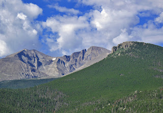
Longs Peak at sunrise
Longs Peak where Luke DeMuth and Junaid Dawud
completed their "through hike" of all of
Colorado's 14,000-foot peaks on Sunday
According to reports by the Denver Post and on 14ers.com, Luke DeMuth and Junaid Dawud completed a successful "through hike" of all 58 of Colorado's 14,000-foot mountains on Sunday when they successfully reached summit of Longs Peak in Rocky Mountain National Park. The two climbers started their amazing trek 70 days ago in the San Luis Valley and have walked 1,300 miles and gained somewhere around 300,000 feet of elevation.

Though the duo were the first to accomplish the feat, they have stated they were simply "jonesing for a long hike," and that setting records was not a major factor in the decision to undertake the journey. The two had to overcome numerous difficulties, including many days of rain, hail, and "brutal" miles of pavement, but they say they never once seriously considered giving up.

DeMuth and Dawud successfully reached the summit of all 53 of Colorado's "official" 14ers as well as five of the "unofficial" summits, such as North Maroon Peak in the Elk Range, as well. Not only did they undertake the epic adventure for their own enjoyment but they have also been raising money for Big City Mountaineers, an organization whose goal is to "transform the lives of under-served urban youth through wilderness mentoring expeditions that instill critical life skills" according to the mission statement on their website. To read more about their adventures, check out their official website 14ersthruhike.com.

Visit THE ARCHIVE: A list of most of our articles sorted by department

find us on facebook


Copyright notice: This website and all its contents are the intellectual property of www.coloradomountaineering.com and its authors. None of the content can be used or reproduced without the approval of www.coloradomountaineering.com.

Climbing and mountaineering are dangerous!! Please see the DISCLAIMER page
For information about how to contact us, visit this link


Monday, September 23, 2013

NEWS: Helicopter Rescue on North Maroon Peak (9/23/13)

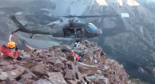
A helicopter rescue on the Maroon Bells
A helicopter rescues an injured climber on North Maroon
Peak. Screenshot from Youtube video
A 59-year-old man had to be rescued by helicopter after falling while descending North Maroon Peak on Saturday. According to a report on the Aspen Business Journalthe man fell 50 feet and suffered numerous injuries, including a possibly broken jaw. The helicopter rescue was successful and caught on video. The injured climber was with four other people when the accident occurred.

2013 has been a difficult year in the Elk Range. There have been several accidents and harrowing rescues this season, including the deaths of Steve Gladbach on "Thunder Pyramid" and Ryan Palmer on Capitol Peak, and the rescue of Daniel Palmer (no relation) also on Capitol Peak.

Check out this video caught by another climber of the successful rescue:


Visit THE ARCHIVE: A list of most of our articles sorted by department

find us on facebook


Copyright notice: This website and all its contents are the intellectual property of www.coloradomountaineering.com and its authors. None of the content can be used or reproduced without the approval of www.coloradomountaineering.com.

Climbing and mountaineering are dangerous!! Please see the DISCLAIMER page
For information about how to contact us, visit this link


Friday, September 20, 2013

Hot Route: Independence Tower Otto's Route (III 5.9 R)

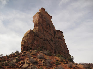
Independence Monument in Western Colorado
Approaching Independence Monument
Trailhead: Lower Monument Canyon
Distance: 5 miles
Elevation gain: 1,200 feet
Difficulty: 4 pitches, 5.9

OVERVIEW
Independence Tower is not a mountain, nor is it alpine. It is a desert tower, which makes it somewhat rare for Colorado. And this is Otto's Route, a classic of Colorado climbing established in an age before climbing was set in its course towards what we know today.

Some people are against this route because it follows of line of chipped pipe holds the entire way. In a sense, I see their point. By modern standards this route would be an abomination. But John Otto, the man who drilled the holes in 1911 so he could insert pipe handholds, was considered a steward of nature and the forefront figure for establishing protection for the Colorado National Monument. He was an adventurer who loved these desert formations. If while climbing this route you are upset by the unnatural jugs throughout, consider a couple of things first: John Otto led this climb with a hemp rope in cowboy boots, without the chipped holds this route would probably go in the 5.11 range, and the chipping occurred over 100 years ago.

I encourage people, and I feel like most climbers who have climbed this route agree, to view Otto's as a historical route and not be bothered by its manufactured feel. It is still a great climb and the climbing itself despite everything is still fun. The positions are spectacular and the exposure is invigorating. Each pitch, not just the legendary pitch 4, has sections that are runout and hard to protect.

THE ROUTE
Approach: From the Lower Monument Trail, hike 2.5 miles (gaining 800 feet) to the base of Independence Monument. The route is on the northwest side of the tower following an obvious crack system. You will have to climb a small talus cone to get to the bottom.

Pitch 1: climb a 5.easy step to a junky 5.6 corner. Pass this to a nice finger crack with chopped steps. Climb up and left and gain a large ledge with a bolted belay. 130 feet (5.6)
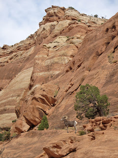
Bighorn in the Colorado National Monument
You might have an audience...
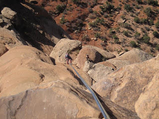
Otto's Route (5.9) in Monument Canyon
Starting pitch 1
Pitch 2: move the belay to the right and scale a funky, over-hanging off-width. This would be a tricky pitch without the chopped holds. Here you will probably want a #4 and possibly a #5 too, though you can get away with less if you have good technique and a go-for-it attitude. There is some ledgefall potential pulling through the OW without big pieces. Pull, claw, thrutch through the OW and gain another huge belay ledge. Once you have belayed everyone up, most people with de-rope to pass through the next section. 70 feet (5.8+).

The OW P2 on Otto's Route
Climbing the overhanging OW on Pitch 2
The Time Tunnel on Otto's Route
The Time Tunnel between pitches 2 & 3

Scramble: Squeeze through the Time Tunnel, a tight gap between a the main tower and a detached spire. It is a little scrambly in one spot, maybe some minor, non-exposed class 3. At the other side is another massive belay ledge called the Lunch Box Ledge. Here you can leave most of your gear behind for the rest of the climb. All you need to get through the last 2 pitches are draws, maybe a few slings, optional tri-cams and gear to tie into the chain anchors at every belay.

Pitch 3: Pitch three is not hard or exposed, but it is runout between pitons. Tricams can be used in several spots but just trust those slightly sandy chopped buckets and the pitch will be over in no time. Climb up a seam and move up and right following the pipe holds through spaced pitons. Mantle a ledge and arrive at a bolted belay on Sundeck Ledge, where you might see get direct sunlight for the first time. Here the exposure might hit you for the first time. While this belay ledge is also large and comfortable, pitch 4 looms above you, and for some it can look pretty intimidating. 80 feet (5.7)

P3 of the classic Colorado climbing route Otto's Route (5.9)
Pitch 3 follows this seam then goes up and
right (the chopped holds can be seen
in the center). Pitch 4 can be seen top left
Pitches 3 ad 4
Pitches 3 & 4 seen from the Lunch Box Ledge
Pitch 4: This is the classic money pitch and a great lead for the grade. The position is spectacular and the exposure is tremendous. Leave the belay on the right-ish side of the fin and climb fifty feet of unprotected but easy climbing (5.3 R/X). Pay attention to your footwork and your hands on this sandy, dangerous section and keep your mind focused on careful movement. The climbing is easy and it's over in no time. There is potential to use a few tricams to moderate the danger somewhat. Clip a couple of solid pitons and arrive at the route's excellent crux: a fun overhang on massive, bucket holds. This section is well protected by pitons and there is potential for a couple cams to back them up if you want. It may be useful to extend a draw or two at the crux to reduce drag while top-belaying your follower. 90 feet (5.9)

Climber of the Pitch 4 crux of Otto's Route
Pulling the crux on P4 of Otto's Route
The top of Indy Tower
Looking down from the top of 
Independence Tower

Pitch 5: This "pitch" is really just a couple of moves from the big belay ledge at the top of P4. There is no protection, and the climbing is probably about 5.8. Some people "aid" through the botto by standing on the old flagpole base and/or the chains. What makes it a bit scary is that you are fully exposed at the top of the tower with air all around and no protection. Some choose to do this on belay. The top is spacious. On Independence Day you will find many people up here. You also have to downclimb P5, it is hard not to use the flagpole now.... Some people will want to be on belay for the downclimb too. NOTE: The flagpole has since been removed. You will have to climb the rock. There are still chopped holds, however, making it exciting because it is so exposed but not too difficult.

summit panorama from Independence tower
Panorama from the summit of Independence Tower
A shaky but mostly comprehensive helmet cam look at this route from Youtube:


Descent: Double-rope rap from the summit to the Lunch Box Ledge (the bottom of P3). Scramble back through the Time Tunnel. From the bolted anchor you can do a double rope rap (180') from these anchors straight to the ground or rap the route to the anchors of P1 (70 feet), then from these anchors to the ground (110 feet).

The first rappel
The first rappel to the Lunch Box Ledge

The last rappel

Rack: This could be debated and depends largely on your comfort. If you wanted to protect it as well as it can be, bring a full rack of cams to BD #4 Camalot (and possibly even a #5) with extras in the small to mid size, a set of tricams, slings, possible stoppers (though we didn't use any), 6-8 slings and 6-8 quickdraws.

DIRECTIONS
Independence Monument
Otto's Route follows the crack system right of center
then the top via the right skyline
Follow Grand Avenue from downtown Grand Junction west where it turns into Broadway and crosses the Colorado River. Continue on this road 8 miles through a neighbrhood and past many intersections (the road becomes Highway 340) until you reach a small dirt road marked with a sign for Lower Monument Canyon. This turnoff is notoriously easy to miss so be alert. There is a small parking lot here at this popular trailhead.

TRIP REPORTS
What does Independence Mean to You? Four days climbing in western Colorado including Unaweep Canyon, Monument Canyon, bouldering, and an ascent of Otto's Route on Independence Monument in the Colorado National Monument.

LINKS
Check out this helmet cam video guide for Otto's Route

Otto's Route on Mountainproject.com

Otto's Route on Summitpost.org

Monument Canyon- more info on climbing/hiking in Monument Canyon

Visit THE ARCHIVE: A list of most of our articles sorted by department

find us on facebook


Copyright notice: This website and all its contents are the intellectual property of www.coloradomountaineering.com and its authors. None of the content can be used or reproduced without the approval of www.coloradomountaineering.com.

Climbing and mountaineering are dangerous!! Please see the DISCLAIMER page
For information about how to contact us, visit this link


Monday, September 16, 2013

The Next Level: The Future of Climbing and Mountaineering

Chris Sharma on La Dura Dura (5.15c).
Screenshot from BigUp's Reel Rock 7.
When Adam Ondra sent Change at Flatanger, Norway, the 20-year-old Czech climber had just pushed the of world climbing to a whole new level... or so it seemed. It was the first climb rated 5.15c (9b+), a grade that had once seemed impossible. Just a few months later, he and climbing legend Chris Sharma were sparring to redpoint something even harder: La Dura Dura. It was a climb that even Sharma, who at 20 years of age established the world's first 5.15a (9a+) when he sent Realization, had once called impossible. Though it was Ondra who first sent this futuristic climb, Sharma soon followed with a send of his own. The climbers set the rating at 5.15c (9b+). Both Ondra and Sharma agreed that La Dura Dura was probably the hardest rock climb in the world. Some have speculated that La Dura Dura may actually prove to be the world's first 5.15d.

There are only a handful of climbers in the world who can climb 5.15. The list is limited to names like Alex Megos, Ramon Julian, Dave Graham, Adam Ondra and, of course, Chris Sharma. Undoubtedly there are a few others, but this very small list shows just how hard the grade is. If these climbers, people like Sharma and Ondra, find these climbs to be at the very limits of their abilities, taking months of rehearsal and many many attempts to complete, just how much more difficult can climbing get? Have humans now reached the limits of physical capacity where, short of developing sticky pads on our fingers or some improbable gear innovation, we simply are not able to climb anything harder? Will we ever see a 5.15d or even a 5.16? How about bouldering? V16? V17? The alpine realm seems more open, with many peaks out there that still have yet to be climbed. But eventually, it seems, humans will soon have stood on every high point in this wide world. What then? Are the sports of climbing and mountaineering destined to fall in decrepit mediocrity without the excitement of progress? Already here in Colorado there are no exciting peaks still awaiting a first ascent. Even finding a new line on any of the major peaks is going to be hard to impossible (though Tommy Caldwell and Joe Mills did establish the first 5.14 line on the Diamond one month ago). Or will someone in the next generation prove that what is considered possible is never capped?

Cerro Torre
Cerro Torre, where Hayden Kennedy and 
Jason Kruk made the first "fair means"
ascent of the in famous Compressor Route.
Photo courtesy Wikimedia Commons.
Despite that the sports of climbing and mountaineering seem limited by the capacity of human physiology, new levels of achievement have been reached in recent years. Hayden Kennedy and Jason Kruk made the first "fair means" ascent of the legendary Compressor Route on Cerro Torre in the Torres Del Paine region of Patagonia in January of 2012. The Compressor Route is infamous in the history of mountaineering and considered by some the biggest atrocity in alpinism due to its excessive bolts and the abandonment of a heavy air-compressor on top of the mountain used to create the bolt ladder on the 1970 first ascent. Kennedy and Kruk decided, however, to chop the bolts off as they descended from the mountain after their ascent. A few days later, David Llama climbed the route completely free calling it 8a (5.13b). Though the chopping of the bolts was controversial, these two ascents show that what people believe to be possible in alpine climbing world has changed over the decades.

Another young climber who is proving that there are other ways than just pure difficulty which the sports of climbing and mountaineering can expand is Alex Honnold. In 2008 Honnold made the first free solo ascent of the Regular Northwest Face of Half Dome (VI 5.12b), climbing the 23-pitch route without a rope. Honnold's achievements have proven that newer generations of climbers are still willing to push the sport in "bold" directions. In 2012 Honnold managed to achieve a solo link-up Half Dome, the Nose and Mt. Watkins in a single day.

Modern Yosemite pioneer Tommy Caldwell also continues to push the sport of climbing. At 35 years of age, Caldwell has done more to push the sport of rock climbing to new levels than almost any one. In 2003 he put several months of hard work into a massive, overhanging cave on a remote wall in western Colorado, establishing Kryptonite, the country's first 5.14d (9a), and Flex Luthor, quite likely the first 5.15 in North America though it remains unrepeated and unconfirmed to this day. In recent years, Caldwell has been back where he feels most comfortable, on big walls, freeing old aid lines on Colorado's Diamond and Yosemite's Half Dome and El Capitan. Caldwell's free version of Mescalito on El Capitan, if completed, could be the hardest big-wall free climb in the world.

And what about the next generation? Young climbers today are better than ever. A crop of super-young, highly talented climbers are already scaling the best rock in the world, threatening to push the boundaries of a sport that has been accused of stagnation. 12-year-olds Mirko Caballero and Ashima Shiraishia have both climbed V13. Ashima, in fact, became the youngest person to climb that grade when she sent Crown of Aragorn at Hueco Tanks State Park, Texas at the age of 11. Other young climbers like Brooke Raboutou and Kai Lightner and others are all also climbing 5.14 and are all under 14 years of age.

The Ruth Glacier in Alaska. Photo courtesy
Wikimedia Commons.
And in the mountains, the great peaks of Karakoram and Chamonix continue to prove to be the forefront in the world of mountaineering, as new lines are found and ascended. Hard mixed routes and ice climbs are established each season. The popularity of the Ouray Ice Climbing Festival grows every year. Way up north, along the Great Gorge of the Ruth Glacier in Denali National Park, climbers have been climbing new faces and establishing brutal link-ups and traverses that nobody before had ever imagined. There are still many pitches of rock, ice and snow in this world that have yet to be climbed. These hotspots continue to produce neo-classic alpine routes that will entice and challenge mountaineers for generations to come. And there is more to be found. After all, 24,836-foot Gangkhar Puensum is generally considered the highest unclimbed mountain remaining in the world, and it is likely to stay that way for the time being, as climbing it is against the rules of the local governments. There are several other 7000m peaks that have yet to see a first ascent.

With all the growth in the sports of climbing and mountaineering, it is easy to think that we are reaching the limits of what is possible for a human. There are only so many mountains to explore. Someday soon we will have climbed them all. On the other hand, progressing into harder and harder difficulty too seems capped by simple human physiology. We can only hold onto to holds so small. Yet, despite these constraints, it seems that a new generation continues to surprise, finding and sending harder and harder climbs, or re-hashing old climbs in new style. Though maybe someday we will find that limit, for now the world of climbing and mountaineering continues to thrive.

Check out this video of Adam Ondra and Chris Sharma battling for the first ascent of La Dura Dura (5.15c):


Visit THE ARCHIVE: A list of most of our articles sorted by department

find us on facebook

Follow us on Twitter!

Copyright notice: This website and all its contents are the intellectual property of www.coloradomountaineering.com and its authors. None of the content can be used or reproduced without the approval of www.coloradomountaineering.com.

Climbing and mountaineering are dangerous!! Please see the DISCLAIMER page
For information about how to contact us, visit this link


Saturday, September 14, 2013

VIDEO: Diamond in the Rain

Rain and a rescue hamper Tommy Caldwell and Jonathan Siegrist while they work on their free version of Dunn-Westbay on the Diamond of Longs Peak. Caldwell later returned with Joe Mills to send the climb, rating the second pitch 5.14a.


Visit THE ARCHIVE: A list of most of our articles sorted by department

find us on facebook


Copyright notice: This website and all its contents are the intellectual property of www.coloradomountaineering.com and its authors. None of the content can be used or reproduced without the approval of www.coloradomountaineering.com.

Climbing and mountaineering are dangerous!! Please see the DISCLAIMER page
For information about how to contact us, visit this link


Friday, September 13, 2013

NEWS: UPDATED: Climbers Stranded on Longs Peak (9/13/13)

Mt. Meeker, Longs Peak and the Loft
Mt. Meeker, Longs Peak and the Loft where two
mountain climbers became stranded yesterday morning.
A rescue attempt was planned for today
In the middle all of the chaos of the Front Range floods, two women have become stranded and are in need of rescue on Longs Peak. According to the page started on tumblr.com by the sister of one of the climbers, Connie Yang and Suzanne Turell became stuck on Longs Peak in a "Whiteout snow storm" yesterday. The sister received a series of text messages from the pair stating that they were stranded at 13,400 feet because everything on the mountain had become iced over. According to the text messages they are on the "South Ridge...South East of Peak...Near the Notch". The women have a tent and are not injured but wrote that they are at risk for hypothermia. Reports have stated that rangers are going to attempt a rescue but it has been difficult to get anyone to the trailhead due to numerous road closures. Bad weather and low visibility have also made it impossible to fly a rescue helicopter.

The stranded women have come at a bad time for authorities in the area who are dealing with record rainfall and horrific flooding. The cities of Boulder, Lyons, Fort Collins, and others have been pounded by incessant rainfall the past few days, leading to record flooding and widespread destruction. The entire town of Lyons has been evacuated as of this morning with the National Guard coming in to help get everyone out of the stranded town.

UPDATED: 9News is reporting that rescue teams were able to get the two women safely off the mountain. We are highly relieved to hear this story has a happy ending and our thoughts are still with those affected by this large-scale weather disaster.

A video showing some of the record flooding in Big Thompson Canyon, which right now (9/13/13) is even higher than during the historic 1976 flood that killed 143 people:


Visit THE ARCHIVE: A list of most of our articles sorted by department

find us on facebook


Copyright notice: This website and all its contents are the intellectual property of www.coloradomountaineering.com and its authors. None of the content can be used or reproduced without the approval of www.coloradomountaineering.com.

Climbing and mountaineering are dangerous!! Please see the DISCLAIMER page
For information about how to contact us, visit this link

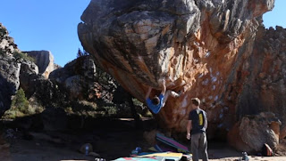
VIDEO: Daniel Woods Climbs Wheel of Chaos (V14) at 10,600 feet

Daniel Woods climbs his new Colorado testpiece Wheel of Chaos (V14). This long, hard boulder problem is at 10,600 feet in Rocky Mountain National Park and requires a four-mile approach.

 
Daniel Woods - Wheel of Chaos V14 FA from Bearcam Media on Vimeo.


Visit THE ARCHIVE: A list of most of our articles sorted by department

find us on facebook


Copyright notice: This website and all its contents are the intellectual property of www.coloradomountaineering.com and its authors. None of the content can be used or reproduced without the approval of www.coloradomountaineering.com.

Climbing and mountaineering are dangerous!! Please see the DISCLAIMER page
For information about how to contact us, visit this link


Tuesday, September 10, 2013

Peak of the Week: Arrow Peak (13,803 feet or 4207 m)

INTRO
There are those in the Colorado mountaineering community who are convinced that the best mountains to climb in our great state are not the ultra-popular 14ers but the lesser-known but just as mighty 13ers. Arrow Peak, in the heart of the San Juan Mountains, is a testament to this.

At 13,803 feet, Arrow Peak falls just shy of hitting the "Centennial" List (Colorado's 100 highest peaks). In terms of rock quality, route aesthetics, and general fun potential, there is hardly a peak anywhere in the state that is more dramatic and fun to climb than Arrow.

When seen from the Colorado Trail alongside its more-famous companion, Vestal Peak, Arrow looks like a peak removed perhaps from the Tetons or one of the rugged ranges of Europe. Arrow Peak is a mountain Colorado can be proud of.

What makes Arrow even more enticing is that its foreboding slopes are not easy to climb. The easiest route, the Northeast Face, is a class 3-4 scramble with many thoughtful and complicated vertical feet. Luckily, the climb is on surprisingly solid quartzite which is unique to the San Juans. Though this route does not require a rope, it is exposed and intricate and not for the beginner.

Not surprisingly, Arrow's rugged escarpments are also home to several technical climbs, especially the North Ridge, a high-quality class 5.6 alpine route.

Arrow Peak in the Grenadier Range
The Northeast Face of Arrow Peak
DIRECTIONS
The trailhead at Elk Park at the edge of the Weminuche Wilderness Area is accessible either by taking the Durango-Silverton Narrow Gauge Railroad from Durango or by hiking in from the Molas Pass Trailhead. The Molas Pass trailhead is two miles north of Molas Pass on Highway 550 in-between the turnoffs for Molas and Little Molas Lake campgrounds. This large dirt lot and trailhead is five miles south of Silverton.

ROUTES
Northeast Face (class 3)
This is the standard and easiest route on Arrow Peak. It is an amazing scramble up remarkably solid rock with amazing positions and views. Most people establish a base camp near 11,500 feet in Vestal Basin right at the foot of this route. From basecamp, follow the spiraling ramp up the northeast face of Arrow peak through some sustained and excellent scrambling to the summit.

North Ridge (class 5.6)
Though not as famous and not as aesthetic as its neighbor Wham Ridge, many argue that the North Ridge of Arrow is quite possibly the better climb of the two. It is longer and more sustained and a bit more difficult than its Vestal Peak sibling. The quartzite is as good as any in the San Juans, and the pitches and high quality and generally fairly well protected.

Arrow and Vestal Peak
Arrow and Vestal Peak from the Colorado Trail
Arrow Spire (class 5.8)
An incredible route that climbs a buttress on the peak's west side. This incredible spire to a sub-summit can be see from the Beaver Ponds at 10,000 feet on the Colorado Trail. This is perhaps the most rugged and spectacular of all the Grenadier routes.

SPECIAL CONSIDERATIONS
Arrow Peak is in the Weminuche Wilderness. As with all wilderness areas, special regulations apply. Arrow Peak has some unique features worth noting. Taking the train from Durango to the Elk Park station will cut off over 6 miles and 1,800 feet of additional gain and loss of elevation. This is helpful but costs $85 one way. Visit durangotrain.com for more information.

TRIP REPORTS
Dirty (Wet) 30: An Attempt at Arrow and Vestal Peaks to celebrate turning 30.

LINKS
Arrow Peak on summitpost.org

North Ridge on mountainproject.com

Northeast Face on summitpost.org

Arrow Spire on mountainproject.com

Visit THE ARCHIVE: A list of most of our articles sorted by department

find us on facebook


Copyright notice: This website and all its contents are the intellectual property of www.coloradomountaineering.com and its authors. None of the content can be used or reproduced without the approval of www.coloradomountaineering.com.

Climbing and mountaineering are dangerous!! Please see the DISCLAIMER page
For information about how to contact us, visit this link

Monday, September 9, 2013

VIDEO: Jimmy Webb on Colorado's Jade (V14)

Jimmy Webb crushes this classic Colorado testpiece Jade (V14) in Rocky Mountain National Park. Jade was originally climbed by Daniel Woods and rated V15. The rating was later downgraded after several repeats  to V14. Reportedly, 12-year-old Ashima Shiraishi, who recently sent The Automator (V13) also in RMNP, has her eyes Jade, which would make her the youngest person to climb the grade if she managed to complete it.


Jade V14 from Jimmy Webb on Vimeo.

Visit THE ARCHIVE: A list of most of our articles sorted by department

find us on facebook


Copyright notice: This website and all its contents are the intellectual property of www.coloradomountaineering.com and its authors. None of the content can be used or reproduced without the approval of www.coloradomountaineering.com.

Climbing and mountaineering are dangerous!! Please see the DISCLAIMER page
For information about how to contact us, visit this link


Thursday, September 5, 2013

NEWS: Jimmy Webb Establishes V15 on Mount Evans (9/5/13)

James Webb in Rocklands
Webb in Rocklands, South Africa. Screenshot from
his vimeo video
Jimmy Webb has reported on his 8a.nu scorecard that he has sent Wheel of Wolvo on Mt. Evans in Colorado, giving the climb a grade of Fontainebleau 8C (V15). "The break down is sick. A 10 move 8B+ into a 15 move 8a/+. A pumpy one for sure and suited my style/height so perfectly," Webb wrote. He went on to add, "Psyched to go back and try one of the harder exits!?"

Mount Evans and Rocky Mountain National Park have gained popularity in recent years as bouldering destinations. Through the work mostly of Dave Graham and Daniel Woods, several hard V14 and V15 problems have been established in these high-alpine destinations. Just a couple of weeks ago Daniel Woods opened The Wheel of Chaos (V14) at 10,600 feet in Rocky Mountain National Park. Just barely a week later, 12-year-old Ashima Shiraishi sent The Automator, a V13 also located in the park. The Automator was Shiraishi's second V13 after she became the youngest person of either gender to send the grade when she climbed Crown of Aragorn in famed Hueco Tanks at age 11.

Webb has proved himself as one of the top boulderers in world recently. On a June trip to Rocklands, South Africa, he flashed several V13s and sent several V14s. Wheel of Wolvo is his first V15. He also won first place at the star-studded Psiocbloc Masters Series event in Salt Lake City in early August.

Check out this video of Webb battling it out against Daniel Woods at the Psiocobloc Masters Series:

Also enjoy this video of Webb in Rocklands:
 
First try in Rocklands from Jimmy Webb on Vimeo.

Visit THE ARCHIVE: A list of most of our articles sorted by department

find us on facebook


Copyright notice: This website and all its contents are the intellectual property of www.coloradomountaineering.com and its authors. None of the content can be used or reproduced without the approval of www.coloradomountaineering.com.

Climbing and mountaineering are dangerous!! Please see the DISCLAIMER page
For information about how to contact us, visit this link


Wednesday, September 4, 2013

Hot Route: The DeCaLiBron (The Democrat, Cameron, Lincoln, Bross Loop)

Kite Lake Trailhead          
Length: 7 miles
Difficulty: class 2
Elevation gain: 3,500 feet
Exposure: Mild

OVERVIEW
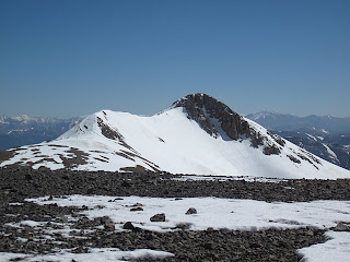
Mt. Lincoln from Mt. Cameron
Mt. Lincoln in late spring
**NOTE** As of now the summit of Mt. Bross is closed to public access. Climbers that choose to o to the summit anyway could jeopardize future access, which the CFI (Colorado Fourteener Initiative) and CMC (Colorado Mountain Club) are currently fighting to obtain. The Bross portions of this historic route are included only for reference and in the hope that future access is restored.

The Decalibron is by far the easiest route in the state that allows you to collect four of the 59 fourteeners on the extended "59 List", and 3 of the 53 fourteeners on the standard list. In one big loop you can make a ring around this large cirque and collect Democrat, Cameron, Lincoln, and Bross. Since the trailhead at Kite Lake is over 12,000 feet and can be reached by a passenger car, this four-summit tour is highly abridged and quite popular.

Though the technical difficulty on this climb never exceeds class 2, the amount of time you are above 13,000 feet is substantial as is your exposure to weather. At the deepest points of the route the fastest way off is to simply continue around the cirque. As we discovered on a 2010 attempt of this ridge when we climbed in 80 mph winds, getting caught in the wrong conditions can be an unpleasant and even dangerous proposition.

THE ROUTE

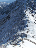
The saddle between Colorado 14ers Mount Democrat and Mount Cameron
The saddle between Cameron
and Democrat from Democrat's
summit
From the Kite Lake trailhead, cross the creek and find a strong trail that heads north from the lake. Ascend the easy but winding class 1 trail to the 13,300 foot saddle between Democrat and Cameron. Turn left (west) and climb Mt. Democrat on a low class 2 trail. After enjoying Democrat's summit, descend back to the 13,300 foot saddle. Climb east to the rotund summit of Mt. Cameron, which is not ranked but usually included as one of the six unranked summits to be included in the 59 list.

From Cameron descend gently south to the saddle and it is only a short ways to Lincoln, the tallest route of the group. Lincoln's summit cap involves a small amount of boulder hopping. When you are done with Lincoln descend back to the saddle between Lincoln and Cameron and traverse to Cameron's east side to avoid having to re-climb to the top. Continue aroun the cirque to Bross and make a decision.

Mt. Bross on the Decalibron
Mt. Bross from Mt. Cameron
Currently, it is illegal to climb Mt. Bross, which is located on private property. It is legal to get within a few hundred feet of the summit and traverse on around to descend the West Slopes of Bross. Many people, eager to check off all of Colorado's 14ers, will quickly, quietly and respectfully make the out-and-back to Bross's summit and quietly move on. While it may be tempting to do so, you could jeopardize future access to the peak. Tread lightly!

The descent down Bross is steep and a bit gravelly at times, but very quickly you will be back down at your car.

DIRECTIONS
In the center of Alma turn west (right if coming from Hoosier Pass, left if coming from Fairplay) off Highway 9 onto Kite Lake Rd. Follow this mostly smooth dirt road for 6 miles to Kite Lake. In some conditions lower clearance cars will sometimes park a few turns below the lake but I've seen sports cars come rolling into the parking lot before. There is limited camping available here.

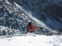
Mount Democrat in the snow
The last few, snowy feet on Democrat
TRIP REPORTS
Decalibron: How to Climb in a Hurricane- Eighty mile-per-hour winds and snowy conditions on the Democrat, Cameron, Lincoln, and Bross loop.

LINKS
Decalibron on 14ers.com

Decalibron on Summitpost.org

Colorado's Fourteeners: From Hikes to Climbs by Gerry Roach on Amazon.com- Better yet, buy this helpful and entertaining guidebook at your local gear shop or bookstore.

Visit THE ARCHIVE: A list of most of our articles sorted by department

find us on facebook

Follow us on Twitter!

Copyright notice: This website and all its contents are the intellectual property of www.coloradomountaineering.com and its authors. None of the content can be used or reproduced without the approval of www.coloradomountaineering.com.

Climbing and mountaineering are dangerous!! Please see the DISCLAIMER page
For information about how to contact us, visit this link


Sunday, September 1, 2013

NEWS: UPDATED: Dramatic Blackhawk Rescue on Capitol Peak (9/1/13)

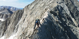
Capitol Peak's Knife Edge on the Northeast Ridge route on this dangerous 14er
The Knife Edge of Capitol Peak
A Fort Collins man had to be rescued off Capitol Peak in Colorado's Elk Range after becoming stranded not far below the summit. According to a report on Aspentimes.com, Daniel Palmer, of Fort Collins, was trapped on the peak and had to be rescued by team from Mountain Rescue Aspen as well as a Blackhawk Helicopter. Reportedly, Palmer suffered only minor injuries in the incident.

At 14,130 feet Capitol is the 29th tallest mountain in Colorado. It is considered one of the most difficult and exposed of all Colorado's 14er, largely due to the "Knife Edge," an exposed fin that mountaineers must traverse. Capitol Peak was the scene of a fatal accident earlier this year when Ryan Palmer (no relation) decided to downclimb the north face of the mountain instead of returning over the Knife Edge and fell to his death.

UPDATED: According to an interview in the Aspen Times, Daniel Palmer claims to have gotten turned around on the descent and mistakenly descended to a point on the north face where he was unable to descend and unable to go back up. He was able to call authorities from a cell phone he was carrying.

Check out this video of the Knife Edge from a 2011 trip to Capitol:


Visit THE ARCHIVE: A list of most of our articles sorted by department

find us on facebook


Copyright notice: This website and all its contents are the intellectual property of www.coloradomountaineering.com and its authors. None of the content can be used or reproduced without the approval of www.coloradomountaineering.com.

Climbing and mountaineering are dangerous!! Please see the DISCLAIMER page
For information about how to contact us, visit this link